

12.0 miles
Distance
2,779 ft
Climb
-2,789 ft
Descent
1 mile
High Point
-11 ft
Altitude change
4,852 ft
Altitude min
4,863 ft
Altitude start
4,852 ft
Altitude end
-75.5%
Grade max
76.2%
Grade min
6 miles
Distance climb
5 miles
Distance down
3,255 ft
Distance flat

Terror ridge to bobsled. Insane uphill to fun tech then flow.

Detailed Description
Hell yeah is a 12 mile popular expert route located near Salt Lake City Utah. This mountain bike only route. This route includes 10 trails. This route climbs 2,779 ft with a max elevation of 6,267 ft then descends -2,789 ft.
Tags

Trail Issues on Route

  • Closed: 1 trail (newest: Jul 8, 2026)
  • Minor Issue / Yellow: 2 trails (newest: Aug 31, 2026)

Local Trail Association

Local trail association
Bike Utah (bikeutah.org)
Please consider joining or donating to the local riding association to support trail development & maintenance.
Donate to earn trail karma!

Stats

  • Distance
    12 miles
  • Altitude change
    -11 ft
  • Altitude min
    4,852 ft
  • Altitude start
    4,863 ft
  • Altitude end
    4,852 ft
  • Climb
    2,779 ft
  • Descent
    -2,789 ft
  • Grade max
    -75.5%
  • Grade min
    76.2%
  • Distance climb
    6 miles
  • Distance down
    5 miles
  • Distance flat
    3,255 ft

72 Reviews & Comments


We hope you've been enjoying Trailforks!

Create a FREE account to view all route reviews and much more.

Details

no votes yet
close
Trail transparency
  • Singletrack
mtb
trail: Bobsled
1,770
mtb
trail: Bobsled
2,165 | 1 faves
mtb
trail: Bobsled
2,644
mtb
trail: Bobsled
2,439 | 3 comments | 3 faves
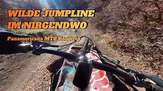
Abandoned jumpline in the middle of the desert
mtb
Abandoned jumpline in the middle of the desert
trail: Bobsled
16:00 | 251 | comments: 0 | favs:
Mar 28, 2026
First hits on Bobsled
mtb
First hits on Bobsled
trail: Bobsled
0:40 | 292 | comments: 0 | favs:
May 27, 2025

Recent Trail Reports Along Route

statustraildateconditiondescription
Bobsled
Aug 31, 2026 @ 7:14am (America/Denver)
Aug 31, 2026
Rut in the upper section is as bad as i’ve ever seen it. Not really sure how this could be sustainably fixed on a fall line gully trail though. Has work been done in the past to fill it in? Would guess that dirt would just wash right back out next time it rains
BST (Dry Creek Gulch)
Aug 18, 2026 @ 12:28pm (America/Denver)
Aug 18, 2026
BST (Salt Lake City)
Aug 18, 2026 @ 12:28pm (America/Denver)
Aug 18, 2026
BST Access (Dry Gulch)
Aug 18, 2026 @ 12:28pm (America/Denver)
Aug 18, 2026
Pop Access
Aug 18, 2026 @ 12:28pm (America/Denver)
Aug 18, 2026
more reports »
  • By NateV5blX3TF Pro & contributors
  • #63628 - 363 views

Hit the Trail

Open in App

Get this route on your phone instantly.

Download Route

Save to wishlist, Garmin & download.
