

37.9 miles
Distance
5,330 ft
Climb
-5,320 ft
Descent
2,772 ft
High Point
10 ft
Altitude change
1,015 ft
Altitude min
1,267 ft
Altitude start
1,276 ft
Altitude end
-77.1%
Grade max
64.8%
Grade min
19 miles
Distance climb
15 miles
Distance down
4 miles
Distance flat

No description for Melrose Big Loop route has been added yet! Submit one here.

Detailed Description
Melrose Big Loop is a 38 mile moderately popular intermediate route located near Melrose. This mountain bike only route. This route includes 17 trails. This route climbs 5,330 ft with a max elevation of 2,772 ft then descends -5,320 ft.
Tags
BermsRock gardens

Trail Issues on Route

  • Minor Issue / Yellow: 3 trails (newest: Sep 29, 2026)

Local Trail Association

Local trail association
Bike Melrose (bikemelrose.com.au)
Please consider joining or donating to the local riding association to support trail development & maintenance.
Donate to earn trail karma!

Stats

  • Distance
    38 miles
  • Altitude min
    1,015 ft
  • Altitude start
    1,267 ft
  • Altitude end
    1,276 ft
  • Climb
    1 mile
  • Descent
    -5,320 ft
  • Grade max
    -77.1%
  • Grade min
    64.8%
  • Distance climb
    19 miles
  • Distance down
    15 miles
  • Distance flat
    4 miles

22 Reviews & Comments


We hope you've been enjoying Trailforks!

Create a FREE account to view all route reviews and much more.

Details

  • Riding area
  • Primary Activity
    Mountain Bike
  • Difficulty rating
    Blue
  • Route Type
    Loop

Directions

  1. Bike southwest on Mawson Trail Section 4.
  2. Continue for 100 meters.
  3. Turn left onto Mawson Trail Section 3.
  4. Continue for 3 kilometers.
  5. Bike north on Mawson Trail Section 3.
  6. Continue for 30 meters.
  7. Make a sharp left onto Horse Gully Rd.
  8. Continue for 2 kilometers.
  9. Bike southeast on Horrocks Highway.
  10. Continue for 400 meters.
  11. Bike southeast on Southern Flinders Rail Trail.
  12. Continue for 300 meters.
  13. Bike south on Southern Flinders Rail Trail.
  14. Continue for 400 meters.
  15. Bike southeast on Southern Flinders Rail Trail.
  16. Continue for 3 kilometers.
  17. Bike south on Southern Flinders Rail Trail.
  18. Continue for 1 kilometer.
  19. Bike west on Showtime to Rail Trail Link.
  20. Continue for 20 meters.
  21. Bear left onto Southern Flinders Rail Trail.
  22. Continue for 200 meters.
  23. Bike southwest on Southern Flinders Rail Trail.
  24. Continue for 500 meters.
  25. Bike south on Southern Flinders Rail Trail.
  26. Continue for 300 meters.
  27. Turn right onto Showgrounds Link.
  28. Continue for 100 meters.
  29. Bike southeast on Showgrounds Link.
  30. Continue for 800 meters.
no votes yet
close
Trail transparency
  • Singletrack
  • Unpaved
mtb
trail: North Face
61
mtb
trail: North Face
101
mtb
trail: Bale Out
111
mtb
trail: Bale Out
123
Eskidna
mtb
Eskidna
trail: E-Skid-Na
0:21 | 476 | comments: 0 | favs:
Nov 6, 2022

Recent Trail Reports Along Route

statustraildateconditiondescription
The Chicken Run
Sep 29, 2026 @ 5:35pm (Australia/Adelaide)
Sep 29, 2026
Bridge has made its way further down stream but prime conditions otherwise
Weaving Camels
Sep 29, 2026 @ 5:35pm (Australia/Adelaide)
Sep 29, 2026
Dualing Banjo's (Melrose Dual Slalom)
May 9, 2026 @ 4:18pm (Australia/Adelaide)
May 8, 2026
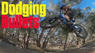
Dodging Bullets
May 9, 2026 @ 4:18pm (Australia/Adelaide)
May 8, 2026
Benchin
May 7, 2026 @ 2:01am (Australia/Adelaide)
May 6, 2026
more reports »
  • By AckoblasterTF Pro NPSA & contributors
  • #58797 - 664 views

Hit the Trail

Open in App

Get this route on your phone instantly.

Download Route

Save to wishlist, Garmin & download.
