
12.1 miles
Distance
1,051 ft
Climb
-1,054 ft
Descent
4,699 ft
High Point
-1 ft
Altitude change
4,400 ft
Altitude min
4,644 ft
Altitude start
4,642 ft
Altitude end
-28.5%
Grade max
35%
Grade min
5 miles
Distance climb
5 miles
Distance down
2 miles
Distance flat

Sweet challenging loop with a sweet view

Detailed Description
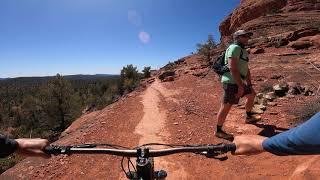
Mescal Loop is a 12 mile popular intermediate route located near Sedona Arizona. This mountain bike only route. This route includes 6 trails. This route climbs 1,051 ft with a max elevation of 4,699 ft then descends -1,054 ft.
Tags
Views

Local Trail Association

Please consider joining or donating to the local riding association to support trail development & maintenance.
Donate to earn trail karma!

Stats

  • Distance
    12 miles
  • Avg time
    2 hr 18 min
  • Altitude change
    -1 ft
  • Altitude min
    4,400 ft
  • Altitude start
    4,644 ft
  • Altitude end
    4,642 ft
  • Climb
    1,051 ft
  • Descent
    -1,054 ft
  • Grade max
    -28.5%
  • Grade min
    35%
  • Distance climb
    5 miles
  • Distance down
    5 miles
  • Distance flat
    2 miles

9 Reviews & Comments


We hope you've been enjoying Trailforks!

Create a FREE account to view all route reviews and much more.

Trails in Route

Long Canyon To Mescal440 ft
Aerie (Lower)4,318 ft
OK1,083 ft
Snake2,694 ft

Details

  • Riding area
  • Primary Activity
    Mountain Bike
  • Difficulty rating
    Blue
  • Activity Logs
    213

Directions

  1. Walk northeast on Chuck Wagon.
  2. Continue for 6 kilometers.
  3. Turn left to stay on Chuck Wagon.
  4. Continue for 2.5 kilometers.
  5. Turn right onto Long Canyon Road.
  6. Continue for 40 meters.
  7. Walk southeast on To Mescal.
  8. Continue for 2.5 kilometers.
  9. Keep right to take Mescal.
  10. Continue for 1 kilometer.
  11. Turn left onto Deadmans Pass.
  12. Continue for 2 kilometers.
  13. Turn left onto Cockscomb.
  14. Continue for 1.5 kilometers.
  15. Walk northeast on Dawa.
  16. Continue for 1.5 kilometers.
  17. Walk south on OK.
  18. Continue for 400 meters.
  19. Turn left onto AZ Cypress.
  20. Continue for 700 meters.
  21. Turn right onto Snake.
  22. Continue for 800 meters.
  23. Turn left to stay on Snake.
  24. Continue for 20 meters.
  25. Turn left onto Girdner.
  26. Continue for 300 meters.
  27. Turn left onto Chuck Wagon.
  28. Continue for 400 meters.
Avg: 3.45 (7 votes)
close
Trail transparency
  • Singletrack
  • Unpaved
Mescal Trails Sedona, Arizona
mtb
Mescal Trails Sedona, Arizona
23:33 | 215 | comments: 0 | favs:
Aug 25, 2021
Sedona Mountain Biking // Aerie to Cockscomb: Pt 1
mtb
Sedona Mountain Biking // Aerie to Cockscomb: Pt 1
10:43 | 538 | comments: 0 | favs:
Aug 9, 2022

Recent Trail Reports Along Route

statustraildateconditiondescription
Aerie (Lower)
Oct 13, 2026 @ 1:32pm (America/Phoenix)
Oct 13, 2026
Long Canyon To Mescal
Sep 30, 2026 @ 1:03pm (America/Vancouver)
Sep 30, 2026
OK
Aug 31, 2026 @ 8:11am (America/Phoenix)
Aug 31, 2026
Snake
Nov 25, 2025 @ 8:20am (America/Phoenix)
Nov 25, 2025
more reports »
  • By krustyjake & contributors
  • #18514 - 10,927 views

Hit the Trail

Open in App

Get this route on your phone instantly.

Download Route

Save to wishlist, Garmin & download.