

Open in App
Get this route on your phone instantly.
Please do not attempt to ride up Loess Rider or the Green outside of race day. These are downhill specific trails but for the duration of the race.
The Phoenix Enduro is back for its third year
This one will be loaded with local talent thanks to boarder restrictions from COVID-19.
2 days practice on the 21st & 22nd, race day the 23rd October.
Race day course:
Liaison 1
Pedal up the green trail to the top of the chairlift.
Stage 1
Summit Connection, into Wasabi crossing over to Community Transmission then again to The GC.
Liaison 2
Pedal up Loess Rider, across Dyers Pass Road at Traffic Management intersection, up Victoria Park 4wd roads and along the Bowenvale Traverse to the top of Lava Flow
Stage 2
Lava Flow finishing before the natives.
Liaison 3
Pedal up the shared use 4wd track to Bowenvale Traverse. Along the Traverse to top of Victoria Park.
Stage 3
Racers start block, Tilted Sally to 4wd road after road gap, up 4wd road to Rad^Sick then dropping into Sneaky Ridge into Bridges then New Bridges down.
Liaison 4
Up through Victoria Park 4wd Roads then cross Dyers Pass at Traffic Management intersection and along Choir Boy.
Stage 4
Locomotion into Double Vision
Liaison 5
Up the Chairlift and around Choir Boy to Start of Gung-Ho
Stage 5
Gung-Ho, Pick 'n' Mix into Five X
Liaison 6
Up the Chairlift (depart off to the right of chairlift).
Stage 6
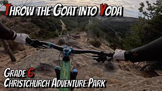
Throw the Goat / Yoda along access road to The GC, Down The GC then up to Handle the Jandal out to the finish.
DISCLAIMER
The elevation stated above includes 2 Chairlift assisted Liaisons.
We hope you've been enjoying Trailforks!
Create a FREE account to view all route reviews and much more.

| 1 | Stage 2 - Lava Flow
|
| 2 | Stage 3 - Tilted Sally - 4WD Road - Rad^Sick - Sneaky Ridge - New Bridges
|
| 3 | Stage 4 - Locomotion - Double Vision
|
| 4 | Stage 5 - Gung-Ho - Pick 'n' Mix - Five X
|
| 5 | Stage 6 - Throw The Goat - Yoda - 4wd Road - The GC - Handle The Jandal
|
| 6 | Stage 1 - Summit Connection - Wasabi - The GC
|
| 7 | Stage 1 - Summit Connection - Wasabi - The GC
|
| 8 | Stage 2 - Lava Flow
|
| 9 | Stage 3 - Tilted Sally - 4wd Rd - Rad^Sick - Sneaky Ridge - New Bridges
|
| 10 | Stage 4 - Locomotion - Double Vision
|
| 11 | Stage 5 - Pick 'n' Mix - Five X
|
| 12 | Stage 6 - Throw The Goat - Yoda - 4wd Road - The GC - Handle The Jandal
|
| 4,859 ft | |||||
| 3 miles | |||||
| 669 ft | |||||
| 348 ft | |||||
| 1 mile | |||||
| 9 miles | |||||
| 308 ft | |||||
| 2,254 ft | |||||
| 2 miles | |||||
| 2,999 ft | |||||
| 197 ft | |||||
| 866 ft | |||||
| 180 ft | |||||
| 696 ft | |||||
| 1 mile | |||||
| 781 ft | |||||
| 1,982 ft | |||||
| 2,513 ft | |||||
| 2,461 ft | |||||
| 2,461 ft | |||||
| 1,601 ft | |||||
| 646 ft | |||||
| 2,549 ft | |||||
| 2,093 ft | |||||
| 2,874 ft | |||||
| 650 ft | |||||
| 1,194 ft | |||||
| 456 ft | |||||
| 190 ft | |||||
| 1,686 ft |

Service Road Atlas is a free to use, community-driven service for viewing and creating reports on the numerous back-country service roads around B.C. and Alberta.
Save the current map location and zoom level as your default home location whenever this page is loaded.
Save & contributors