This route is hidden from the public, you have special permissions to view hidden routes in this region. Please keep this route info private!
11.4 miles
Distance
1,990 ft
Climb
-2,018 ft
Descent
3,678 ft
High Point
-28 ft
Altitude change
2,923 ft
Altitude min
3,179 ft
Altitude start
3,153 ft
Altitude end
-47.9%
Grade max
49.2%
Grade min
6 miles
Distance climb
5 miles
Distance down
2,096 ft
Distance flat
This route is archived

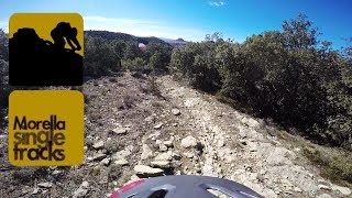
No siempre se tiene una mañana entera para completar una ruta mtb enduro aúténtica. Snait es una ruta corta y directa, con mucha senda, una ruta dentro de la cabecera del Riu de les Corces y con una vuelta a casa del nivel de Red Hot. Así que una ruta BTT enduro, con todos los alicientes técnicos y naturales para completar en poco más de 2 h.

Porcentaje de senda: 40 %
Porcentaje de pista: 17 %
Porcentaje de asfalto: 43 %
Balizada Centre BTT: No
Duración estimada: de 2:30 a 3 h.

source: Snait
Detailed Description
Snait is a 11 mile intermediate route located near Morella. This mountain bike primary route can be used one direction and has a moderate overall physical rating. This route includes 6 trails. This route climbs 1,990 ft with a max elevation of 3,678 ft then descends -2,018 ft.
Local Trail Association
Local trail association
AREA
Please consider joining or donating to the local riding association to support trail development & maintenance.
Donate to earn trail karma!

Stats

  • Distance
    11 miles
  • Altitude min
    2,923 ft
  • Altitude start
    3,179 ft
  • Altitude end
    3,153 ft
  • Climb
    1,990 ft
  • Descent
    -2,018 ft
  • Grade max
    -47.9%
  • Grade min
    49.2%
  • Distance climb
    6 miles
  • Distance down
    5 miles
  • Distance flat
    2,096 ft

Comments


We hope you've been enjoying Trailforks!

Create a FREE account to view route comments and much more.

Details

  • Riding area
  • Primary Activity
    Mountain Bike
  • Other Activities
    • E-Bike
  • Difficulty rating
    Blue
  • Route Type
    Loop
  • eBike Allowed
  • Bike type
    AM, XC, Fat
  • Direction
    One Direction
  • Physical rating
    Moderate
no votes yet

The builders of this route have requested that its location be kept hidden.
Go out and explore!

69
64
41
Morella Singletracks | Ruta Cabeza
5:54 | 143 | comments: 0 | favs:
Sep 4, 2023
Morella Singletracks | Ruta Cabeza
trail: Mas Roig
5:54 | 98 | comments: 0 | favs:
Sep 4, 2023

Recent Trail Reports Along Route

statustraildateconditiondescription
Barranco De La Carcellera Superior
May 3, 2026 @ 6:57pm (Europe/Madrid)
May 3, 2026
Mas Roig
Apr 8, 2026 @ 10:19pm (Europe/Madrid)
Apr 8, 2026
Colela Superior
Apr 8, 2026 @ 10:18pm (Europe/Madrid)
Apr 8, 2026
Autumn
Oct 14, 2023 @ 12:38am
Oct 14, 2023
reporter
Atajo Autumn
Oct 14, 2023 @ 12:38am
Oct 14, 2023
reporter
more reports »
  • By CrisjacaTF Pro & contributors
  • #34370 - 285 views
  • Flag

Hit the Trail

Open in App

Get this route on your phone instantly.

Download Route

Save to wishlist, Garmin & download.