
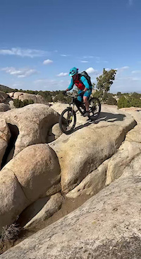
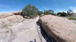
This is a fun loop in the Three Peaks area. It starts off with some moderate tech, then more advanced tech riding on petrified whales. From there it's flowy ups and downs for the remaining majority of the ride. This area can be sandy but it makes for some great Winter riding when it's wet and the rest of the Cedar City trails are covered in snow. The direction indicated on the route would be the preferred way to ride it.
Trail Issues on Route
- Minor Issue / Yellow: 1 trail (newest: Oct 2, 2026)
Local Trail Association
Iron TrailCraft (irontrailcraft.org)Stats
-
Distance12 miles
-
Avg time1 hr 11 min
-
Altitude min5,750 ft
-
Altitude start5,759 ft
-
Altitude end5,758 ft
-
Climb918 ft
-
Descent-920 ft
-
Grade max-22.7%
-
Grade min20.2%
-
Distance climb5 miles
-
Distance down5 miles
-
Distance flat1 mile
13 Reviews & Comments
We hope you've been enjoying Trailforks!
Create a FREE account to view all route reviews and much more.
Trails in Route
| 1,112 ft | |||||
| 3 miles | |||||
| 1,371 ft | |||||
| 4,088 ft | |||||
| 2 miles | |||||
| 735 ft | |||||
| 4,646 ft | |||||
| 4,482 ft | |||||
| 2,854 ft | |||||
| 1,138 ft | |||||
| 1,696 ft | |||||
| 1,578 ft | |||||
| 2,464 ft | |||||
| 2,178 ft | |||||
| 2,313 ft | |||||
| 3,878 ft | |||||
| 4,442 ft |
Details
-
Riding area
-
Primary ActivityMountain Bike
-
Difficulty ratingBlue
-
Route TypeLoop
-
Activity Logs
- Unknown
- Snow Groomed
- Snow Packed
- Snow Covered
- Snow Cover Partial
- Freeze/thaw Cycle
- Icy
- Prevalent Mud
- Wet
- Variable
- Ideal
- Dry
- Very Dry
The colour categories are based on what percentage of users are riding a trail in its intended direction.
- > 96%
- > 90%
- > 80%
- > 70%
- > 50%
- < 50%
- bi-directional trail
- no data
- < 2 days
- < 1 week
- < 2 weeks
- < 1 month
- < 6 months
- > 6 months
- Downhill Only
- Downhill Primary
- Both Directions
- Uphill Primary
- Uphill Only
- One Direction
- Description
- Photos
- Description & Photos
- Videos
- most popular
- popular
- less popular
- not popular
Service Road Atlas is a free to use, community-driven service for viewing and creating reports on the numerous back-country service roads around B.C. and Alberta.
Save the current map location and zoom level as your default home location whenever this page is loaded.
Save- Singletrack
- Unpaved
Photos
Videos
Recent Trail Reports Along Route
- By nickmay26
& contributors - #26704 - 914 views
