

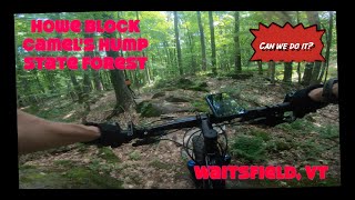
Unofficial, unadvisedly unfettered, unusually undulating, unevenly unbalanced, unchained, unabridged, unchecked, uncertainly unequaled, uniquely ungroomed, untameable, unbelievable, uncouth, undaunted, unreal, underrated, unhinged, unsigned, unled, unsupported, unlimitedly unlevel, unleashed, unsavory, unrideable, unserious, unsteady, unsettling, unruly and more than a little uneasy.

Trail Issues on Route
- Closed: 12 trails (newest: Nov 15, 2026)
Route Supporters
Local Trail Association
Mad River Trails Alliance (www.madriverriders.com)Stats
-
Distance27 miles
-
Avg time22 hr 31 min
-
Altitude min715 ft
-
Altitude start755 ft
-
Altitude end755 ft
-
Climb3,958 ft
-
Descent-3,955 ft
-
Grade max-38.7%
-
Grade min30.7%
-
Distance climb15 miles
-
Distance down11 miles
-
Distance flat1 mile
57 Reviews & Comments
We hope you've been enjoying Trailforks!
Create a FREE account to view all route reviews and much more.
Trails in Route
| 1 mile | |||||
| 4,606 ft | |||||
| 2,185 ft | |||||
| 4,232 ft | |||||
| 2,441 ft | |||||
| 4,186 ft | |||||
| 1 mile | |||||
| 1,578 ft | |||||
| 1,949 ft | |||||
| 2,927 ft | |||||
| 1 mile | |||||
| 5,082 ft | |||||
| 1 mile | |||||
| 2 miles | |||||
| 1 mile |
Details
-
Riding area
-
Primary ActivityMountain Bike
-
Other Activities
- Hike
- Trail Running
- Snowshoe
- Backcountry Ski
-
Difficulty ratingDouble Black Diamond
-
Route TypeLoop
-
Bike typeAM, XC, Fat
-
DirectionBoth Directions
-
Physical ratingExtreme
-
Activity Logs
- Unknown
- Snow Groomed
- Snow Packed
- Snow Covered
- Snow Cover Partial
- Freeze/thaw Cycle
- Icy
- Prevalent Mud
- Wet
- Variable
- Ideal
- Dry
- Very Dry
The colour categories are based on what percentage of users are riding a trail in its intended direction.
- > 96%
- > 90%
- > 80%
- > 70%
- > 50%
- < 50%
- bi-directional trail
- no data
- < 2 days
- < 1 week
- < 2 weeks
- < 1 month
- < 6 months
- > 6 months
- Downhill Only
- Downhill Primary
- Both Directions
- Uphill Primary
- Uphill Only
- One Direction
- Description
- Photos
- Description & Photos
- Videos
- most popular
- popular
- less popular
- not popular
Service Road Atlas is a free to use, community-driven service for viewing and creating reports on the numerous back-country service roads around B.C. and Alberta.
Save the current map location and zoom level as your default home location whenever this page is loaded.
Save- Singletrack
- Unpaved
Photos
Videos
Recent Trail Reports Along Route
- By atkinsonvt
& contributors - #14807 - 2,003 views


