

more stats
2.5 miles
Distance
95 ft
Climb
-1,354 ft
Descent
00:24:04
Avg time
-1,260 ft
Altitude change
846 ft
Altitude min
2,130 ft
Altitude max
2,105 ft
Altitude start
846 ft
Altitude end
-9.5%
Grade
-54.5%
Grade max
21.4%
Grade min
2,123 ft
Distance climb
2 miles
Distance down
745 ft
Distance flat
00:24:04
Avg time

28-19 Freeride Details

  • Activities
    • Mountain Bike
    • E-Bike
    • Hike
    • Trail Running
  • Riding Area
  • Difficulty Rating
  • Voted Difficulty
    Black Diamond (3 votes)
  • Local Popularity
    100 in Mountain Biking heatmap [+]
    • 100 in E-Biking
    • 95 in Trail Running
    • 5 in Hiking
  • Global Ranking
    #6415 in Mountain Biking [+]
    • #2051 in E-Biking
    • #83932 in Trail Running
    • #158928 in Hiking
  • National Ranking
    #656 in Mountain Biking · Italy [+]
    • #309 in E-Biking
    • #2,289 in Trail Running
    • #4,908 in Hiking
  • Hiking SAC Scale
    T2 Mountain Hiking
  • Trail Type
    Singletrack
  • Bike Type
    DH, AM, XC
  • Direction
    Downhill Primary
    Popular Direction Shown
  • Physical Rating
    Moderate
  • Dogs Allowed
    Yes
  • eBike Allowed
    Yes up to Class 1
  • TTFs on Trail
    Jump, Rock Garden

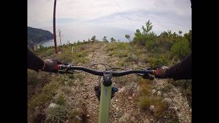
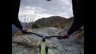
Bellissimo single track ligure. Prima parte veloce con salti vari poi diventa più roccioso e tecnico. Esistono diverse varianti.

Access Info

Strada del Bracco, Levanto, Framura, Deiva Marina

Tags
JumpsPicnic spotRock gardens

Recent Activity on Trail

Past Week
  • 0 rides
  •  
6 Months
  • 31 rides
  • 20 miles avg distance
All
  • 226 rides
  • Last: Nov 14, 2026
c1c2c3c4
January
February
March
April
May
June
July
August
September
October
November
December
update trails status or condition

28-19 Freeride Trail Reports

statusdatedescription
Aug 4, 2026 @ 9:46am (Europe/Rome)
Aug 4, 2026
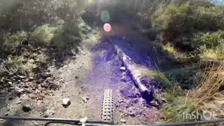
Perfetto, albero caduto parte bassa. Grazie a chi stava pulendo!
Jul 18, 2026 @ 8:17am (Europe/Monaco)
Jul 17, 2026
1 albero caduto, ci si passa abbastanza bene sotto
Jul 11, 2026 @ 8:41am (Europe/Monaco)
Jul 10, 2026
2 alberi caduti
Jul 8, 2026 @ 11:52am (Europe/Rome)
Jul 8, 2026
sempre bello e ben tenuto
Jun 1, 2026 @ 10:55am (Europe/Monaco)
Jun 1, 2026
Appena sistemato, perfetto!
more »
Status:
on Aug 4, 2026
Very Dry
Avg: 4.67 (30 votes)
Your vote: 0

view (1,208)
close
      Directions to 2819-freeride trailhead (44.208460, 9.595170)

      Photos

      67 more »
      mtb
      145 |
      Apr 19, 2022 @ 12:05am
      Apr 19, 2022
      mtb
      132 |
      Apr 15, 2022 @ 1:23pm
      Apr 15, 2022
      mtb
      309 |
      Aug 9, 2019 @ 3:23am
      Aug 9, 2019
      mtb
      86 |
      Sep 1, 2025 @ 9:13am
      Sep 1, 2025

      Videos

      4 more »
      La Rai + 2819 Freeride + Streghe + Tornantini...
      mtb
      23:15 | 13 | Oct 12, 2026 , Levanto
      28-19 Freeride - Levanto - 22.03.2026
      mtb
      12:27 | 72 | Sep 24, 2026 , Levanto
      Levanto 28 19
      mtb
      11:47 | 96 | Nov 29, 2025 , Levanto
      28 19 Freeride, Levanto
      mtb
      13:49 | 635 | May 2, 2023 , Levanto

      Routes with this trail

      more »
      15 miles • 4,773 ft • 16 • Loop •
      Orizzonte Levanto - Loop intorno alla Rossola
      4.8 ★★★★★
      30 Ratings
      5 ★ 87%
      4 ★ 7%
      3 ★ 7%
      2 ★
      1 ★

      16 Reviews & Comments

      raffganz raffganz
      Sentiero senza eccessive difficoltà ma molto divertente. Paesaggi spettacolari con scenari rocciosi stile western
      Tomknobel
      Seems freshly maintenaced. Great job! Amazing trail
      Arzi71
      Trail veramente bello e molto ben tenuto.

      We hope you've been enjoying Trailforks!

      Create a FREE account to view all trail reviews and much more.

      Nearby Trails

      • By j8lud & contributors
      • #94556 - 7,895 views

      Frequently Asked Questions

      ▼ Where is 28-19 Freeride located?
      28-19 Freeride is located in Levanto, Italy. It is part of the Levanto trail network. The trailhead is located at coordinates 44.20846, 9.59517.
      ▼ How hard is 28-19 Freeride?
      28-19 Freeride is rated as Blue difficulty. The physical rating is Moderate. The average grade is 9.5%.
      ▼ What is the elevation gain for 28-19 Freeride?
      28-19 Freeride has 95 ft of elevation gain. The trail has 1,354 ft of elevation descent. The elevation ranges from 846 ft to 2,130 ft.
      ▼ Is 28-19 Freeride a point to point trail?
      28-19 Freeride is not a point to point trail. The direction is Downhill Primary. The trail type is singletrack.
      ▼ How long is 28-19 Freeride?
      28-19 Freeride is 2.5 miles long. The trail type is singletrack.
      ▼ Are dogs allowed on 28-19 Freeride?
      Yes, dogs are allowed on 28-19 Freeride. Please keep dogs on a leash where required and clean up after them.
      ▼ How do I access 28-19 Freeride? Where is the closest parking trailhead?
      The closest parking and trailhead locations to 28-19 Freeride are: View all parking locations in the area.
      ▼ How long does it take to ride 28-19 Freeride?
      Based on recorded activities, it takes an average of 24 minutes to ride 28-19 Freeride. The trail is 2.5 miles long. Actual times will vary based on fitness level, conditions, and pace. View recent activity logs for more details.
      ▼ How busy is 28-19 Freeride?
      28-19 Freeride is a very popular trail. There have been 1,202 recorded activities on this trail. The trail has received 1,208 check-ins. View recent activity on this trail.

      Hit the Trail

      Open in App

      Get this trail on your phone instantly.

      open trail in app

      Download Trail

      Save to wishlist, Garmin & download.
      save the trail

      Find Related Routes

      Find routes and users activities that include this trail.
      find routes for this trail

      You must enter a description before submitting.

