more stats
4,111 ft
Distance
11 ft
Climb
-139 ft
Descent
00:04:14
Avg time
-128 ft
Altitude change
1,002 ft
Altitude min
1,130 ft
Altitude max
1,130 ft
Altitude start
1,001 ft
Altitude end
-3.1%
Grade
-17.1%
Grade max
8.8%
Grade min
390 ft
Distance climb
3,018 ft
Distance down
702 ft
Distance flat
00:04:14
Avg time

Barranc del Ramachol Details

  • Activities
    • Mountain Bike
    • E-Bike
    • Horse
    • Hike
    • Trail Running
  • Riding Area
    La Plana Alta
    Vilanova D'Alcolea
  • Difficulty Rating
  • Local Popularity
    100 in Mountain Biking [+]
    • 95 in E-Biking
    • 95 in Trail Running
    • 5 in Hiking
    • 5 in Horseback
  • Global Ranking
    #126527 in Mountain Biking [+]
    • #17839 in E-Biking
    • #26305 in Trail Running
    • #186687 in Hiking
    • #7249 in Horseback
  • Trail Exposure
    Normal
  • Trail Type
    Singletrack
  • Bike Type
    AM, XC
  • Direction
    Both Directions
    Popular In Reverse
  • Climb Difficulty
    Blue
  • Physical Rating
    Moderate
  • Trail Visibility
    Sometimes hard to follow
  • Dogs Allowed
    Yes
  • eBike Allowed
    Yes up to Class 1
  • TTFs on Trail
    Rock Garden

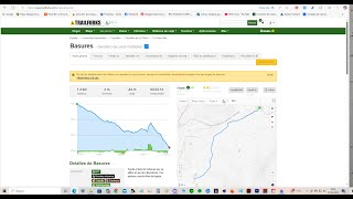
Senda al lado de Cabanes que se utiliza en las dos direcciones. Con piedras y mucho flow de bajada.

Local Trail Association

Recent Activity on Trail

Past Week
  • 0 rides
  •  
6 Months
  • 17 rides
  • 49 miles avg distance
All
  • 119 rides
  • Last: May 15, 2026
c1c2c3c4
January
February
March
April
May
June
July
August
September
October
November
December
update trails status or condition

Barranc del Ramachol Trail Reports

Status:
on May 30, 2026
Ideal
Avg: 2.5 (2 votes)
Your vote: 0

view (439)
close
3D
Trail Conditions
  • Unknown
  • Snow Groomed
  • Snow Packed
  • Snow Covered
  • Snow Cover Partial
  • Freeze/thaw Cycle
  • Icy
  • Prevalent Mud
  • Wet
  • Variable
  • Ideal
  • Dry
  • Very Dry
Trail Flow (Ridden Direction)
Trailforks scans users ridelogs to determine the most popular direction each trail is ridden. A good flowing trail network will have most trails flowing in a single direction according to their intension.
The colour categories are based on what percentage of riders are riding a trail in its intended direction.
  • > 96%
  • > 90%
  • > 80%
  • > 70%
  • > 50%
  • < 50%
  • bi-directional trail
  • no data
Trail Last Ridden
Trailforks scans ridelogs to determine the last time a trail was ridden.
  • < 2 days
  • < 1 week
  • < 2 weeks
  • < 1 month
  • < 6 months
  • > 6 months
Trail Ridden Direction
The intended direction a trail should be ridden.
  • Downhill Only
  • Downhill Primary
  • Both Directions
  • Uphill Primary
  • Uphill Only
  • One Direction
Contribute Details
Colors indicate trail is missing specified detail.
  • Description
  • Photos
  • Description & Photos
  • Videos
Trail Popularity ?
Trailforks scans ridelogs to determine which trails are ridden the most in the last 9 months. Trails are compared with nearby trails in the same city region with a possible 25 colour shades. Think of this as a heatmap, more rides = more kinetic energy = warmer colors.
  • most popular
  • popular
  • less popular
  • not popular
ATV/ORV/OHV Filter
Max Vehicle Width
inches
US Cell Coverage
Legend
cell carrier legend

Radar Time
Activity Recordings
Trailforks uses anonymized public activity data. ?
Activity Recordings
Trailforks uses anonymized public activity data. ?
Personal Heatmap
Activity Types
all / none
Options
2
Date range month
Winter Trails
Warning A routing network for winter maps does not exist. Selecting trails using the winter trails layer has been disabled.
Missing Trails
Most Popular
Least Popular
Trails are colored based on popularity. The more popular a trail is, the more red. Less popular trails trend towards green.
Jump Magnitude Heatmap
Heatmap of where riders jump on trails. Zoom in to see individual jumps, click circles to view jump details.
BC Backroad Status

Service Road Atlas is a free to use, community-driven service for viewing and creating reports on the numerous back-country service roads around B.C. and Alberta.

map legend
Slope Aspect
Direction the slope faces
Flat N NE E SE S SW W NW
Trails Deemphasized
Trails are shown in grey.
disable
Only show trails with no bike usage.
Enable
Suggested Layers
Based on selected activity type

    Save the current map location and zoom level as your default home location whenever this page is loaded.

    Save
        Directions to barranc-del-ramachol trailhead (40.156290, 0.062910)

        Photos

        No photos have been added for Barranc del Ramachol yet, add a photo.

        Videos

        2 more »
        Senda Basures  cabanes
        3:33 | 25 | Jun 30, 2025 , Vilanova D'Alcolea
        Basures 4k (cabanes)
        4:11 | 65 | Apr 7, 2025 , Vilanova D'Alcolea

        Routes with this trail

        51 miles 4,672 ft 23
        Etapa 3 de la Mediterranean Epic 2026. 82 km ; +1.415 m

        Reviews / Comments

        No reviews yet, be the first to write a review or ask a question.
        Use trail reports to comment on trail conditions.


        We hope you've been enjoying Trailforks!

        Create a FREE account to view trail comments and much more.

        • By architrepaTF Pro TFSPAIN & contributors
        • #526300 - 381 views

        Frequently Asked Questions About Barranc del Ramachol

        Where is Barranc del Ramachol located?
        Barranc del Ramachol is located in La Plana Alta, Vilanova D'Alcolea, Spain. It is part of the La Plana Alta trail network. The trailhead is located at coordinates 40.15629, 0.06291.
        How hard is Barranc del Ramachol?
        Barranc del Ramachol is rated as Blue difficulty. The physical rating is Moderate. The average grade is 3.1%. The climb difficulty is rated Blue.
        What is the elevation gain for Barranc del Ramachol?
        Barranc del Ramachol has 11 ft of elevation gain. The trail has 139 ft of elevation descent. The elevation ranges from 1,002 ft to 1,130 ft.
        Is Barranc del Ramachol a point to point trail?
        Barranc del Ramachol is not a point to point trail. The direction is Both Directions. The trail type is singletrack.

        Hit the Trail

        Open in App

        Get this trail on your phone instantly.
        open trail in app

        Download Trail

        Save to wishlist, Garmin & download.
        save the trail

        Find Related Routes

        Find routes and users activities that include this trail.
        find routes for this trail

        You must enter a description before submitting.