more stats
558 ft
Distance
-9 ft
Descent
00:02:44
Avg time
-9 ft
Altitude change
560 ft
Altitude min
569 ft
Altitude max
569 ft
Altitude start
561 ft
Altitude end
-1.5%
Grade
-4.6%
Grade max
0.8%
Grade min
16 ft
Distance climb
299 ft
Distance down
246 ft
Distance flat
00:02:44
Avg time

Beech Details

  • Activities
    • Mountain Bike
  • Riding Area
  • Difficulty Rating
  • Local Popularity
    100 in Mountain Biking heatmap
  • Global Ranking
    #2402 in Mountain Biking
  • State Ranking
    #25 in Mountain Biking · North Carolina
  • Trail Type
    Machine Groomed
  • Bike Type
    DH, AM, DJ
  • eBike Allowed
  • TTFs on Trail
    Berm, Jump
  • Land Owner
    Durham Country Parks & Rec/Orange County Parks

Beginner skills line featuring jumps and berms.
All jumps are constructed with galvanized steel frames and have rough sawn cedar planks as the riding surface. This creates a long lasting set of consistent jumps for all riders to advance their skills. The radius of all the jumps are consistent, which leads to a greater sense of confidence for the riders. All jumps are set into tabletop/step-up style dirt landings so there are NO gaps to stress over. Plop it on the top until you can clear it without much worry.
Beech trail, a Green Jumpline, will get the novice riders confident in the air. The line starts with a pair of rollers to set the speed for a 3 pack of 3' tall jumps that are separated with a nice roller in-between each of them to help maintain flow. The trail then has a left hand berm into the final 2 jumps which are slightly taller to promote proper technique and timing so that you carry your speed through the entire line. Once riders have confidently cleared this line they should have the skills and self-confidence to progress on to Poplar.

Tags
BermsJumpsRollers

Local Trail Association

Traditionally Indigenous Territory

Recent Activity on Trail

Past Week
  • 0 rides
  •  
6 Months
  • 7 rides
  • 8 miles avg distance
All
  • 33 rides
  • Last: Nov 11, 2026
c1c2c3c4
January
February
March
April
May
June
July
August
September
October
November
December
Status:
on Nov 8, 2026
Ideal
Avg: 4.13 (1 votes)
Your vote: 0

view (2,842)
close
      Directions to beech-865215 trailhead (36.162860, -78.967900)

      Photos

      6 more »
      mtb
      107 |
      Sep 23, 2025 @ 9:41am
      Sep 23, 2025
      mtb
      119 |
      Sep 23, 2025 @ 9:41am
      Sep 23, 2025
      mtb
      117 |
      Sep 23, 2025 @ 9:41am
      Sep 23, 2025
      mtb
      130 |
      Sep 23, 2025 @ 9:41am
      Sep 23, 2025

      Videos

      1 more »
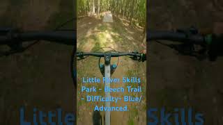
      Little River Skills Park -  Beech Trail -...
      mtb
      0:41 | 226 | Sep 19, 2025 , Durham
      5.0 ★★★★★
      1 Ratings
      5 ★ 100%
      4 ★
      3 ★
      2 ★
      1 ★

      1 Review & Comments

      chuckmallott chuckmallott
      Really enjoyed this. As someone still learning to be comfortable on jumps, this is the perfect place to practice. There are enough jumps and they are spaced apart perfectly in order to get into a good rhythm. And the return is simple enough so that you feel like you can session this over and over again. Actually ramps look expertly constructed, too.

      We hope you've been enjoying Trailforks!

      Create a FREE account to view all trail reviews and much more.

      Frequently Asked Questions

      ▼ Where is Beech located?
      Beech is located in Little River Regional Park and Natural Area, Durham, North Carolina, United States. It is part of the Little River Regional Park and Natural Area trail network. The trailhead is located at coordinates 36.16286, -78.9679.
      ▼ How hard is Beech?
      Beech is rated as Green difficulty. The average grade is 1.5%.
      ▼ What is the elevation gain for Beech?
      The trail has 9 ft of elevation descent. The elevation ranges from 560 ft to 569 ft.
      ▼ How long is Beech?
      Beech is 558 ft long. The trail type is machine groomed.
      ▼ Are dogs allowed on Beech?
      There is no information about dogs being allowed on Beech. Check with local trail managers or the trail page for the latest access rules.
      ▼ How do I access Beech? Where is the closest parking trailhead?
      The closest parking and trailhead locations to Beech are: View all parking locations in the area.
      ▼ How long does it take to ride Beech?
      Based on recorded activities, it takes an average of 3 minutes to ride Beech. The trail is 558 ft long. Actual times will vary based on fitness level, conditions, and pace. View recent activity logs for more details.
      ▼ How busy is Beech?
      Beech is a very popular trail. There have been 179 recorded activities on this trail. The trail has received 2,842 check-ins. View recent activity on this trail.

      Hit the Trail

      Open in App

      Get this trail on your phone instantly.

      open trail in app

      Download Trail

      Save to wishlist, Garmin & download.
      save the trail

      Find Related Routes

      Find routes and users activities that include this trail.
      find routes for this trail

      You must enter a description before submitting.