
more stats
2,156 ft
Distance
-292 ft
Descent
00:02:13
Avg time
-292 ft
Altitude change
2,835 ft
Altitude min
3,127 ft
Altitude max
3,127 ft
Altitude start
2,835 ft
Altitude end
-13.5%
Grade
-58.9%
Grade max
62 ft
Distance climb
1,906 ft
Distance down
62 ft
Distance flat
00:02:13
Avg time

Jump Line Details

  • Activities
    • Mountain Bike
    • E-Bike
  • Riding Area
  • Ref Number
    #5
  • AKA
    Biker X
  • Difficulty Rating
  • Local Popularity
    60 in Mountain Biking [+]
    • 65 in E-Biking
  • Global Ranking
    #94206 in Mountain Biking [+]
    • #48684 in E-Biking
  • National Ranking
    #3,542 in Mountain Biking · Germany [+]
    • #2,711 in E-Biking
  • Trail Type
    Singletrack
  • Bike Type
    DH, AM, DJ
  • Direction
    Downhill Only
    Popular Direction Shown
  • Season
    April - November
  • eBike Allowed
  • TTFs on Trail
    Jump
  • Ride in Rain
    Yes

English below

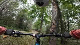
Die Jump Line beginnt direkt an der Mittelstation. Die Streckenlänge beträgt 720 m, der Höhenunterschied 100 m. Diese Strecke ist sehr flüssig zu fahren, die Anlieger sind hoch, die Kurven langgezogen und die Tables lang. Durch die vielen Richtungswechsel und das ständige auf und ab entsteht eine Art schwereloses Fahrgefühl.

Die Strecke ist mit Brechsand präpariert. Sie ist wegen ihrer glatten und harten Oberfläche auch für Hardtail-Fahrer geeignet und auch bei schlechtem Wetter befahrbar. Da wir für diese Strecke nur Tables als Sprünge haben, ist sie auch sehr gut für Anfänger und Bikepark-Neulinge zu befahren.

The trail begins right below the Midstation. The Trail is 720 m long and has a difference in altitude of 100m. It is a very flowy trail, long tables, big curves. All the changes of direction as well as the up and down create a feeling of weightlessness. The Trail is prepared with a special sand.Its hard and even surface make it suitable for Hardtails and bad weather days. Because all the jumps are tables, beginners and less experienced riders will also experience a great time on this trail.

Tags
FlowyJumps

Bike Park

Recent Activity on Trail

Past Week
  • 4 rides
  • 15 miles average
6 Months
  • 169 rides
  • 24 miles avg distance
All
  • 497 rides
  • Last: Oct 7, 2026
c1c2c3c4
January
February
March
April
May
June
July
August
September
October
November
December
Status:
on Aug 16, 2026
Ideal
Avg: 3.76 (16 votes)
Your vote: 0

view (4,567)
close
      Directions to jump-line-25896 trailhead (48.929230, 13.040790)

      Photos

      12 more »
      mtb
      350 |
      Sep 9, 2010 @ 1:29am
      Sep 9, 2010
      mtb
      253 |
      Aug 19, 2007 @ 3:00am
      Aug 19, 2007
      mtb
      264 |
      Aug 19, 2007 @ 1:19pm
      Aug 19, 2007
      mtb
      223 |
      Aug 21, 2007 @ 9:37am
      Aug 21, 2007

      Videos

      7 more »
      Jumpline - Bikepark Geisskopf, MTB Zone
      mtb
      3:53 | 143 | Dec 31, 2024 , Bischofsmais
      MTB Zone Bikepark Geisskopf Biker X
      mtb
      0:21 | 58 | Aug 22, 2020 , Bischofsmais
      MTB ZONE Bikepark Geisskopf Mixtape Evil Eye...
      mtb
      6:54 | 28 | Jun 6, 2019 , Bischofsmais
      MTB ZONE Bikepark Geisskopf Biker X
      mtb
      0:33 | 55 | Jun 6, 2019 , Bischofsmais
      3.8 ★★★★★
      16 Ratings
      5 ★ 38%
      4 ★ 13%
      3 ★ 38%
      2 ★ 13%
      1 ★

      2 Reviews & Comments

      ktnkgb ktnkgb
      It's realy worn and washed out. Could benefit of some care.

      We hope you've been enjoying Trailforks!

      Create a FREE account to view all trail reviews and much more.

      • By UniqueTerrainProductions & contributors
      • #25896 - 3,962 views

      Frequently Asked Questions

      ▼ Where is Jump Line located?
      Jump Line is located in MTB Zone Bikepark Geisskopf, Bischofsmais, Germany. It is part of the MTB Zone Bikepark Geisskopf trail network. The trailhead is located at coordinates 48.92923, 13.04079.
      ▼ How hard is Jump Line?
      Jump Line is rated as Red difficulty. The average grade is 13.5%.
      ▼ What is the elevation gain for Jump Line?
      The trail has 292 ft of elevation descent. The elevation ranges from 2,835 ft to 3,127 ft.
      ▼ Is Jump Line a point to point trail?
      Yes, Jump Line is a point to point trail. The direction is Downhill Only. The trail type is singletrack.
      ▼ How long is Jump Line?
      Jump Line is 2,156 ft long. The trail type is singletrack.
      ▼ Are dogs allowed on Jump Line?
      There is no information about dogs being allowed on Jump Line. Check with local trail managers or the trail page for the latest access rules.
      ▼ When is the best time of year to ride Jump Line?
      Jump Line is best visited during: April - November.
      ▼ How do I access Jump Line? Where is the closest parking trailhead?
      The closest parking and trailhead locations to Jump Line are: View all parking locations in the area.
      ▼ How long does it take to ride Jump Line?
      Based on recorded activities, it takes an average of 2 minutes to ride Jump Line. The trail is 2,156 ft long. Actual times will vary based on fitness level, conditions, and pace. View recent activity logs for more details.
      ▼ How busy is Jump Line?
      Jump Line is a moderately popular trail. There have been 2,575 recorded activities on this trail. The trail has received 4,567 check-ins. View recent activity on this trail.

      Hit the Trail

      Open in App

      Get this trail on your phone instantly.

      open trail in app

      Download Trail

      Save to wishlist, Garmin & download.
      save the trail

      Find Related Routes

      Find routes and users activities that include this trail.
      find routes for this trail

      You must enter a description before submitting.