more stats
1.3 miles
Distance
102 ft
Climb
-323 ft
Descent
00:10:00
Avg time
-221 ft
Altitude change
176 ft
Altitude min
408 ft
Altitude max
407 ft
Altitude start
187 ft
Altitude end
-3.2%
Grade
-31.5%
Grade max
15.5%
Grade min
1,719 ft
Distance climb
4,324 ft
Distance down
850 ft
Distance flat
00:10:00
Avg time

Birdwing Details

  • Activities
    • Mountain Bike
    • E-Bike
    • Hike
    • Trail Running
  • Riding Area
  • Difficulty Rating
  • Local Popularity
    90 in Mountain Biking heatmap [+]
    • 90 in E-Biking
    • 80 in Trail Running
    • 80 in Hiking
  • Global Ranking
    #57643 in Mountain Biking [+]
    • #18245 in E-Biking
    • #123111 in Trail Running
    • #117280 in Hiking
  • National Ranking
    #2,796 in Mountain Biking · Australia [+]
    • #1,152 in E-Biking
    • #4,035 in Trail Running
    • #3,848 in Hiking
  • Trail Type
    Singletrack
  • Bike Type
    AM, XC
  • Direction
    Both Directions
    Popular In Reverse
  • Climb Difficulty
    Blue
  • Physical Rating
    Moderate
  • Dogs Allowed
    Yes
  • eBike Allowed
    Yes up to Class 1
  • TTFs on Trail
    Berm, Jump
  • Land Owner
    Logan City Council

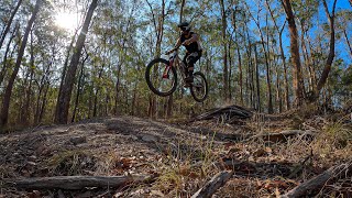
Two way trail featuring bike park style rollers and jumps, mostly hardpack dirt, and bermed corners. This trail is suitable for all levels of riders.

Access Info

Access is either from Parkview Crescent, or fire break access at 178 Parkview Cres or from Kimberly Drive.

Tags
BermsJumpsRollers

Trail Supporters

  • Logan City Trail Alliance
    Sponsor

Local Trail Association

Traditionally Indigenous Territory

Recent Activity on Trail

Past Week
  • 0 rides
  •  
6 Months
  • 65 rides
  • 12 miles avg distance
All
  • 1,185 rides
  • Last: Nov 17, 2026
c1c2c3c4
January
February
March
April
May
June
July
August
September
October
November
December
update trails status or condition

Birdwing Trail Reports

statusdatedescription
Oct 18, 2026 @ 12:18pm (Australia/Brisbane)
Oct 17, 2026
Mar 14, 2026 @ 8:17am (Australia/Brisbane)
Mar 13, 2026
Mar 18, 2025 @ 9:17am
Mar 18, 2025
BIG SHOUT OUT AND THANKS TO THE GUYS CLEARING THESE TRAILS WITH THEIR CHAIN SAWS
Feb 27, 2025 @ 10:01am
Feb 27, 2025
Dec 19, 2024 @ 5:11pm
Dec 19, 2024
Trail is open but may still have some wet areas.
more »
Status:
on Oct 18, 2026
Variable
Avg: 3.79 (13 votes)
Your vote: 0

view (14,273)
close
      Directions to birdwing-48748 trailhead (-27.647110, 153.193690)

      Photos

      27 more »
      mtb
      126 |
      Jun 17, 2022 @ 1:44pm
      Jun 17, 2022
      mtb
      120 |
      Jun 4, 2021 @ 11:28pm
      Jun 4, 2021
      mtb
      267 |
      Oct 20, 2015 @ 5:19pm
      Oct 20, 2015
      report
      mtb
      61 |
      Dec 31, 2024 @ 9:24pm
      Dec 31, 2024

      Videos

      6 more »
      youtuber Technology Ruins Everything at Cornubia
      mtb
      12:21 | 540 | Nov 20, 2021 , Brisbane
      youtuber The best Mountain bike riding in LOGAN CITY!
      mtb
      10:42 | 88 | Sep 2, 2025 , Brisbane
      youtuber RAW OG style mountain bike trails
      mtb
      17:11 | 102 | Jun 30, 2025 , Brisbane
      CORNUBIA MTB POV | BIRDWING
      mtb
      4:58 | 965 | Jan 14, 2020 , Brisbane

      Routes with this trail

      more »
      7 miles • 1,305 ft • 8 • Loop •
      Start at Carpark - go downhill & back up fire trail

      Trail Events

      3.7 ★★★★★
      13 Ratings
      5 ★ 38%
      4 ★ 23%
      3 ★ 23%
      2 ★
      1 ★ 15%

      5 Reviews & Comments

      DaemonSpecis
      First track I’ve ridden, came off and went down ditches twice and ran into trees but it’s a really good ride, visit the quarry nearby in the next segment of trails, it’s a nice view!
      Steveba
      Totally agree with comments above. Good climb back up unless you’ve got new shoes to wear in on Parkview Ridge. Whoever rated Cornubia should do Daisy Hill. There wouldn’t be much blue left there...
      benharms benharms
      To think that this trail is green but Koala at Daisy is a blue....

      We hope you've been enjoying Trailforks!

      Create a FREE account to view all trail reviews and much more.

      • By micko1000 & contributors
      • #48748 - 5,239 views

      Frequently Asked Questions

      ▼ Where is Birdwing located?
      Birdwing is located in Cornubia Forest Park, Brisbane, Australia. It is part of the Cornubia Forest Park trail network. The trailhead is located at coordinates -27.64711, 153.19369.
      ▼ How hard is Birdwing?
      Birdwing is rated as Blue difficulty. The physical rating is Moderate. The average grade is 3.2%. The climb difficulty is rated Blue.
      ▼ What is the elevation gain for Birdwing?
      Birdwing has 102 ft of elevation gain. The trail has 323 ft of elevation descent. The elevation ranges from 176 ft to 408 ft.
      ▼ Is Birdwing a point to point trail?
      Birdwing is not a point to point trail. The direction is Both Directions. The trail type is singletrack.
      ▼ How long is Birdwing?
      Birdwing is 1.3 miles long. The trail type is singletrack.
      ▼ Are dogs allowed on Birdwing?
      Yes, dogs are allowed on Birdwing. Please keep dogs on a leash where required and clean up after them.
      ▼ How do I access Birdwing? Where is the closest parking trailhead?
      The closest parking and trailhead locations to Birdwing are: View all parking locations in the area.
      ▼ How long does it take to ride Birdwing?
      Based on recorded activities, it takes an average of 10 minutes to ride Birdwing. The trail is 1.3 miles long. Actual times will vary based on fitness level, conditions, and pace. View recent activity logs for more details.
      ▼ How busy is Birdwing?
      Birdwing is a very popular trail. There have been 8,203 recorded activities on this trail. The trail has received 14,273 check-ins. View recent activity on this trail.

      Hit the Trail

      Open in App

      Get this trail on your phone instantly.

      open trail in app

      Download Trail

      Save to wishlist, Garmin & download.
      save the trail

      Find Related Routes

      Find routes and users activities that include this trail.
      find routes for this trail

      You must enter a description before submitting.