
more stats
4,291 ft
Distance
461 ft
Climb
-42 ft
Descent
00:12:45
Avg time
419 ft
Altitude change
1,188 ft
Altitude min
1,607 ft
Altitude max
1,188 ft
Altitude start
1,607 ft
Altitude end
9.772%
Grade
-12.771%
Grade max
31.112%
Grade min
3,255 ft
Distance climb
702 ft
Distance down
335 ft
Distance flat
00:12:45
Avg time

Bowfield Trail Details

  • Activities
    • Mountain Bike
    • Winter Fat Bike
    • Hike
    • Trail Running
  • Riding Area
    Oak Park
    , California
  • Difficulty Rating
  • Local Popularity
    55 in Mountain Biking [+]
    • 5 in Trail Running
    • 90 in Hiking
  • Global Ranking
    #224324 in Mountain Biking [+]
    • #325958 in Trail Running
    • #76977 in Hiking
    • #49295 in Winter Fat Biking
  • State Ranking
    #7,404 in Mountain Biking · California [+]
    • #13,330 in Trail Running
    • #4,370 in Hiking
    • #1,083 in Winter Fat Biking
  • Trail Type
    Singletrack
  • Bike Type
    AM, XC, Fat
  • Direction
    Both Directions
  • Climb Difficulty
    Blue
  • Physical Rating
    Moderate
  • Dogs Allowed
    Yes

This little section is really fun to go down because its hard packed and has some nice turns and you can go super fast. Just watch out for hikers.

Tags

Traditionally Indigenous Territory

Recent Activity on Trail

Past Week
  • 0 rides
  •  
6 Months
  • 1 rides
  • 8 miles avg distance
All
  • 30 rides
  • Last: Sep 23, 2026
update trails status or condition

Bowfield Trail Trail Reports

statusdatedescription
Mar 8, 2026 @ 11:57am (America/Los_Angeles)
Mar 8, 2026
Jun 9, 2023 @ 4:33am
Jun 9, 2023
A bit overgrown but fine to ride.
Mar 25, 2023 @ 10:08pm
Mar 25, 2023
Beware of the one mudspot. It is the stickiest mud I have ever encountered!
Apr 11, 2021 @ 12:49pm
Apr 11, 2021
more »
Status:
on Mar 8, 2026
Dry
no votes yet
Your vote: 0

view (394)
close
      Directions to bowfield-trail trailhead (34.178660, -118.792880)

      Photos

      No photos have been added for Bowfield Trail yet, add a photo.

      Videos

      4 more »
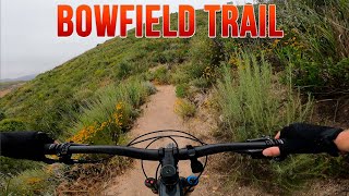
      youtuber Bowfield Trail - Mountain Biking - Oak Park, CA
      mtb
      3:02 | 304 | Jun 9, 2023 , Oak Park
      youtuber Bowfield Trail on E-bikes  - Oak Park, CA
      mtb
      4:36 | 440 | Nov 24, 2021 , Oak Park
      Quick Downhill Run -- Oak Park, CA
      mtb
      374 | Jun 3, 2017 , Oak Park
      mtb
      2:50 | 43 | Oct 19, 2019 , Oak Park

      2 Reviews & Comments

      Boltdude
      Be careful on the descent to Bowfield. There is significant erosion from the recent heavy rains, including a couple collapsed trail sections near the top and a large sink hole in the middle of the trail at the bottom. Easy enough to steer around when going slow on the climb, but could ruin your day if bombing down. .

      We hope you've been enjoying Trailforks!

      Create a FREE account to view all trail reviews and much more.

      Nearby Trails

      • By mtbcommunity-comTF Pro & contributors
      • #92304 - 1,757 views

      Frequently Asked Questions

      ▼ Where is Bowfield Trail located?
      Bowfield Trail is located in Oak Park, California, United States. It is part of the Oak Park trail network. The trailhead is located at coordinates 34.17866, -118.79288.
      ▼ How hard is Bowfield Trail?
      Bowfield Trail is rated as Blue difficulty. The physical rating is Moderate. The average grade is 9.772%. The climb difficulty is rated Blue.
      ▼ What is the elevation gain for Bowfield Trail?
      Bowfield Trail has 461 ft of elevation gain. The trail has 42 ft of elevation descent. The elevation ranges from 1,188 ft to 1,607 ft.
      ▼ Is Bowfield Trail a point to point trail?
      Bowfield Trail is not a point to point trail. The direction is Both Directions. The trail type is singletrack.
      ▼ How long is Bowfield Trail?
      Bowfield Trail is 4,291 ft long. The trail type is singletrack.
      ▼ Are dogs allowed on Bowfield Trail?
      Yes, dogs are allowed on Bowfield Trail. Please keep dogs on a leash where required and clean up after them.
      ▼ How do I access Bowfield Trail? Where is the closest parking trailhead?
      The closest parking and trailhead locations to Bowfield Trail are: View all parking locations in the area.
      ▼ How long does it take to ride Bowfield Trail?
      Based on recorded activities, it takes an average of 13 minutes to ride Bowfield Trail. The trail is 4,291 ft long. Actual times will vary based on fitness level, conditions, and pace. View recent activity logs for more details.
      ▼ How busy is Bowfield Trail?
      Bowfield Trail is a moderately popular trail. There have been 314 recorded activities on this trail. The trail has received 394 check-ins. View recent activity on this trail.

      Hit the Trail

      Open in App

      Get this trail on your phone instantly.

      open trail in app

      Download Trail

      Save to wishlist, Garmin & download.
      save the trail

      Find Related Routes

      Find routes and users activities that include this trail.
      find routes for this trail

      You must enter a description before submitting.

