
more stats
1.0 mile
Distance
3 ft
Climb
-759 ft
Descent
00:10:24
Avg time
-755 ft
Altitude change
1,895 ft
Altitude min
2,650 ft
Altitude max
2,650 ft
Altitude start
1,896 ft
Altitude end
-13.7%
Grade
-82.7%
Grade max
3.6%
Grade min
167 ft
Distance climb
5,049 ft
Distance down
299 ft
Distance flat
00:10:24
Avg time

Bruciato Details

  • Activities
    • Mountain Bike
    • E-Bike
    • Winter Fat Bike
    • Hike
    • Trail Running
  • Riding Area
  • Difficulty Rating
  • Local Popularity
    30 in Mountain Biking heatmap [+]
    • 25 in E-Biking
    • 5 in Trail Running
    • 5 in Hiking
    • 5 in Winter Fat Biking
  • Global Ranking
    #128667 in Mountain Biking [+]
    • #100409 in E-Biking
    • #305871 in Trail Running
    • #299202 in Hiking
    • #3814 in Winter Fat Biking
  • National Ranking
    #9,783 in Mountain Biking · Italy [+]
    • #10,856 in E-Biking
    • #10,471 in Trail Running
    • #10,552 in Hiking
    • #101 in Winter Fat Biking
  • Trail Type
    Singletrack
  • Bike Type
    DH, AM, XC, DJ, RD, Fat
  • Direction
    Downhill Only
    Popular Direction Shown
  • Physical Rating
    Moderate
  • Season
    All seasons
  • Dogs Allowed
    Yes
  • eBike Allowed
    Yes up to Class 1

No community description for Bruciato trail has been added yet!

AI Generated Description

Bruciato is a 2 km less popular blue difficulty singletrack trail located near Coldirodi. This mountain bike primary trail can be used downhill only and has a moderate overall physical rating. On average it takes 10 minutes to complete this trail.

Tags

Recent Activity on Trail

Past Week
  • 0 rides
  •  
6 Months
  • 8 rides
  • 12 miles avg distance
All
  • 60 rides
  • Last: Oct 16, 2026
c1c2c3c4
January
February
March
April
May
June
July
August
September
October
November
December
update trails status or condition

Bruciato Trail Reports

statusdatedescription
Nov 2, 2026 @ 5:03pm (Europe/Rome)
Nov 2, 2026
Feb 7, 2026 @ 6:27pm (Europe/Rome)
Feb 7, 2026
Luckily the sandstone provides a surprising amount of grip in these wet condition. Creeks have loads of water but are still possible to cross...
Dec 29, 2025 @ 4:32pm (Europe/Rome)
Dec 29, 2025
Un po’ di foglie e pietre. Ma si gira comunque bene.
Oct 14, 2024 @ 12:53am
Oct 14, 2024
Parte centrale necessita pulizia. Pietre smosse, rami e foglie
Mar 28, 2024 @ 8:54am
Mar 28, 2024
more »
Status:
on Nov 2, 2026
Dry
Avg: 3.66 (12 votes)
Your vote: 0

view (560)
close
      Directions to bruciato trailhead (43.843020, 7.718530)

      Photos

      2 more »
      mtb
      103 |
      Apr 20, 2025 @ 5:25am
      Apr 20, 2025
      mtb
      95 |
      Sep 26, 2023 @ 7:24am
      Sep 26, 2023

      Videos

      1 more »
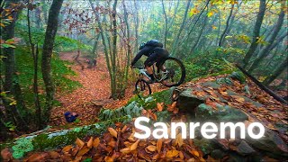
      Scogli Grossi | Bruciato | Boot Hill 2 -> Isola
      mtb
      22:58 | 155 | Dec 6, 2024 , Coldirodi

      Routes with this trail

      more »
      ★ 4.0 • 13 miles • 3,386 ft • 4 • Loop •
      Uscita al casello di Sanremo, seguire direzione Coldirodi, al bivio girare a destra e parcheggiare. Le...
      1 mile • 72 ft • 1 • Point to Point •
      Bruciato Description: The route follows one of the most iconic enduro trails in the San Romolo area; it...
      3.7 ★★★★★
      12 Ratings
      5 ★ 17%
      4 ★ 50%
      3 ★ 25%
      2 ★
      1 ★ 8%

      6 Reviews & Comments

      Sam3181Rr
      Fun and flowy at the top then a bit more techy lower down but all rollable
      AlejandroohTSDt
      Normalilla ni un 0 ni un 10, sucia y algo descuidada....quizás en otra época del año valga la pena, ahora preferible hacer otras...
      BAB0
      Fallen tree in the middle, need to lift your bike over it

      We hope you've been enjoying Trailforks!

      Create a FREE account to view all trail reviews and much more.

      Frequently Asked Questions

      ▼ Where is Bruciato located?
      Bruciato is located in Coldirodi, Italy. It is part of the Coldirodi trail network. The trailhead is located at coordinates 43.84302, 7.71853.
      ▼ How hard is Bruciato?
      Bruciato is rated as Blue difficulty. The physical rating is Moderate. The average grade is 13.7%.
      ▼ What is the elevation gain for Bruciato?
      Bruciato has 3 ft of elevation gain. The trail has 759 ft of elevation descent. The elevation ranges from 1,895 ft to 2,650 ft.
      ▼ Is Bruciato a point to point trail?
      Yes, Bruciato is a point to point trail. The direction is Downhill Only. The trail type is singletrack.
      ▼ How long is Bruciato?
      Bruciato is 1.0 mile long. The trail type is singletrack.
      ▼ Are dogs allowed on Bruciato?
      Yes, dogs are allowed on Bruciato. Please keep dogs on a leash where required and clean up after them.
      ▼ When is the best time of year to ride Bruciato?
      Based on activity log data, the most popular months to ride Bruciato are:
      • May (7 activities)
      • April (4 activities)
      • June (3 activities)
      Check the reports page for current trail conditions.
      ▼ How do I access Bruciato? Where is the closest parking trailhead?
      The closest parking and trailhead locations to Bruciato are: View all parking locations in the area.
      ▼ How long does it take to ride Bruciato?
      Based on recorded activities, it takes an average of 10 minutes to ride Bruciato. The trail is 1.0 mile long. Actual times will vary based on fitness level, conditions, and pace. View recent activity logs for more details.
      ▼ How busy is Bruciato?
      Bruciato is a less popular trail with lighter traffic. There have been 524 recorded activities on this trail. The trail has received 560 check-ins. View recent activity on this trail.

      Hit the Trail

      Open in App

      Get this trail on your phone instantly.

      open trail in app

      Download Trail

      Save to wishlist, Garmin & download.
      save the trail

      Find Related Routes

      Find routes and users activities that include this trail.
      find routes for this trail

      You must enter a description before submitting.

