

more stats
1.8 miles
Distance
70 ft
Climb
-1,670 ft
Descent
00:18:12
Avg time
-1,600 ft
Altitude change
1,736 ft
Altitude min
3,336 ft
Altitude max
3,336 ft
Altitude start
1,736 ft
Altitude end
-16.5%
Grade
-103.5%
Grade max
30.1%
Grade min
771 ft
Distance climb
2 miles
Distance down
305 ft
Distance flat
00:18:12
Avg time

Ca Fuochi Details

  • Activities
    • Mountain Bike
    • E-Bike
    • Hike
    • Trail Running
  • Riding Area
  • Difficulty Rating
  • Voted Difficulty
    Black Diamond (1 vote)
  • Local Popularity
    70 in Mountain Biking heatmap [+]
    • 65 in E-Biking
    • 70 in Trail Running
    • 5 in Hiking
  • Global Ranking
    #63620 in Mountain Biking [+]
    • #43704 in E-Biking
    • #134133 in Trail Running
    • #298911 in Hiking
  • National Ranking
    #5,445 in Mountain Biking · Italy [+]
    • #5,145 in E-Biking
    • #4,325 in Trail Running
    • #10,516 in Hiking
  • Trail Type
    Singletrack
  • Bike Type
    AM
  • Physical Rating
    Hard
  • Trail Visibility
    Always easy to follow
  • Dogs Allowed
    Yes
  • eBike Allowed
    Yes up to Class 1
  • TTFs on Trail
    Roller Coaster

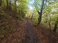
Prima parte piuttosto flow, ma con traccia stretta e con qualche tratto esposto, poi si gira a destra e inizia il ripido con qualche bel tornantino e tratto scassato. si passa un caseggiato in rovina con un ripido non banale, o tornante in nose press. Poi continua con dei saliscendi non banali, da fare attenzione all'esposizione. Tratto molto scassato prima di arrivare alla forestale. Si fa un tratto di forestale, poi inizia il tratto più fisico con molti sassi, tratti scassati, saltini, poi di nuovo su stradina per 200m , curva secca a sx, e finale con il botto, tratto single track molto impegnativo (per Double Diamond in questo punto), e si arriva a Fanano Ponti.

Tags
Rollers

Recent Activity on Trail

Past Week
  • 0 rides
  •  
6 Months
  • 9 rides
  • 12 miles avg distance
All
  • 50 rides
  • Last: Oct 21, 2026
Status:
on Oct 31, 2026
Ideal
Avg: 4.32 (3 votes)
Your vote: 0

view (166)
close
      Directions to ca-fuochi trailhead (44.196040, 10.808440)

      Photos

      12 more »
      mtb
      54 |
      Jul 22, 2025 @ 3:14am
      Jul 22, 2025
      mtb
      55 |
      Jul 22, 2025 @ 3:14am
      Jul 22, 2025
      mtb
      54 |
      Jul 22, 2025 @ 3:14am
      Jul 22, 2025
      mtb
      58 |
      Jul 22, 2025 @ 3:14am
      Jul 22, 2025

      Videos

      4 more »
      Ca Fuochi (da 0.25 fino a 2.40)
      mtb
      13:27 | 209 | Jul 28, 2025 , Fanano
      Cà dei Fuochi, Fanano
      mtb
      10:00 | 364 | Jul 13, 2023 , Fanano
      Ca Fuochi - Rider Christian Baruffi
      mtb
      9:49 | 6 | Nov 8, 2026 , Fanano
      youtuber Ca Fuochi - PS1 Senators Cup 2025
      ebike
      5:57 | 276 | Jul 23, 2025 , Fanano
      5.0 ★★★★★
      3 Ratings
      5 ★ 100%
      4 ★
      3 ★
      2 ★
      1 ★

      1 Review & Comments

      nottide
      noi siamo andati a dx dopo il lago pratignano prendendo il 407
      che si ricongiunge con caselle

      We hope you've been enjoying Trailforks!

      Create a FREE account to view all trail reviews and much more.

      • By anatas & contributors
      • #55472 - 2,327 views

      Frequently Asked Questions

      ▼ Where is Ca Fuochi located?
      Ca Fuochi is located in Monte Cimone (Fanano - Sestola), Fanano, Italy. It is part of the Monte Cimone (Fanano - Sestola) trail network. The trailhead is located at coordinates 44.19604, 10.80844.
      ▼ How hard is Ca Fuochi?
      Ca Fuochi is rated as Red difficulty. The physical rating is Hard. The average grade is 16.5%.
      ▼ What is the elevation gain for Ca Fuochi?
      Ca Fuochi has 70 ft of elevation gain. The trail has 1,670 ft of elevation descent. The elevation ranges from 1,736 ft to 3,336 ft.
      ▼ How long is Ca Fuochi?
      Ca Fuochi is 1.8 miles long. The trail type is singletrack.
      ▼ Are dogs allowed on Ca Fuochi?
      Yes, dogs are allowed on Ca Fuochi. Please keep dogs on a leash where required and clean up after them.
      ▼ How do I access Ca Fuochi? Where is the closest parking trailhead?
      The closest parking and trailhead locations to Ca Fuochi are: View all parking locations in the area.
      ▼ How long does it take to ride Ca Fuochi?
      Based on recorded activities, it takes an average of 18 minutes to ride Ca Fuochi. The trail is 1.8 miles long. Actual times will vary based on fitness level, conditions, and pace. View recent activity logs for more details.
      ▼ How busy is Ca Fuochi?
      Ca Fuochi is a very popular trail. There have been 178 recorded activities on this trail. The trail has received 166 check-ins. View recent activity on this trail.

      Hit the Trail

      Open in App

      Get this trail on your phone instantly.

      open trail in app

      Download Trail

      Save to wishlist, Garmin & download.
      save the trail

      Find Related Routes

      Find routes and users activities that include this trail.
      find routes for this trail

      You must enter a description before submitting.

