

more stats
1,982 ft
Distance
-292 ft
Descent
00:01:18
Avg time
-294 ft
Altitude change
1,089 ft
Altitude min
1,383 ft
Altitude max
1,383 ft
Altitude start
1,089 ft
Altitude end
-14.9%
Grade
-52.8%
Grade max
-2.6%
Grade min
1,982 ft
Distance down
00:01:18
Avg time

Chutes & Splatters Details

  • Activities
    • Mountain Bike
    • E-Bike
  • Riding Area
    Del Valle Regional Park
    Livermore, California
  • Difficulty Rating
  • Voted Difficulty
    Blue (7 votes)
  • Local Popularity
    90 in Mountain Biking heatmap [+]
    • 80 in E-Biking
  • Global Ranking
    #544 in Mountain Biking [+]
    • #12241 in E-Biking
  • State Ranking
    #21 in Mountain Biking · California [+]
    • #291 in E-Biking
  • Trail Type
    Singletrack
  • Bike Type
    DH, AM, XC
  • Direction
    Downhill Only
    Popular Direction Shown
  • Physical Rating
    Hard
  • Trail Visibility
    Sometimes hard to follow
  • eBike Allowed
    Yes up to Class 1
  • TTFs on Trail
    Berm, Skinny

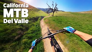
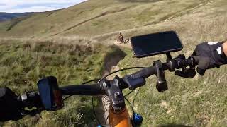
This trail starts off by dropping in to a quickly accelerating slalom-slope style downhill run. There are banks and you will need to use them. Modulated braking is highly recommended and the trail is a single track 90% of the time (not counting the banks). The faster you let yourself go, the more of a physical challenge your body will experience and more effort you will need to put in because again, speed and acceleration slaps you in the face with how quickly you move. There is a blind jump/drop midway through and your landing can be flat if you push too hard; so speed and timing is key here. Good luck, be safe and enjoy the ride

This trail is unsanctioned.

Disclaimer

VERY FAST - Wear protective gear!

Tags
BermsFaint trailSkinnies

Traditionally Indigenous Territory

Recent Activity on Trail

Past Week
  • 1 rides
  • 8 miles average
6 Months
  • 37 rides
  • 11 miles avg distance
All
  • 333 rides
  • Last: Nov 8, 2026
c1c2c3c4
January
February
March
April
May
June
July
August
September
October
November
December
update trails status or condition

Chutes & Splatters Trail Reports

statusdatedescription
Nov 8, 2026 @ 5:09pm (America/Los_Angeles)
Nov 8, 2026
Braking bumps and a bit dusty.
Aug 9, 2026 @ 6:37am (America/Los_Angeles)
Aug 9, 2026
The turns are starting to get dusty and the braking bumps are back. The last few weeks had been really good, but it’s getting to later season...
Apr 5, 2026 @ 10:46am (America/Los_Angeles)
Apr 5, 2026
Mar 17, 2026 @ 8:14am (America/Los_Angeles)
Mar 17, 2026
Feb 2, 2026 @ 3:14pm (America/Los_Angeles)
Feb 2, 2026
getting dusty
more »
Status:
on Nov 8, 2026
Dry
Avg: 4.27 (5 votes)
Your vote: 0

view (2,504)
close
      Directions to chutes--splatters trailhead (37.602030, -121.684520)

      Photos

      7 more »
      mtb
      155 |
      Jun 7, 2025 @ 10:23am
      Jun 7, 2025
      mtb
      205 |
      Feb 25, 2024 @ 11:36am
      Feb 25, 2024
      mtb
      216 |
      Nov 7, 2023 @ 9:07am
      Nov 7, 2023
      mtb
      368 |
      Apr 22, 2023 @ 1:45pm
      Apr 22, 2023

      Videos

      5 more »
      youtuber Del Valle  Amazing MTB Flow Trails, Like No Other!
      mtb
      14:48 | 210 | Jan 31, 2026 , Livermore
      Chutes & Splatters at Del Valle
      mtb
      2:03 | 271 | Jan 25, 2026 , Livermore
      youtuber Del Valle Regional Park: MTB Single-Track Bliss!
      mtb
      8:01 | 525 | Apr 4, 2024 , Livermore
      Livermore Luge Trail ridden on a 2021 Intense...
      mtb
      0:46 | 1030 | Jul 14, 2021 , Livermore

      Routes with this trail

      more »
      14 miles • 3,077 ft • 12 • Loop •
      Hit all the worthwhile downhill black trails in one loop.
      12 miles • 2,655 ft • 10 • Loop •
      Hit the best trails Dell Valle has to offer.
      5 miles • 941 ft • 4 •
      First attempt at making some sort of route to check out riding in del valle
      4.6 ★★★★★
      5 Ratings
      5 ★ 60%
      4 ★ 40%
      3 ★
      2 ★
      1 ★

      10 Reviews & Comments

      bigboyriffs bigboyriffs
      Some work must've been put in since the comments about it being unrideable. Hit it today for the first time and was running great. Really fast and flowy, a little jump or drop here and there but all manageable for an intermediate rider. Not technical but definitely gets steep and real fast.
      Jonwolfson
      was smooth and flow! Just tall weeds around trail
      maximumg maximumg
      as described by others, more of a blue than even a black. Used to be double black but certainly not that now. Black trails on other side of Del Valle down to the lake are harder than this trail. 10 people with shovels and mattocks could make this a sweet trail. Sketchy drop near the bottom needs work, right now you have to go around either right or left.

      We hope you've been enjoying Trailforks!

      Create a FREE account to view all trail reviews and much more.

      • #450280 - 5,079 views

      Frequently Asked Questions

      ▼ Where is Chutes & Splatters located?
      Chutes & Splatters is located in Del Valle Regional Park, Livermore, California, United States. It is part of the Del Valle Regional Park trail network. The trailhead is located at coordinates 37.60203, -121.68452.
      ▼ How hard is Chutes & Splatters?
      Chutes & Splatters is rated as Blue difficulty. The physical rating is Hard. The average grade is 14.9%.
      ▼ What is the elevation gain for Chutes & Splatters?
      The trail has 292 ft of elevation descent. The elevation ranges from 1,089 ft to 1,383 ft.
      ▼ Is Chutes & Splatters a point to point trail?
      Yes, Chutes & Splatters is a point to point trail. The direction is Downhill Only. The trail type is singletrack.
      ▼ How long is Chutes & Splatters?
      Chutes & Splatters is 1,982 ft long. The trail type is singletrack.
      ▼ Are dogs allowed on Chutes & Splatters?
      There is no information about dogs being allowed on Chutes & Splatters. Check with local trail managers or the trail page for the latest access rules.
      ▼ How do I access Chutes & Splatters? Where is the closest parking trailhead?
      The closest parking and trailhead locations to Chutes & Splatters are: View all parking locations in the area.
      ▼ How long does it take to ride Chutes & Splatters?
      Based on recorded activities, it takes an average of 1 minute to ride Chutes & Splatters. The trail is 1,982 ft long. Actual times will vary based on fitness level, conditions, and pace. View recent activity logs for more details.
      ▼ How busy is Chutes & Splatters?
      Chutes & Splatters is a very popular trail. There have been 2,006 recorded activities on this trail. The trail has received 2,504 check-ins. View recent activity on this trail.

      Hit the Trail

      Open in App

      Get this trail on your phone instantly.

      open trail in app

      Download Trail

      Save to wishlist, Garmin & download.
      save the trail

      Find Related Routes

      Find routes and users activities that include this trail.
      find routes for this trail

      You must enter a description before submitting.

