more stats
3,632 ft
Distance
37 ft
Climb
-517 ft
Descent
00:15:32
Avg time
-480 ft
Altitude change
682 ft
Altitude min
1,162 ft
Altitude max
1,162 ft
Altitude start
682 ft
Altitude end
-13.2%
Grade
-55%
Grade max
24.8%
Grade min
381 ft
Distance climb
2,749 ft
Distance down
502 ft
Distance flat
00:15:32
Avg time

Cuddles Details

  • Activities
    • Mountain Bike
    • E-Bike
  • Riding Area
    Blue Derby
    Derby
  • Difficulty Rating
  • Voted Difficulty
    Double Black Diamond (3 votes)
  • Local Popularity
    55 in Mountain Biking [+]
    • 55 in E-Biking
  • Global Ranking
    #13363 in Mountain Biking [+]
    • #63299 in E-Biking
  • Trail Type
    Singletrack
  • Bike Type
    DH, AM
  • Trail Visibility
    Always easy to follow
  • Dogs Allowed
    Yes
  • eBike Allowed
    Yes up to Class 1
  • TTFs on Trail
    Berm, Drop, Rock Face, Wallride
  • Year Opened
    2023

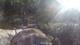
Built for the 2023 EDR (RIP EWS) in Derby, it's largely fast and flows but with some notable features, including THAT rock roll. The rock roll has 3 options, the middle being the easiest, the right hand being just a touch more intimidating, and the left hand line being frankly terrifying to most sane folk

Local Trail Association
Traditionally Indigenous Territory

Recent Activity on Trail

Past Week
  • 0 rides
  •  
6 Months
  • 49 rides
  • 18 miles avg distance
All
  • 190 rides
  • Last: Jun 21, 2026
c1c2c3c4
January
February
March
April
May
June
July
August
September
October
November
December
update trails status or condition

Cuddles Trail Reports

statusdatedescription
Jun 24, 2025 @ 7:00am
Jun 24, 2025
reporter
Jun 23, 2025 @ 6:50pm
Jun 23, 2025
reporter
Apr 28, 2025 @ 2:42pm
Apr 28, 2025
reporter
Apr 16, 2025 @ 1:42pm
Apr 16, 2025
Feb 13, 2025 @ 11:19am
Feb 13, 2025
Awesome, awesome trail. Thank you trial builders!!!
more »
Status:
on Jun 24, 2025
Wet
Avg: 4.46 (9 votes)
Your vote: 0

view (1,352)
close
3D
Trail Conditions
  • Unknown
  • Snow Groomed
  • Snow Packed
  • Snow Covered
  • Snow Cover Partial
  • Freeze/thaw Cycle
  • Icy
  • Prevalent Mud
  • Wet
  • Variable
  • Ideal
  • Dry
  • Very Dry
Trail Flow (Ridden Direction)
Trailforks scans users ridelogs to determine the most popular direction each trail is ridden. A good flowing trail network will have most trails flowing in a single direction according to their intension.
The colour categories are based on what percentage of riders are riding a trail in its intended direction.
  • > 96%
  • > 90%
  • > 80%
  • > 70%
  • > 50%
  • < 50%
  • bi-directional trail
  • no data
Trail Last Ridden
Trailforks scans ridelogs to determine the last time a trail was ridden.
  • < 2 days
  • < 1 week
  • < 2 weeks
  • < 1 month
  • < 6 months
  • > 6 months
Trail Ridden Direction
The intended direction a trail should be ridden.
  • Downhill Only
  • Downhill Primary
  • Both Directions
  • Uphill Primary
  • Uphill Only
  • One Direction
Contribute Details
Colors indicate trail is missing specified detail.
  • Description
  • Photos
  • Description & Photos
  • Videos
Trail Popularity ?
Trailforks scans ridelogs to determine which trails are ridden the most in the last 9 months. Trails are compared with nearby trails in the same city region with a possible 25 colour shades. Think of this as a heatmap, more rides = more kinetic energy = warmer colors.
  • most popular
  • popular
  • less popular
  • not popular
ATV/ORV/OHV Filter
Max Vehicle Width
inches
US Cell Coverage
Legend
cell carrier legend

Radar Time
Activity Recordings
Trailforks uses anonymized public activity data. ?
Activity Recordings
Trailforks uses anonymized public activity data. ?
Personal Heatmap
Activity Types
all / none
Options
2
Date range month
Winter Trails
Warning A routing network for winter maps does not exist. Selecting trails using the winter trails layer has been disabled.
Missing Trails
Most Popular
Least Popular
Trails are colored based on popularity. The more popular a trail is, the more red. Less popular trails trend towards green.
Jump Magnitude Heatmap
Heatmap of where riders jump on trails. Zoom in to see individual jumps, click circles to view jump details.
BC Backroad Status

Service Road Atlas is a free to use, community-driven service for viewing and creating reports on the numerous back-country service roads around B.C. and Alberta.

map legend
Slope Aspect
Direction the slope faces
Flat N NE E SE S SW W NW
Trails Deemphasized
Trails are shown in grey.
disable
Only show trails with no bike usage.
Enable
Suggested Layers
Based on selected activity type

    Save the current map location and zoom level as your default home location whenever this page is loaded.

    Save
        Directions to cuddles trailhead (-41.153920, 147.815760)

        Photos

        6 more »
        165 |
        Apr 28, 2025 @ 3:42am
        Apr 28, 2025
        148 |
        Apr 28, 2025 @ 3:33am
        Apr 28, 2025
        239 |
        May 25, 2024 @ 1:42am
        May 25, 2024
        185 |
        Jan 13, 2024 @ 3:04am
        Jan 13, 2024

        Videos

        3 more »
        Blue Derby ICONIC Cuddles and Trouty MTB Trails
        9:58 | 308 | Dec 21, 2024 , Derby
        youtuber Derby’s HARDEST Trails! | Tasmania Australia
        11:09 | 472 | Jul 16, 2024 , Derby
        Cuddles
        4:48 | 269 | May 14, 2024 , Derby

        Routes with this trail

        20 miles 3,543 ft 18 Loop Race
        Dales of Derby Tas Gravity ROUND 5 - BLUE DERBY 2023/24 Series It’s a classic season ender, and it...
        16 miles 1,966 ft 7 Loop Race
        Tas Gravity Enduro Series Women's Enduro 2024
        22 miles 3,306 ft 9 Loop Race
        Dales of Derby Tas Gravity Enduro Series 2024/25 R5 - BLUE DERBY Our classic season-ender, and the best...

        3 Reviews & Comments


        We hope you've been enjoying Trailforks!

        Create a FREE account to view trail comments and much more.

        • By willrhobbsTF Pro & contributors
        • #642559 - 2,526 views

        Frequently Asked Questions About Cuddles

        Where is Cuddles located?
        Cuddles is located in Blue Derby, Derby, Australia. It is part of the Blue Derby trail network. The trailhead is located at coordinates -41.15392, 147.81576.
        How hard is Cuddles?
        Cuddles is rated as Black Diamond difficulty. The average grade is 13.2%.
        What is the elevation gain for Cuddles?
        Cuddles has 37 ft of elevation gain. The trail has 517 ft of elevation descent. The elevation ranges from 682 ft to 1,162 ft.
        How long is Cuddles?
        Cuddles is 3,632 ft long. The trail type is singletrack.

        Hit the Trail

        Open in App

        Get this trail on your phone instantly.
        open trail in app

        Download Trail

        Save to wishlist, Garmin & download.
        save the trail

        Find Related Routes

        Find routes and users activities that include this trail.
        find routes for this trail

        You must enter a description before submitting.