

more stats
1.5 miles
Distance
18 ft
Climb
-1,119 ft
Descent
00:09:39
Avg time
-1,101 ft
Altitude change
2,492 ft
Altitude min
3,593 ft
Altitude max
3,593 ft
Altitude start
2,493 ft
Altitude end
-13.5%
Grade
-60.7%
Grade max
13.3%
Grade min
423 ft
Distance climb
1 mile
Distance down
135 ft
Distance flat
00:09:39
Avg time

Del Cueto Details

  • Activities
    • Mountain Bike
    • E-Bike
    • Hike
    • Trail Running
  • Riding Area
  • AKA
  • Difficulty Rating
  • Voted Difficulty
    Red (3 votes)
  • Local Popularity
    95 in Mountain Biking heatmap [+]
    • 100 in E-Biking
    • 5 in Trail Running
    • 5 in Hiking
  • Global Ranking
    #101173 in Mountain Biking [+]
    • #64500 in E-Biking
    • #343337 in Trail Running
    • #317982 in Hiking
  • National Ranking
    #7,476 in Mountain Biking · Spain [+]
    • #8,038 in E-Biking
    • #36,736 in Trail Running
    • #31,926 in Hiking
  • Hiking SAC Scale
    T2 Mountain Hiking
  • Trail Type
    Singletrack
  • Bike Type
    DH, AM, XC, Fat
  • Direction
    Downhill Primary
    Popular Direction Shown
  • Climb Difficulty
    Blue
  • Physical Rating
    Hard
  • Trail Visibility
    Always easy to follow
  • Season
    todo el año
  • Family Friendly
    Yes
  • Dogs Allowed
    Yes
  • eBike Allowed
    Yes up to Class 1
  • TTFs on Trail
    Teeter Totter
  • Ride in Rain
    Yes

despues de subir al Cueto, que mejor manera de bajar a Sobron que por esta espectacular senda....al principio sus hayedos y despues se pone rapida y con alguna trialera hacen que sea muy completa y diferente de principio a fin

Tags
Family friendlyWooden features

Recent Activity on Trail

Past Week
  • 0 rides
  •  
6 Months
  • 3 rides
  • 10 miles avg distance
All
  • 43 rides
  • Last: Oct 25, 2026
c1c2c3c4
January
February
March
April
May
June
July
August
September
October
November
December
update trails status or condition

Del Cueto Trail Reports

statusdatedescription
Nov 7, 2026 @ 7:16am (Europe/Madrid)
Nov 6, 2026
Zona del hayedo con mucha hoja,el resto esta perfecto.
Mar 10, 2026 @ 9:04pm (Europe/Madrid)
Mar 10, 2026
Problema menor de drenaje de agua, agua estancada en la superficie del sendero.
Jan 17, 2026 @ 4:49pm (Europe/Madrid)
Jan 17, 2026
Podados todos los espinos en la última parte del sendero que golpeaban manos y espiñillas.
Jan 4, 2026 @ 9:12am (Europe/Madrid)
Jan 4, 2026
Nov 29, 2025 @ 9:36am (Europe/Madrid)
Nov 29, 2025
Tronco caído! Se puede pasar por encima.
more »
Status:
on Nov 7, 2026
Ideal
Avg: 4.64 (11 votes)
Your vote: 0

view (349)
close
      Directions to del-cueto trailhead (42.775170, -3.133310)

      Photos

      10 more »
      mtb
      96 |
      Nov 28, 2023 @ 12:45am
      Nov 28, 2023
      mtb
      84 |
      Nov 28, 2023 @ 12:45am
      Nov 28, 2023
      mtb
      70 |
      Sep 21, 2022 @ 4:37am
      Sep 21, 2022
      mtb
      62 |
      Sep 21, 2022 @ 4:37am
      Sep 21, 2022

      Videos

      1 more »
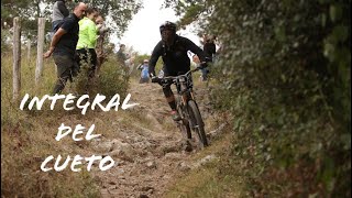
      Integral del Cueto(Sobron)cueto completo
      mtb
      10:38 | 485 | Oct 18, 2021 , Sobron

      Trail Lists

      Routes with this trail

      more »
      ★ 5.0 • 587 miles • 28,619 ft • 111 • Point to Point •
      El GR 99 recorre el río Ebro de principio a fin a lo largo de la península. Desde tiempos remotos el...
      18 miles • 5,015 ft • 9 • Loop •
      La primera subida son casi 11 kilometrazos por pista, con un tramo de sendero precioso en el último...
      24 miles • 4,090 ft • 3 •
      Partiendo de herran por carreterilla secundaria hasta el pueblo abandonado de Plagaro donde se coje la...
      5.0 ★★★★★
      11 Ratings
      5 ★ 100%
      4 ★
      3 ★
      2 ★
      1 ★

      3 Reviews & Comments

      Crisjaca Crisjaca
      La hice por primera vez haciendo el GR 99 con alforjas, y no lo recuerdo tan heavy como la he visto hoy, haya muchas zonas de escalones rocosos, que le dan dificultad, imagino que el agua he hecho estragos. Votada a Roja, eso si...flipante de lo mejorcito.
      correcamimos
      Sendero azul con algúnos tramos rojos.
      Muy guapo de principio a fin. Tiene buenos fotones para ir parando.

      We hope you've been enjoying Trailforks!

      Create a FREE account to view all trail reviews and much more.

      • By guillytTF Pro & contributors
      • #40146 - 1,384 views

      Frequently Asked Questions

      ▼ Where is Del Cueto located?
      Del Cueto is located in Sobron-Obarenes Center, Sobron, Spain. It is part of the Sobron-Obarenes Center trail network. The trailhead is located at coordinates 42.77517, -3.13331.
      ▼ How hard is Del Cueto?
      Del Cueto is rated as Blue difficulty. The physical rating is Hard. The average grade is 13.5%. The climb difficulty is rated Blue.
      ▼ What is the elevation gain for Del Cueto?
      Del Cueto has 18 ft of elevation gain. The trail has 1,119 ft of elevation descent. The elevation ranges from 2,492 ft to 3,593 ft.
      ▼ Is Del Cueto a point to point trail?
      Del Cueto is not a point to point trail. The direction is Downhill Primary. The trail type is singletrack.
      ▼ How long is Del Cueto?
      Del Cueto is 1.5 miles long. The trail type is singletrack.
      ▼ Are dogs allowed on Del Cueto?
      Yes, dogs are allowed on Del Cueto. Please keep dogs on a leash where required and clean up after them.
      ▼ When is the best time of year to ride Del Cueto?
      Based on activity log data, the most popular months to ride Del Cueto are:
      • May (3 activities)
      • October (3 activities)
      • April (2 activities)
      Check the reports page for current trail conditions.
      ▼ How do I access Del Cueto? Where is the closest parking trailhead?
      The closest parking and trailhead locations to Del Cueto are: View all parking locations in the area.
      ▼ How long does it take to ride Del Cueto?
      Based on recorded activities, it takes an average of 10 minutes to ride Del Cueto. The trail is 1.5 miles long. Actual times will vary based on fitness level, conditions, and pace. View recent activity logs for more details.
      ▼ How busy is Del Cueto?
      Del Cueto is a very popular trail. There have been 355 recorded activities on this trail. The trail has received 349 check-ins. View recent activity on this trail.

      Hit the Trail

      Open in App

      Get this trail on your phone instantly.

      open trail in app

      Download Trail

      Save to wishlist, Garmin & download.
      save the trail

      Find Related Routes

      Find routes and users activities that include this trail.
      find routes for this trail

      You must enter a description before submitting.

