
more stats
3,570 ft
Distance
-841 ft
Descent
00:09:52
Avg time
-841 ft
Altitude change
3,174 ft
Altitude min
4,015 ft
Altitude max
4,015 ft
Altitude start
3,176 ft
Altitude end
-23.5%
Grade
-53.2%
Grade max
-5.3%
Grade min
3,570 ft
Distance down
00:09:52
Avg time

Dragon Khan Details

  • Activities
    • Mountain Bike
    • E-Bike
    • Trail Running
  • Riding Area
    Eremua
    Zubiri
  • Ref Number
    #2
  • Difficulty Rating
  • Voted Difficulty
    Black (3 votes)
  • Local Popularity
    75 in Mountain Biking [+]
    • 85 in E-Biking
    • 70 in Trail Running
  • Global Ranking
    #119439 in Mountain Biking [+]
    • #70535 in E-Biking
    • #130660 in Trail Running
  • National Ranking
    #9,717 in Mountain Biking · Spain [+]
    • #10,519 in E-Biking
    • #11,219 in Trail Running
  • Hiking SAC Scale
    T2 Mountain Hiking
  • Trail Type
    Singletrack
  • Bike Type
    DH, AM
  • Direction
    Downhill Only
    Popular Direction Shown
  • Physical Rating
    Moderate
  • Trail Visibility
    Sometimes hard to follow
  • Dogs Allowed
    Yes
  • eBike Allowed
    Yes up to Class 1
  • TTFs on Trail
    Berm, Drop, Jump, Rock Face, Skinny

El trail mas tecnico de Eremua, pasos con raíces y piedras. Tiene varios rock faces, drops y algunos skinny.

Trail Supporters

Local Trail Association

Recent Activity on Trail

Past Week
  • 3 rides
  • 14 miles average
6 Months
  • 15 rides
  • 15 miles avg distance
All
  • 101 rides
  • Last: Nov 1, 2026
c1c2c3c4
January
February
March
April
May
June
July
August
September
October
November
December
update trails status or condition

Dragon Khan Trail Reports

statusdatedescription
Oct 24, 2026 @ 9:26am (Europe/Andorra)
Oct 24, 2026
reporter Visibilidad perfecta, pero delicado con todo muy húmedo
Oct 18, 2026 @ 9:27am (Europe/Andorra)
Oct 18, 2026
reporter
Oct 14, 2026 @ 4:07pm (Europe/Andorra)
Oct 14, 2026
Oct 13, 2026 @ 3:13pm (Europe/Madrid)
Oct 13, 2026
reporter
Limpieza y soplado general
Oct 5, 2026 @ 4:01pm (Europe/Andorra)
Oct 5, 2026
reporter hay hojas por todo el sendero. fácil de perder la senda. ahora mismo no merece la pena bajarla...
more »
Status:
on Oct 24, 2026
Ideal
Avg: 4.43 (17 votes)
Your vote: 0

view (425)
close
      Directions to dragon-khan trailhead (42.988590, -1.548570)

      Photos

      31 more »
      mtb
      136 |
      Apr 17, 2025 @ 6:11am
      Apr 17, 2025
      mtb
      166 |
      May 27, 2024 @ 5:50am
      May 27, 2024
      mtb
      84 |
      Jun 30, 2025 @ 5:58am
      Jun 30, 2025
      mtb
      73 |
      Jun 30, 2025 @ 5:29am
      Jun 30, 2025

      Videos

      9 more »
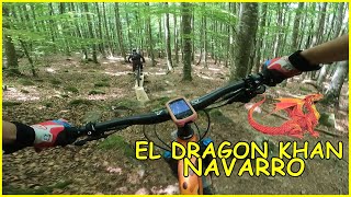
      youtuber El Dragon Khan Navarro ​ Living Enduro MTB
      mtb
      5:52 | 329 | Aug 21, 2025 , Zubiri
      youtuber No te pido que lo mejores, igualámelo ​...
      mtb
      19:34 | 88 | Jul 17, 2025 , Zubiri
      youtuber Viaje al paraíso ️​ Eremua día 1 |...
      mtb
      23:11 | 69 | Jul 10, 2025 , Zubiri
      Dragon Khan + Carboneras + Erregerena ---...
      mtb
      5:44 | 568 | Jun 8, 2020 , Zubiri

      Routes with this trail

      ★ 4.0 • 6 miles • 2,654 ft • 8 • Point to Point •
      Bonito bucle que se desarrolla en la parte alta de Burdindogi. Partiendo desde Sugea hasta la cima de...
      ★ 4.0 • 23 miles • 6,084 ft • 9 •
      Muy buena combinacion de las muchas que se pueden hacer
      4.5 ★★★★★
      17 Ratings
      5 ★ 59%
      4 ★ 29%
      3 ★ 12%
      2 ★
      1 ★

      4 Reviews & Comments

      Crisjaca Crisjaca
      Si se hace entera con los pasos propuestos es Negra, pero si se esquivan es Roja, osea que sin miedo, eso si, esta algo sucia de hojas, lo que hace difícil seguir bien el rastro, pero se ve la caja medianamente.
      Dientedeleon Dientedeleon
      2-1-25. Imposible de seguir por las hojas y las ramas, muy sucias. No es una bajada de invierno.
      steeploamer steeploamer
      Very rocky at the top but gets more flowy in the lower half. Great trail!

      We hope you've been enjoying Trailforks!

      Create a FREE account to view all trail reviews and much more.

      • By tronchonik & contributors
      • #104970 - 2,608 views

      Frequently Asked Questions

      ▼ Where is Dragon Khan located?
      Dragon Khan is located in Eremua, Zubiri, Spain. It is part of the Eremua trail network. The trailhead is located at coordinates 42.98859, -1.54857.
      ▼ How hard is Dragon Khan?
      Dragon Khan is rated as Black difficulty. The physical rating is Moderate. The average grade is 23.5%.
      ▼ What is the elevation gain for Dragon Khan?
      The trail has 841 ft of elevation descent. The elevation ranges from 3,174 ft to 4,015 ft.
      ▼ Is Dragon Khan a point to point trail?
      Yes, Dragon Khan is a point to point trail. The direction is Downhill Only. The trail type is singletrack.
      ▼ How long is Dragon Khan?
      Dragon Khan is 3,570 ft long. The trail type is singletrack.
      ▼ Are dogs allowed on Dragon Khan?
      Yes, dogs are allowed on Dragon Khan. Please keep dogs on a leash where required and clean up after them.
      ▼ When is the best time of year to ride Dragon Khan?
      Based on activity log data, the most popular months to ride Dragon Khan are:
      • August (12 activities)
      • October (11 activities)
      • June (10 activities)
      Check the reports page for current trail conditions.
      ▼ How do I access Dragon Khan? Where is the closest parking trailhead?
      The closest parking and trailhead locations to Dragon Khan are: View all parking locations in the area.
      ▼ How long does it take to ride Dragon Khan?
      Based on recorded activities, it takes an average of 10 minutes to ride Dragon Khan. The trail is 3,570 ft long. Actual times will vary based on fitness level, conditions, and pace. View recent activity logs for more details.
      ▼ How busy is Dragon Khan?
      Dragon Khan is a very popular trail. There have been 442 recorded activities on this trail. The trail has received 425 check-ins. View recent activity on this trail.

      Hit the Trail

      Open in App

      Get this trail on your phone instantly.

      open trail in app

      Download Trail

      Save to wishlist, Garmin & download.
      save the trail

      Find Related Routes

      Find routes and users activities that include this trail.
      find routes for this trail

      You must enter a description before submitting.