more stats
4,760 ft
Distance
186 ft
Climb
-8 ft
Descent
00:16:27
Avg time
178 ft
Altitude change
1,832 ft
Altitude min
2,010 ft
Altitude max
1,832 ft
Altitude start
2,011 ft
Altitude end
3.8%
Grade
-5.5%
Grade max
17.9%
Grade min
3,228 ft
Distance climb
433 ft
Distance down
1,099 ft
Distance flat
00:16:27
Avg time

Dylan's Path Details

  • Activities
    • Mountain Bike
    • E-Bike
    • Winter Fat Bike
    • Horse
    • Hike
    • Trail Running
    • Snowshoe
  • Riding Area
    Galbraith Gap (Rothrock State Forest)
    State College, Pennsylvania
  • Difficulty Rating
  • Local Popularity
    95 in Mountain Biking [+]
    • 95 in E-Biking
    • 5 in Trail Running
    • 5 in Hiking
    • 5 in Horseback
    • 5 in Snowshoeing
  • Global Ranking
    #57994 in Mountain Biking [+]
    • #22126 in E-Biking
    • #90387 in Trail Running
    • #302277 in Hiking
    • #16538 in Horseback
    • #10930 in Snowshoeing
  • Hiking SAC Scale
    T1 Hiking
  • Trail Type
    Singletrack
  • Bike Type
    AM, XC, Fat
  • Direction
    Both Directions
  • Climb Difficulty
    Blue
  • Physical Rating
    Moderate
  • Trail Visibility
    Always easy to follow
  • Season
    All Year
  • Dogs Allowed
    Yes
  • eBike Allowed
    Yes up to Class 1
  • Ride in Rain
    Yes
  • Land Owner
    Private & DCNR

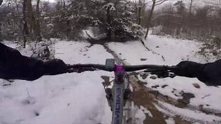
This is a continual climb that will bust a lung in a few spots that takes one up across private property to DCNR land. Cutting left across the gas line and then a short stint with a"grunting" steep climb to the intersection of Tussey Mountain Tr at the infamous local landmark known as the beer tap. This is typically open all year BUT BE RESPECTFUL of the local hunting seasons that run Mon - Sat during certain time and limit you use during those periods

Access Info

Off the Tussey Mountain Trail or from Corner Rd

Local Trail Association
Traditionally Indigenous Territory

Recent Activity on Trail

Past Week
  • 0 rides
  •  
6 Months
  • 29 rides
  • 12 miles avg distance
All
  • 397 rides
  • Last: Jun 30, 2026
c1c2c3c4
January
February
March
April
May
June
July
August
September
October
November
December
update trails status or condition

Dylan's Path Trail Reports

statusdatedescription
May 5, 2026 @ 10:15am (America/New_York)
May 5, 2026
Dec 13, 2025 @ 12:03pm (America/Los_Angeles)
Dec 13, 2025
Nov 28, 2025 @ 3:00pm (America/New_York)
Nov 28, 2025
reporter CLOSED for hunting season from 11/29 to 12/13. Our continued access to these trails depends on you respecting these closures. Thank you!
Aug 31, 2025 @ 8:42am
Aug 31, 2025
Aug 28, 2025 @ 4:37pm
Aug 28, 2025
more »
Status:
on May 5, 2026
Ideal
Avg: 3.81 (10 votes)
Your vote: 0

view (2,093)
close
3D
Trail Conditions
  • Unknown
  • Snow Groomed
  • Snow Packed
  • Snow Covered
  • Snow Cover Partial
  • Freeze/thaw Cycle
  • Icy
  • Prevalent Mud
  • Wet
  • Variable
  • Ideal
  • Dry
  • Very Dry
Trail Flow (Ridden Direction)
Trailforks scans users ridelogs to determine the most popular direction each trail is ridden. A good flowing trail network will have most trails flowing in a single direction according to their intension.
The colour categories are based on what percentage of riders are riding a trail in its intended direction.
  • > 96%
  • > 90%
  • > 80%
  • > 70%
  • > 50%
  • < 50%
  • bi-directional trail
  • no data
Trail Last Ridden
Trailforks scans ridelogs to determine the last time a trail was ridden.
  • < 2 days
  • < 1 week
  • < 2 weeks
  • < 1 month
  • < 6 months
  • > 6 months
Trail Ridden Direction
The intended direction a trail should be ridden.
  • Downhill Only
  • Downhill Primary
  • Both Directions
  • Uphill Primary
  • Uphill Only
  • One Direction
Contribute Details
Colors indicate trail is missing specified detail.
  • Description
  • Photos
  • Description & Photos
  • Videos
Trail Popularity ?
Trailforks scans ridelogs to determine which trails are ridden the most in the last 9 months. Trails are compared with nearby trails in the same city region with a possible 25 colour shades. Think of this as a heatmap, more rides = more kinetic energy = warmer colors.
  • most popular
  • popular
  • less popular
  • not popular
ATV/ORV/OHV Filter
Max Vehicle Width
inches
US Cell Coverage
Legend
cell carrier legend

Radar Time
Activity Recordings
Trailforks uses anonymized public activity data. ?
Activity Recordings
Trailforks uses anonymized public activity data. ?
Personal Heatmap
Activity Types
all / none
Options
2
Date range month
Winter Trails
Warning A routing network for winter maps does not exist. Selecting trails using the winter trails layer has been disabled.
Missing Trails
Most Popular
Least Popular
Trails are colored based on popularity. The more popular a trail is, the more red. Less popular trails trend towards green.
Jump Magnitude Heatmap
Heatmap of where riders jump on trails. Zoom in to see individual jumps, click circles to view jump details.
BC Backroad Status

Service Road Atlas is a free to use, community-driven service for viewing and creating reports on the numerous back-country service roads around B.C. and Alberta.

map legend
Slope Aspect
Direction the slope faces
Flat N NE E SE S SW W NW
Trails Deemphasized
Trails are shown in grey.
disable
Only show trails with no bike usage.
Enable
Suggested Layers
Based on selected activity type

    Save the current map location and zoom level as your default home location whenever this page is loaded.

    Save
        Directions to dylan-s-path-25541 trailhead (40.765900, -77.716480)

        Photos

        11 more »
        107 |
        Aug 28, 2023 @ 9:41am
        Aug 28, 2023
        78 |
        Aug 9, 2023 @ 11:28am
        Aug 9, 2023
        81 |
        Oct 15, 2017 @ 5:36pm
        Oct 15, 2017
        79 |
        Oct 12, 2021 @ 1:07pm
        Oct 12, 2021

        Videos

        1 more »
        Light crashing down Camp/Dylans path
        2:48 | 230 | Jan 6, 2021 , State College

        Routes with this trail

        5.0 12 miles 1,404 ft 12
        This is very similar to the Clotheshanger Loop route, but it adds the additional Leniency / extension for...
        5.0 10 miles 846 ft 7
        This is the most basic version of a very popular ride plan out of in Rothrock State Forest. This version...
        4.7 12 miles 1,029 ft 11 Loop
        This is a staple loop of the area typically run in the direction of up , left up to to the Beer Tap,...

        Trail Products

        1 Review & Comments


        We hope you've been enjoying Trailforks!

        Create a FREE account to view trail comments and much more.

        • By SaclydesdaleTF Pro NMBA & contributors
        • #25541 - 2,755 views

        Frequently Asked Questions About Dylan's Path

        Where is Dylan's Path located?
        Dylan's Path is located in Galbraith Gap (Rothrock State Forest), State College, Pennsylvania, United States. It is part of the Galbraith Gap (Rothrock State Forest) trail network. The trailhead is located at coordinates 40.7659, -77.71648.
        How hard is Dylan's Path?
        Dylan's Path is rated as Blue difficulty. The physical rating is Moderate. The average grade is 3.8%. The climb difficulty is rated Blue.
        What is the elevation gain for Dylan's Path?
        Dylan's Path has 186 ft of elevation gain. The trail has 8 ft of elevation descent. The elevation ranges from 1,832 ft to 2,010 ft.
        Is Dylan's Path a point to point trail?
        Dylan's Path is not a point to point trail. The direction is Both Directions. The trail type is singletrack.

        Hit the Trail

        Open in App

        Get this trail on your phone instantly.
        open trail in app

        Download Trail

        Save to wishlist, Garmin & download.
        save the trail

        Find Related Routes

        Find routes and users activities that include this trail.
        find routes for this trail

        You must enter a description before submitting.