

This trail is permanently closed/decommissioned
more stats
4,757 ft
Distance
20 ft
Climb
-455 ft
Descent
00:11:44
Avg time
-434 ft
Altitude change
1,163 ft
Altitude min
1,608 ft
Altitude max
1,597 ft
Altitude start
1,165 ft
Altitude end
-9.1%
Grade
-42.9%
Grade max
8.6%
Grade min
535 ft
Distance climb
3,232 ft
Distance down
991 ft
Distance flat
00:11:44
Avg time

Ecstasy Details

  • Activities
    • Mountain Bike
    • Hike
    • Trail Running
  • Riding Area
    Southern Michaux State Forest
    Chambersburg, Pennsylvania
  • Difficulty Rating
  • Local Popularity
    95 in Mountain Biking heatmap [+]
    • 5 in Trail Running
    • 95 in Hiking
  • Trail Type
    Singletrack
  • Bike Type
    DH, AM, XC
  • Direction
    Downhill Primary
    Popular Direction Shown
  • Climb Difficulty
    Black Diamond
  • Physical Rating
    Moderate
  • Trail Visibility
    Sometimes hard to follow
  • Dogs Allowed
    Yes
  • TTFs on Trail
    Drop, Rock Garden

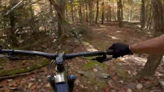
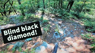
This trail was an old downhillers practice trail that has been brought back to life for our enjoyment. This trail can be hard to find the start but once you're on the trail it is easy to follow in season. The trail has several steep sections and lots of rocks

This trail is unsanctioned.

Tags
DropsFaint trailRock gardens

Recent Activity on Trail

Past Week
  • 0 rides
  •  
6 Months
  • 11 rides
  • 15 miles avg distance
All
  • 97 rides
  • Last: Nov 15, 2026
c1c2c3c4
January
February
March
April
May
June
July
August
September
October
November
December
update trails status or condition

Ecstasy Trail Reports

statusdatedescription
Nov 8, 2026 @ 6:23pm (America/New_York)
Nov 8, 2026
Extremely thick leaf cover, but still navigable.
Sep 9, 2026 @ 10:51pm (America/New_York)
Sep 9, 2026
Aug 20, 2024 @ 7:07am
Aug 20, 2024
Aug 14, 2024 @ 7:06pm
Aug 14, 2024
Tree down just after the first slightly downhill and left corner after the first climb. See photo for GPS.
Oct 27, 2023 @ 1:22pm
Oct 27, 2023
more »
Status:
on Nov 8, 2026
Avg: 4.35 (12 votes)
Your vote: 0

view (616)
close
      Directions to ecstasy trailhead (39.833390, -77.518890)

      Photos

      10 more »
      mtb
      412 |
      Jul 4, 2020 @ 6:17am
      Jul 4, 2020
      mtb
      481 |
      Jul 4, 2020 @ 6:16am
      Jul 4, 2020
      report
      mtb
      66 |
      Aug 20, 2024 @ 7:07am
      Aug 20, 2024
      report
      mtb
      70 |
      Mar 23, 2023 @ 7:58pm
      Mar 23, 2023

      Videos

      4 more »
      Southern Michaux Slabs!  Hobo, Ecstasy, &...
      mtb
      12:48 | 174 | Sep 6, 2023 , Chambersburg
      Ecstacy in South Michaux Forest
      mtb
      7:23 | 325 | Oct 25, 2022 , Chambersburg
      Michaux MTB |...
      mtb
      43:49 | 225 | Jun 30, 2022 , Chambersburg
      The Mont Alto descent / 4 logs to ecstasy /...
      mtb
      6:49 | 674 | Oct 20, 2020 , Chambersburg

      Routes with this trail

      more »
      17 miles • 2,888 ft • 32 • Loop • Race •
      Some of the best mont alto tracks linked up for your enjoyment. Great for enduro training. Some decent...
      4.6 ★★★★★
      12 Ratings
      5 ★ 67%
      4 ★ 25%
      3 ★ 8%
      2 ★
      1 ★

      4 Reviews & Comments

      SirWilhelm SirWilhelm
      Have rode this trail a handful of times over the years and am always impressed with the rock work and overall fun factor. Great trail for technical riders and gravity driven folks.
      RoyGothie3vb RoyGothie3vb
      Did this with a 2023 Ibis Ripley AF and the 8yo used a Polygon Siskiu D24X. Slow and steady. Skipped the drops and walked two sections. It is an amazingly fun and challenging trail. Definitely on the repeat list. Would not recommend riding it in wet conditions.
      Aidkane18 Aidkane18
      Whoever blew the leaves of this trail, you deserve a beer!!

      Trails running prime NOV 2020

      We hope you've been enjoying Trailforks!

      Create a FREE account to view all trail reviews and much more.

      • #210931 - 2,531 views

      Frequently Asked Questions

      ▼ Where is Ecstasy located?
      Ecstasy is located in Southern Michaux State Forest, Chambersburg, Pennsylvania, United States. It is part of the Southern Michaux State Forest trail network. The trailhead is located at coordinates 39.83339, -77.51889.
      ▼ How hard is Ecstasy?
      Ecstasy is rated as Black Diamond difficulty. The physical rating is Moderate. The average grade is 9.1%. The climb difficulty is rated Black Diamond.
      ▼ What is the elevation gain for Ecstasy?
      Ecstasy has 20 ft of elevation gain. The trail has 455 ft of elevation descent. The elevation ranges from 1,163 ft to 1,608 ft.
      ▼ Is Ecstasy a point to point trail?
      Ecstasy is not a point to point trail. The direction is Downhill Primary. The trail type is singletrack.
      ▼ How long is Ecstasy?
      Ecstasy is 4,757 ft long. The trail type is singletrack.
      ▼ Are dogs allowed on Ecstasy?
      Yes, dogs are allowed on Ecstasy. Please keep dogs on a leash where required and clean up after them.
      ▼ How do I access Ecstasy? Where is the closest parking trailhead?
      The closest parking and trailhead locations to Ecstasy are: View all parking locations in the area.
      ▼ How long does it take to ride Ecstasy?
      Based on recorded activities, it takes an average of 12 minutes to ride Ecstasy. The trail is 4,757 ft long. Actual times will vary based on fitness level, conditions, and pace. View recent activity logs for more details.
      ▼ How busy is Ecstasy?
      Ecstasy is a very popular trail. There have been 608 recorded activities on this trail. The trail has received 616 check-ins. View recent activity on this trail.

      Hit the Trail

      Open in App

      Get this trail on your phone instantly.

      open trail in app

      Download Trail

      Save to wishlist, Garmin & download.
      save the trail

      Find Related Routes

      Find routes and users activities that include this trail.
      find routes for this trail

      You must enter a description before submitting.

