
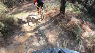

more stats
3,806 ft
Distance
30 ft
Climb
-524 ft
Descent
00:05:45
Avg time
-494 ft
Altitude change
1,332 ft
Altitude min
1,856 ft
Altitude max
1,826 ft
Altitude start
1,332 ft
Altitude end
-13%
Grade
-51.8%
Grade max
15.1%
Grade min
381 ft
Distance climb
3,330 ft
Distance down
95 ft
Distance flat
00:05:45
Avg time

El Tojo Details

  • Activities
    • Mountain Bike
    • E-Bike
    • Hike
    • Trail Running
  • Riding Area
    Montes de Triano
    Trapagaran
  • AKA
    Tojo Viejo, clásico
  • Difficulty Rating
  • Voted Difficulty
    Red (4 votes)
  • Local Popularity
    95 in Mountain Biking heatmap [+]
    • 100 in E-Biking
    • 5 in Trail Running
    • 80 in Hiking
  • Global Ranking
    #95876 in Mountain Biking [+]
    • #68429 in E-Biking
    • #214020 in Trail Running
    • #205109 in Hiking
  • National Ranking
    #6,965 in Mountain Biking · Spain [+]
    • #9,084 in E-Biking
    • #14,842 in Trail Running
    • #11,922 in Hiking
  • Hiking SAC Scale
    T1 Hiking
  • Trail Type
    Singletrack
  • Bike Type
    DH, AM
  • Direction
    Downhill Primary
    Popular Direction Shown
  • Trail Visibility
    Always easy to follow
  • Dogs Allowed
    Yes
  • eBike Allowed
    Yes up to Class 1
  • TTFs on Trail
    Berm, Drop, Rock Garden

Bajada con mejor pasado que presente desde las inmediaciones de la cabaña del Tojo hasta enlzar con el Tetris , aunque actualmente dividida en dos tramos según su uso más frecuente. Aún así, es divertida, con zonas más o menos rotas por las motos, pedroleo, raíces... muy exigente físicamente si se hace sin parar

Access Info

Cabaña de El Tojo

Tags
BermsDropsRock gardens

Local Trail Association

Recent Activity on Trail

Past Week
  • 1 rides
  • 30 miles average
6 Months
  • 59 rides
  • 29 miles avg distance
All
  • 283 rides
  • Last: Nov 16, 2026
c1c2c3c4
January
February
March
April
May
June
July
August
September
October
November
December
update trails status or condition

El Tojo Trail Reports

statusdatedescription
Oct 18, 2026 @ 9:01am (Europe/Madrid)
Oct 18, 2026
reporter
Sep 26, 2026 @ 2:14pm (Europe/Madrid)
Sep 26, 2026
Sep 5, 2026 @ 12:40am (Pacific/Midway)
Sep 5, 2026
motos subiendo como subnormales
Aug 30, 2026 @ 9:20am (Europe/Madrid)
Aug 30, 2026
reporter Recién desbrozado para la Pulmón de Acero, de lujo
Aug 14, 2026 @ 9:07pm (Europe/Madrid)
Aug 14, 2026
Excesiva vegetación pero se puede bajar
more »
Status:
on Oct 18, 2026
Ideal
Avg: 3.86 (2 votes)
Your vote: 0

view (887)
close
      Directions to el-tojo trailhead (43.256200, -3.056420)

      Photos

      3 more »
      mtb
      132 |
      Mar 26, 2023 @ 9:42am
      Mar 26, 2023
      mtb
      151 |
      Feb 15, 2022 @ 2:45am
      Feb 15, 2022
      report
      mtb
      96 |
      Feb 11, 2024 @ 4:45am
      Feb 11, 2024

      Videos

      2 more »
      Tojo MTB Old School
      mtb
      2:01 | 271 | Jan 4, 2024 , Trapagaran
      Segunda parte desde bajada Tojo hasta inicio...
      mtb
      3:07 | 1002 | May 9, 2020 , Trapagaran

      Routes with this trail

      more »
      ★ 5.0 • 24 miles • 4,983 ft • 29 • Loop •
      Ruta que enlaza las mejores bajadas endureras a fecha de Octubre 2025. Saliendo de Trapagaran, donde...
      44 miles • 7,950 ft • 19 • Loop •
      Pulmón de acero 2025, ruta completa
      3.5 ★★★★★
      2 Ratings
      5 ★
      4 ★ 50%
      3 ★ 50%
      2 ★
      1 ★

      6 Reviews & Comments

      trins87 trins87
      Esta bien, falta limpieza, hay muchas plantas que pinchan y hacen dificil bajar bien
      berasa
      Hay un par de arboles tirados, se puede pasar por al lado. Con las ultimas lluvias en las zonas sin pendiente se han formado numerosos charcos.
      jonjo
      Lo comentado por rainbow, a partir del remonte jardín no merece demasiado por las piedras sueltas y roderas que hay. Hoy me he cruzado con un motero que iba por el sendero, y según él el sendero lo crearon ellos hace 20 años y nos estamos adueñando de todos ellos…..lógicamente a bajado por toboganes derrapando a gusto y dejando su firma.

      We hope you've been enjoying Trailforks!

      Create a FREE account to view all trail reviews and much more.

      • By lagar1977TF Pro TSDC TFSPAIN & contributors
      • #282308 - 2,713 views

      Frequently Asked Questions

      ▼ Where is El Tojo located?
      El Tojo is located in Montes de Triano, Trapagaran, Spain. It is part of the Montes de Triano trail network. The trailhead is located at coordinates 43.2562, -3.05642.
      ▼ How hard is El Tojo?
      El Tojo is rated as Blue difficulty. The average grade is 13%.
      ▼ What is the elevation gain for El Tojo?
      El Tojo has 30 ft of elevation gain. The trail has 524 ft of elevation descent. The elevation ranges from 1,332 ft to 1,856 ft.
      ▼ Is El Tojo a point to point trail?
      El Tojo is not a point to point trail. The direction is Downhill Primary. The trail type is singletrack.
      ▼ How long is El Tojo?
      El Tojo is 3,806 ft long. The trail type is singletrack.
      ▼ Are dogs allowed on El Tojo?
      Yes, dogs are allowed on El Tojo. Please keep dogs on a leash where required and clean up after them.
      ▼ How do I access El Tojo? Where is the closest parking trailhead?
      The closest parking and trailhead locations to El Tojo are: View all parking locations in the area.
      ▼ How long does it take to ride El Tojo?
      Based on recorded activities, it takes an average of 6 minutes to ride El Tojo. The trail is 3,806 ft long. Actual times will vary based on fitness level, conditions, and pace. View recent activity logs for more details.
      ▼ How busy is El Tojo?
      El Tojo is a very popular trail. There have been 896 recorded activities on this trail. The trail has received 887 check-ins. View recent activity on this trail.

      Hit the Trail

      Open in App

      Get this trail on your phone instantly.

      open trail in app

      Download Trail

      Save to wishlist, Garmin & download.
      save the trail

      Find Related Routes

      Find routes and users activities that include this trail.
      find routes for this trail

      You must enter a description before submitting.