more stats
3,061 ft
Distance
8 ft
Climb
-157 ft
Descent
00:04:04
Avg time
-149 ft
Altitude change
989 ft
Altitude min
1,139 ft
Altitude max
1,139 ft
Altitude start
991 ft
Altitude end
-4.9%
Grade
-24%
Grade max
4.8%
Grade min
423 ft
Distance climb
1,844 ft
Distance down
771 ft
Distance flat
00:04:04
Avg time

Electric Blue Details

  • Activities
    • Mountain Bike
    • E-Bike
  • Riding Area
    Glentress
    Peebles
  • Difficulty Rating
  • Local Popularity
    95 in Mountain Biking heatmap [+]
    • 95 in E-Biking
  • Global Ranking
    #41006 in Mountain Biking [+]
    • #12318 in E-Biking
  • National Ranking
    #1,114 in Mountain Biking · United Kingdom [+]
    • #562 in E-Biking
  • Trail Type
    Singletrack
  • Bike Type
    AM, XC
  • Direction
    One Direction
    Popular Direction Shown
  • Climb Difficulty
    Blue
  • Physical Rating
    Easy
  • Trail Visibility
    Always easy to follow
  • eBike Allowed
    Yes up to Class 1
  • Ride in Rain
    Yes
  • Land Owner
    Forestry And Land Scotland

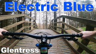
Fun, swoopy trail on the Blue Route. Beginner friendly berms and rollers are also great to ride if you're a bit more experienced. This is a great trail to take a mate who's just getting into tiding - Dirtschool use sections of the trail.

Access Info

Marked on the Blue Route, it starts from the bottom corner of the Buzzards Nest car park. Crosses over the red - just before the wooden bridge - the red climb after is easy, so you can session the top part easily. Or at the end, ride back up the fore road to the car park and go again.

Tags
BermsBridgesRollers

Local Trail Association

Recent Activity on Trail

Past Week
  • 11 rides
  • 13 miles average
6 Months
  • 326 rides
  • 15 miles avg distance
All
  • 1,751 rides
  • Last: Nov 20, 2026
c1c2c3c4
January
February
March
April
May
June
July
August
September
October
November
December
Status:
on May 23, 2026
Ideal
Avg: 3.95 (16 votes)
Your vote: 0

view (17,182)
close
      Directions to electric-blue trailhead (55.658400, -3.148820)

      Photos

      16 more »
      mtb
      320 |
      Feb 9, 2020 @ 7:59am
      Feb 9, 2020
      mtb
      76 |
      Feb 9, 2020 @ 7:03am
      Feb 9, 2020
      mtb
      263 |
      Dec 19, 2008 @ 12:43pm
      Dec 19, 2008
      mtb
      201 |
      Dec 19, 2008 @ 12:43pm
      Dec 19, 2008

      Videos

      5 more »
      youtuber Electric Blue - Glentress 2022
      mtb
      3:01 | 526 | Mar 25, 2022 , Peebles
      Glentress 15.04.2011
      mtb
      11:05 | 374 | Apr 20, 2011 , Peebles
      Electric blue
      mtb
      0:07 | 145 | Dec 19, 2008 , Peebles
      Electric blue
      mtb
      0:08 | 67 | Dec 19, 2008 , Peebles

      Routes with this trail

      more »
      ★ 5.0 • 7 miles • 938 ft • 13 • Loop •
      The Blue Route is big fun for all – from novices taking the next step up from green routes to...
      ★ 5.0 • 155 miles • 14,741 ft • 30 • Loop •
      Capital Trail takes you through some very remote and beautiful places around the Scottish Capital.
      14 miles • 3,074 ft • 55 • Loop •
      A big-ish loop including some off piste, black routes and blue connectors
      4.0 ★★★★★
      16 Ratings
      5 ★ 25%
      4 ★ 50%
      3 ★ 25%
      2 ★
      1 ★

      1 Review & Comments


      We hope you've been enjoying Trailforks!

      Create a FREE account to view all trail reviews and much more.

      • By 20twenty-pTF Pro TVTA & contributors
      • #19969 - 3,400 views

      Frequently Asked Questions

      ▼ Where is Electric Blue located?
      Electric Blue is located in Glentress, Peebles, United Kingdom. It is part of the Glentress trail network. The trailhead is located at coordinates 55.6584, -3.14882.
      ▼ How hard is Electric Blue?
      Electric Blue is rated as Blue difficulty. The physical rating is Easy. The average grade is 4.9%. The climb difficulty is rated Blue.
      ▼ What is the elevation gain for Electric Blue?
      Electric Blue has 8 ft of elevation gain. The trail has 157 ft of elevation descent. The elevation ranges from 989 ft to 1,139 ft.
      ▼ Is Electric Blue a point to point trail?
      Yes, Electric Blue is a point to point trail. The direction is One Direction. The trail type is singletrack.
      ▼ How long is Electric Blue?
      Electric Blue is 3,061 ft long. The trail type is singletrack.
      ▼ Are dogs allowed on Electric Blue?
      There is no information about dogs being allowed on Electric Blue. Check with local trail managers or the trail page for the latest access rules.
      ▼ When is the best time of year to ride Electric Blue?
      Based on activity log data, the most popular months to ride Electric Blue are:
      • August (150 activities)
      • September (126 activities)
      • July (122 activities)
      Check the reports page for current trail conditions.
      ▼ How do I access Electric Blue? Where is the closest parking trailhead?
      The closest parking and trailhead locations to Electric Blue are: View all parking locations in the area.
      ▼ How long does it take to ride Electric Blue?
      Based on recorded activities, it takes an average of 4 minutes to ride Electric Blue. The trail is 3,061 ft long. Actual times will vary based on fitness level, conditions, and pace. View recent activity logs for more details.
      ▼ How busy is Electric Blue?
      Electric Blue is a very popular trail. There have been 17,251 recorded activities on this trail. The trail has received 17,182 check-ins. View recent activity on this trail.

      Hit the Trail

      Open in App

      Get this trail on your phone instantly.

      open trail in app

      Download Trail

      Save to wishlist, Garmin & download.
      save the trail

      Find Related Routes

      Find routes and users activities that include this trail.
      find routes for this trail

      You must enter a description before submitting.