



more stats
1.4 miles
Distance
353 ft
Climb
-7 ft
Descent
00:17:39
Avg time
346 ft
Altitude change
6,085 ft
Altitude min
6,431 ft
Altitude max
6,085 ft
Altitude start
6,430 ft
Altitude end
4.7%
Grade
-7%
Grade max
14.4%
Grade min
1 mile
Distance climb
190 ft
Distance down
1,864 ft
Distance flat
00:17:39
Avg time

Elevate Details

  • Activities
    • Mountain Bike
    • E-Bike
    • Hike
    • Trail Running
  • Riding Area
    Iron Hills Trail System
    Cedar City, Utah
  • Difficulty Rating
  • Voted Difficulty
    Blue (2 votes)
  • Local Popularity
    95 in Mountain Biking heatmap [+]
    • 95 in E-Biking
    • 90 in Trail Running
    • 90 in Hiking
  • Global Ranking
    #26958 in Mountain Biking [+]
    • #13393 in E-Biking
    • #107499 in Trail Running
    • #115338 in Hiking
  • State Ranking
    #569 in Mountain Biking · Utah [+]
    • #190 in E-Biking
    • #2,306 in Trail Running
    • #2,567 in Hiking
  • Hiking SAC Scale
    T2 Mountain Hiking
  • Trail Type
    Singletrack
  • Bike Type
    AM, XC, Fat
  • Direction
    Uphill Primary[+]
    Popular Direction Shown
    • Uphill Primary for E-Biking
    • Uphill Primary for Trail Running
    • Uphill Primary for Hiking
  • Climb Difficulty
    Blue
  • Physical Rating
    Moderate
  • Dogs Allowed
    Yes
  • eBike Allowed
    Yes up to Class 1
  • TTFs on Trail
    Berm, Rock Garden
  • Land Owner
    Bureau of Land Management

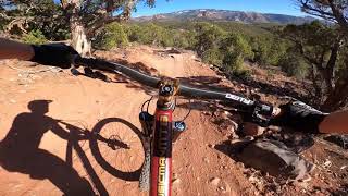
This trail is the most common access to Black Ops, but can be ridden out & back or as a part of larger loop rides in either direction. It has a nice slope with banked turns and well designed as a climbing or descent trail. Please remember to yield to uphill riders and to hikers.

Tags
BermsRock gardens

Trail Supporters

Local Trail Association

Traditionally Indigenous Territory

Recent Activity on Trail

Past Week
  • 4 rides
  • 17 miles average
6 Months
  • 76 rides
  • 11 miles avg distance
All
  • 617 rides
  • Last: Nov 15, 2026
c1c2c3c4
January
February
March
April
May
June
July
August
September
October
November
December
update trails status or condition

Elevate Trail Reports

statusdatedescription
Jul 21, 2026 @ 9:04am (America/Denver)
Jul 21, 2026
reporter Hello everyone, the trails are pretty wet and muddy this morning so we ask that everyone stays off the trails for at least a few hours to give it...
May 21, 2026 @ 10:10am (America/Phoenix)
May 21, 2026
Apr 10, 2026 @ 12:29pm (America/Phoenix)
Apr 10, 2026
reporter Some boot tracks from hikers on trail during muddy conditions a few weeks ago. Please stay off trails when leaving tracks or sinking into mud.
Mar 5, 2026 @ 7:59am (America/Denver)
Mar 5, 2026
Mar 5, 2026 @ 7:47am (America/Denver)
Mar 5, 2026
more »
Status:
on Jul 21, 2026
Prevalent Mud
Avg: 4.58 (20 votes)
Your vote: 0

view (3,046)
close
      Directions to elevate-233068 trailhead (37.620200, -113.097930)

      Photos

      9 more »
      mtb
      100 |
      Jul 9, 2024 @ 5:12pm
      Jul 9, 2024
      mtb
      95 |
      Jul 9, 2024 @ 5:11pm
      Jul 9, 2024
      mtb
      106 |
      Jul 9, 2024 @ 5:10pm
      Jul 9, 2024
      mtb
      91 |
      Jul 21, 2021 @ 10:17pm
      Jul 21, 2021

      Videos

      2 more »
      I CRASHED!!!! Black Opps Mountain Bike Trail...
      mtb
      6:27 | 307 | Jun 9, 2023 , Cedar City
      Turnpike to Elevate to Black Ops
      mtb
      11:13 | 182 | May 5, 2021 , Cedar City

      Routes with this trail

      more »
      11 miles • 1,436 ft • 4 •
      turnpike to tombstone and back down lava flow and back
      15 miles • 2,166 ft • 7 •
      Cedar City Pretty much all the goods Relive Your Rides Climb up Lichen It, You can descend Lava Flow here...
      7 miles • 1,030 ft • 4 •
      Simplest Loop for Boneyard trail
      4.8 ★★★★★
      20 Ratings
      5 ★ 75%
      4 ★ 25%
      3 ★
      2 ★
      1 ★

      5 Reviews & Comments

      bizango-x bizango-x
      Nice grade that makes for a good climb. Some rock tech to deal with, but I enjoyed the spiciness.
      CCS414
      Nice climb to access the other trails. Intermediate rating is spot on.
      bensgig bensgig
      Great little trail for a gentle climb. They knocked it out of the park with this. I would say it's a 95% 5%, 95% beginner easy 5% intermediate. Just a few rock areas to maneuver over and things like that. Gentle climb. Super fun. Great to add some extra miles around this whole area.

      We hope you've been enjoying Trailforks!

      Create a FREE account to view all trail reviews and much more.

      • By toddTF Pro Trailforks & contributors
      • #233068 - 2,281 views

      Frequently Asked Questions

      ▼ Where is Elevate located?
      Elevate is located in Iron Hills Trail System, Cedar City, Utah, United States. It is part of the Iron Hills Trail System trail network. The trailhead is located at coordinates 37.6202, -113.09793.
      ▼ How hard is Elevate?
      Elevate is rated as Blue difficulty. The physical rating is Moderate. The average grade is 4.7%. The climb difficulty is rated Blue.
      ▼ What is the elevation gain for Elevate?
      Elevate has 353 ft of elevation gain. The trail has 7 ft of elevation descent. The elevation ranges from 6,085 ft to 6,431 ft.
      ▼ Is Elevate a point to point trail?
      Elevate is not a point to point trail. The direction is Uphill Primary. The trail type is singletrack.
      ▼ How long is Elevate?
      Elevate is 1.4 miles long. The trail type is singletrack.
      ▼ Are dogs allowed on Elevate?
      Yes, dogs are allowed on Elevate. Please keep dogs on a leash where required and clean up after them.
      ▼ How do I access Elevate? Where is the closest parking trailhead?
      The closest parking and trailhead locations to Elevate are: View all parking locations in the area.
      ▼ How long does it take to ride Elevate?
      Based on recorded activities, it takes an average of 18 minutes to ride Elevate. The trail is 1.4 miles long. Actual times will vary based on fitness level, conditions, and pace. View recent activity logs for more details.
      ▼ How busy is Elevate?
      Elevate is a very popular trail. There have been 2,811 recorded activities on this trail. The trail has received 3,046 check-ins. View recent activity on this trail.

      Hit the Trail

      Open in App

      Get this trail on your phone instantly.

      open trail in app

      Download Trail

      Save to wishlist, Garmin & download.
      save the trail

      Find Related Routes

      Find routes and users activities that include this trail.
      find routes for this trail

      You must enter a description before submitting.

