

more stats
4,180 ft
Distance
12 ft
Climb
-232 ft
Descent
00:06:30
Avg time
-221 ft
Altitude change
523 ft
Altitude min
744 ft
Altitude max
744 ft
Altitude start
522 ft
Altitude end
-5.3%
Grade
-27.8%
Grade max
6.8%
Grade min
315 ft
Distance climb
3,301 ft
Distance down
568 ft
Distance flat
00:06:30
Avg time

E-Ticket (Upper) Details

  • Activities
    • Mountain Bike
    • Adaptive Bike
    • Hike
    • Trail Running
  • Riding Area
    Mission Trails Regional Park
    San Carlos, California
  • Difficulty Rating
  • Voted Difficulty
    Blue (5 votes)
  • Local Popularity
    100 in Mountain Biking heatmap [+]
    • 70 in Trail Running
    • 60 in Hiking
    • 5 in Adaptive Biking
  • Global Ranking
    #25516 in Mountain Biking [+]
    • #112003 in Trail Running
    • #116588 in Hiking
    • #1697 in Adaptive Biking
  • State Ranking
    #673 in Mountain Biking · California [+]
    • #5,464 in Trail Running
    • #6,485 in Hiking
    • #170 in Adaptive Biking
  • Trail Type
    Singletrack
  • Bike Type
    DH, AM, DJ, Adaptive MTB
  • Direction
    Downhill Primary
    Popular Direction Shown
  • Climb Difficulty
    Blue
  • Physical Rating
    Moderate
  • Dogs Allowed
    Yes
  • TTFs on Trail
    Berm, Jump, Pump Track, Rock Garden
  • Land Owner
    City of San Diego

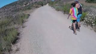
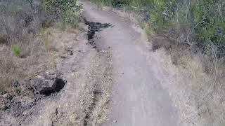
Fun trail with 2 sections. The upper section is a nice downhill with some berms, drops, and jumps. the lower section is slightly downhill with a few more jumps and berms. You can ride the lower section a few times by taking a connecting trail that takes you back where the upper and lower parts connect.

The city parks/rangers call the trail "Suycott Valley Alternate Trail," as indicated by the trail head sign. But the name "E-Ticket" is better known by the mountain bike community and matches Strava.

Access Info

Look for the sign "Suycott Alternate Trail”.

Adaptive Bike Info
aMTB Blue Rating: Intermediate features and steeper terrain.

Dilemma: Steep, loose, ledgy climb

Tags

Local Trail Association

Traditionally Indigenous Territory

Recent Activity on Trail

Past Week
  • 9 rides
  • 14.9 km average
6 Months
  • 177 rides
  • 11.6 km avg distance
All
  • 1,615 rides
  • Last: Nov 7, 2026
update trails status or condition

E-Ticket (Upper) Trail Reports

Status:
on Jun 17, 2026
Ideal
Avg: 4.45 (28 votes)
Your vote: 0

view (10,463)
close
      Directions to eticket-upper trailhead (32.843340, -117.068060)

      Photos

      12 more »
      mtb
      239 |
      Apr 12, 2023 @ 6:40am
      Apr 12, 2023
      mtb
      193 |
      Apr 12, 2023 @ 6:40am
      Apr 12, 2023
      mtb
      199 |
      Apr 12, 2023 @ 6:40am
      Apr 12, 2023
      mtb
      185 |
      Oct 6, 2022 @ 3:52pm
      Oct 6, 2022

      Videos

      18 more »
      E-Ticket Delivers at Mission Trails Regional Park
      mtb
      17:13 | 224 | Aug 1, 2026 , San Carlos
      E-Ticket Is a Certified San Diego Classic |...
      mtb
      17:20 | 225 | May 27, 2026 , San Carlos
      Upper and lower e-ticket out via double s part 2
      mtb
      8:53 | 119 | Jun 29, 2025 , San Carlos
      Upper and Lower E-ticket and SS part 1
      mtb
      8:53 | 92 | Jun 29, 2025 , San Carlos

      Routes with this trail

      more »
      ★ 3.6 • 8 miles • 1,401 ft • 10 • Loop •
      Mission Trails would seem to be the ideal mountain-biking location in San Diego. It's centrally located,...
      ★ 3.0 • 9 miles • 1,141 ft • 10 • Loop •
      If you're of two minds about Mission Trails Regional Park, then this is just the route for you. It has two...
      4.6 ★★★★★
      28 Ratings
      5 ★ 61%
      4 ★ 32%
      3 ★ 7%
      2 ★
      1 ★

      9 Reviews & Comments

      mtbsdca mtbsdca
      Super Fun Trail!
      Be ready for a climb though.
      Definitely preferable on an ebike.
      JGiovanni
      The climb to get here and to get out makes this trail barely worth it. Unfortunate, because it is fun.
      4U7mUg
      Watch out for hikers on the weekends (and possibly in the week) that are unaware of mountain bikers on the trails. This is a fairly popular trail for hikers to use in the opposite/north traveling direction, which can become dicey on blind corners...

      We hope you've been enjoying Trailforks!

      Create a FREE account to view all trail reviews and much more.

      • By ytj1975 & contributors
      • #48765 - 21,708 views

      Frequently Asked Questions

      ▼ Where is E-Ticket (Upper) located?
      E-Ticket (Upper) is located in Mission Trails Regional Park, San Carlos, California, United States. It is part of the Mission Trails Regional Park trail network. The trailhead is located at coordinates 32.84334, -117.06806.
      ▼ How hard is E-Ticket (Upper)?
      E-Ticket (Upper) is rated as Blue difficulty. The physical rating is Moderate. The average grade is 5.3%. The climb difficulty is rated Blue.
      ▼ What is the elevation gain for E-Ticket (Upper)?
      E-Ticket (Upper) has 12 ft of elevation gain. The trail has 232 ft of elevation descent. The elevation ranges from 523 ft to 744 ft.
      ▼ Is E-Ticket (Upper) a point to point trail?
      E-Ticket (Upper) is not a point to point trail. The direction is Downhill Primary. The trail type is singletrack.
      ▼ How long is E-Ticket (Upper)?
      E-Ticket (Upper) is 4,180 ft long. The trail type is singletrack.
      ▼ Are dogs allowed on E-Ticket (Upper)?
      Yes, dogs are allowed on E-Ticket (Upper). Please keep dogs on a leash where required and clean up after them.
      ▼ How do I access E-Ticket (Upper)? Where is the closest parking trailhead?
      The closest parking and trailhead locations to E-Ticket (Upper) are: View all parking locations in the area.
      ▼ How long does it take to ride E-Ticket (Upper)?
      Based on recorded activities, it takes an average of 7 minutes to ride E-Ticket (Upper). The trail is 4,180 ft long. Actual times will vary based on fitness level, conditions, and pace. View recent activity logs for more details.
      ▼ How busy is E-Ticket (Upper)?
      E-Ticket (Upper) is a very popular trail. There have been 8,790 recorded activities on this trail. The trail has received 10,463 check-ins. View recent activity on this trail.

      Hit the Trail

      Open in App

      Get this trail on your phone instantly.

      open trail in app

      Download Trail

      Save to wishlist, Garmin & download.
      save the trail

      Find Related Routes

      Find routes and users activities that include this trail.
      find routes for this trail

      You must enter a description before submitting.