

more stats
2.7 miles
Distance
-2,234 ft
Descent
00:33:00
Avg time
-2,234 ft
Altitude change
2,452 ft
Altitude min
4,686 ft
Altitude max
4,686 ft
Altitude start
2,454 ft
Altitude end
-15.5%
Grade
-62.9%
Grade max
-3.4%
Grade min
3 miles
Distance down
00:33:00
Avg time

Express Details

  • Activities
    • Mountain Bike
    • E-Bike
    • Winter Fat Bike
    • Hike
    • Trail Running
  • Riding Area
  • Difficulty Rating
  • Voted Difficulty
    Red (5 votes)
  • Local Popularity
    90 in Mountain Biking heatmap [+]
    • 100 in E-Biking
    • 45 in Trail Running
    • 70 in Hiking
  • Global Ranking
    #7330 in Mountain Biking [+]
    • #2033 in E-Biking
    • #139932 in Trail Running
    • #116774 in Hiking
    • #2804 in Winter Fat Biking
  • National Ranking
    #750 in Mountain Biking · Italy [+]
    • #308 in E-Biking
    • #4,504 in Trail Running
    • #3,872 in Hiking
    • #10 in Winter Fat Biking
  • Hiking SAC Scale
    T1 Hiking
  • Trail Type
    Singletrack
  • Bike Type
    DH, AM, XC, Fat
  • Physical Rating
    Moderate
  • Trail Visibility
    Always easy to follow
  • Alpine Trail
    Yes
  • Dogs Allowed
    Yes
  • eBike Allowed
  • Year Opened
    2024

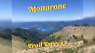
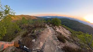
Trail più iconico della riding area, 4km di diversità e di divertimento. Adatto a tutti gli appassionati di MTB anche con capacità beginner. Panorami mozzafiato e punti panoramici con anche qualche panchina
*****************************
The most iconic trail in the riding area, 4km of different ground and fun. Suitable for all MTB riders, even beginners. Amazing views and panoramic points with some benches too!

Access Info

Dalla vetta del Mottarone seguire le creste in discesa verso la palestra di roccia. Dopo la seconda cresta in discesa seguire a destra verso Alpe Celle.
***************************
from the summit of Mottarone, follow the ridges downhill towards the rock climbing gym. After the second downhill ridge, turn right towards Alpe Celle

Tags
AlpineRidgelineSummitViews

Trail Supporters

Local Trail Association

Recent Activity on Trail

Past Week
  • 2 rides
  • 26.6 km average
6 Months
  • 13 rides
  • 31.1 km avg distance
All
  • 139 rides
  • Last: Nov 15, 2026
c1c2c3c4
January
February
March
April
May
June
July
August
September
October
November
December
update trails status or condition

Express Trail Reports

statusdatedescription
Nov 19, 2026 @ 2:11pm (Europe/Vaduz)
1 day
foglie in parte alta e in alcuni punti erba alta, alcune parti sono state decespugliate e al fondo sono statii fatti bei lavori di manutenzione
Nov 18, 2026 @ 9:23am (Europe/Rome)
2 days
reporter
Aperta variante parte bassa e sistemato scoli ed erosione su tutto il trail. A giorni decespugliata finale e soffiata prevista by CTC
Nov 11, 2026 @ 3:45pm (Europe/Rome)
Nov 11, 2026
reporter
Parte bassa decespugliata. Qualche canale e scavo dovuto all'acqua ma tutta fattibile in sella. A breve decespugliata prevista per parte alta e...
Nov 1, 2026 @ 1:59pm (Europe/Rome)
Nov 1, 2026
A tratti scavata ma bellissima
Oct 27, 2026 @ 10:09am (Europe/Vaduz)
Oct 27, 2026
Super trail come al solito Alcuni passaggi nuovi!! Grazie grazie
more »
Status:
on Nov 19, 2026
Variable
Avg: 4.76 (35 votes)
Your vote: 0

view (2,975)
close
      Directions to express-152478 trailhead (45.879670, 8.450920)

      Photos

      47 more »
      mtb
      136 |
      Apr 15, 2026 @ 12:20pm
      Apr 15, 2026
      mtb
      27 |
      Oct 25, 2026 @ 3:30am
      Oct 25, 2026
      mtb
      72 |
      Aug 5, 2026 @ 5:58am
      Aug 5, 2026
      mtb
      79 |
      Aug 5, 2026 @ 5:58am
      Aug 5, 2026

      Videos

      6 more »
      Express - Mottarone (VB)
      mtb
      14:07 | 317 | May 16, 2026 , Omegna
      Agrano - Discesa completa da Mottarone Express...
      mtb
      25:58 | 354 | Apr 27, 2026 , Omegna
      youtuber Iconic Bike Trail
      mtb
      0:26 | 285 | Aug 7, 2025 , Omegna
      Mottarone Express - Orta Lake, Piedmont Italy
      mtb
      7:30 | 440 | Dec 1, 2022 , Omegna
      4.9 ★★★★★
      34 Ratings
      5 ★ 94%
      4 ★ 3%
      3 ★ 3%
      2 ★
      1 ★

      18 Reviews & Comments

      marionide marionide
      Molto bello e ben curato. Top trail della zona!
      Albertocas
      fatto per la seconda volta il 20/4/26 in ottime condizioni ma anche con un pò di umido il brecciolino è inevitabile vista la conformazione geologica del terreno. Trail bellissimo, quasi 4 km con ...tutto...dal flow ai passaggi tecnici (gestibili). Forse il trail più bello e completo nel raggio di 100 km. Il giusto premio dopo una lunga salita che si può fare sia su bitume che anche su trail passando dalle 3 montagnette creando un giro molto appagante. Non è per beginner ma neppure rosso dai (IMHO)
      Laegernblitz
      Great trail, but sure not for beginners.

      We hope you've been enjoying Trailforks!

      Create a FREE account to view all trail reviews and much more.

      • By maramboTF Pro & contributors
      • #152478 - 10,175 views

      Frequently Asked Questions

      ▼ Where is Express located?
      Express is located in Omegna, Italy. It is part of the Omegna trail network. The trailhead is located at coordinates 45.87967, 8.45092.
      ▼ How hard is Express?
      Express is rated as Red difficulty. The physical rating is Moderate. The average grade is 15.5%.
      ▼ What is the elevation gain for Express?
      The trail has 2,234 ft of elevation descent. The elevation ranges from 2,452 ft to 4,686 ft.
      ▼ How long is Express?
      Express is 2.7 miles long. The trail type is singletrack.
      ▼ Are dogs allowed on Express?
      Yes, dogs are allowed on Express. Please keep dogs on a leash where required and clean up after them.
      ▼ When is the best time of year to ride Express?
      Based on activity log data, the most popular months to ride Express are:
      • May (25 activities)
      • April (13 activities)
      • December (12 activities)
      Check the reports page for current trail conditions.
      ▼ How do I access Express? Where is the closest parking trailhead?
      The closest parking and trailhead locations to Express are: View all parking locations in the area.
      ▼ How long does it take to ride Express?
      Based on recorded activities, it takes an average of 33 minutes to ride Express. The trail is 2.7 miles long. Actual times will vary based on fitness level, conditions, and pace. View recent activity logs for more details.
      ▼ How busy is Express?
      Express is a very popular trail. There have been 1,322 recorded activities on this trail. The trail has received 2,975 check-ins. View recent activity on this trail.

      Hit the Trail

      Open in App

      Get this trail on your phone instantly.

      open trail in app

      Download Trail

      Save to wishlist, Garmin & download.
      save the trail

      Find Related Routes

      Find routes and users activities that include this trail.
      find routes for this trail

      You must enter a description before submitting.

