more stats
1.1 miles
Distance
65 ft
Climb
-475 ft
Descent
00:13:42
Avg time
-411 ft
Altitude change
2,150 ft
Altitude min
2,564 ft
Altitude max
2,562 ft
Altitude start
2,152 ft
Altitude end
-7%
Grade
-53.5%
Grade max
17.8%
Grade min
1,358 ft
Distance climb
4,337 ft
Distance down
190 ft
Distance flat
00:13:42
Avg time

Forte basso Details

  • Activities
    • Mountain Bike
    • E-Bike
    • Winter Fat Bike
    • Hike
    • Trail Running
  • Riding Area
  • Difficulty Rating
  • Local Popularity
    70 in Mountain Biking heatmap [+]
    • 80 in E-Biking
    • 80 in Trail Running
    • 5 in Hiking
    • 5 in Winter Fat Biking
  • Global Ranking
    #59781 in Mountain Biking [+]
    • #23756 in E-Biking
    • #101936 in Trail Running
    • #206871 in Hiking
    • #3071 in Winter Fat Biking
  • National Ranking
    #5,223 in Mountain Biking · Italy [+]
    • #2,737 in E-Biking
    • #3,094 in Trail Running
    • #5,990 in Hiking
    • #30 in Winter Fat Biking
  • Trail Type
    Singletrack
  • Bike Type
    AM, XC, Fat
  • Climb Difficulty
    Blue
  • Physical Rating
    Hard
  • Trail Visibility
    Always easy to follow
  • Dogs Allowed
    Yes

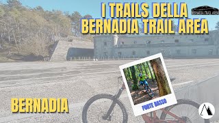
Il Forte Basso Trail è uno dei percorsi più completi della Bernadia Trail Area, un collegamento che dal Forte della Bernadia accompagna il biker verso Dolina attraversando un ambiente dove natura, storia e tecnica si incontrano.
Questo seniero propone una discesa varia e mai monotona: tratti veloci dove lasciar correre la bici si alternano a brevi rilanci in salita che richiedono energia e capacità di gestire il ritmo. Un trail dinamico, capace di mettere alla prova la guida senza mai perdere il piacere della scoperta.
Il finale è il suo punto più spettacolare: il sentiero si snoda tra antichi muri a secco, testimonianza della storia rurale della zona, regalando scorci unici sulla Val Torre e sulle montagne circostanti.
Un percorso dove ogni curva racconta il territorio, perfetto per chi cerca una discesa divertente ma anche un'esperienza immersiva nel paesaggio delle Prealpi Giulie.
Sentiero che con i suoi continui rilanci ti farà rimpiangere di non esserti allenato…o di non averlo affrontato con un e-bike

The Forte Basso Trail is one of the most complete routes in the Bernadia Trail Area, linking Forte Bernadia with Dolina through an environment where nature, history and technique meet.

The descent is varied and never monotonous: fast sections where you can let the bike run alternate with short uphill accelerations requiring energy and rhythm management. A dynamic trail that challenges your riding without taking away from the pleasure of discovery.

The finale is its most spectacular point: the trail winds among old dry-stone walls, evidence of the area's rural history, offering unique views over the Torre Valley and surrounding mountains.

A route where every corner tells a story of the territory, perfect for those looking for a fun descent and an immersive experience in the landscape of the Julian Prealps.

With its constant uphill accelerations, this is the trail that will make you regret not having trained... or not having brought an e-bike

Disclaimer

Indossa casco, resta sui sentieri, rispetta natura e proprietà, precedenza ai pedoni. Wear helmet, stay on trails, respect nature/land, yield to hikers. Sept–Jan: caution Wed/Sun dawn–dusk for hunting season

Tags
Rock gardensViews

Local Trail Association

Recent Activity on Trail

Past Week
  • 0 rides
  •  
6 Months
  • 4 rides
  • 35.7 km avg distance
All
  • 91 rides
  • Last: Nov 6, 2026
c1c2c3c4
January
February
March
April
May
June
July
August
September
October
November
December
Status:
on Oct 7, 2026
Ideal
Avg: 4.32 (6 votes)
Your vote: 0

view (405)
close
      Directions to forte-basso trailhead (46.240560, 13.266040)

      Photos

      9 more »
      mtb
      94 |
      Apr 12, 2025 @ 10:54pm
      Apr 12, 2025
      mtb
      125 |
      Apr 11, 2025 @ 6:20am
      Apr 11, 2025
      report
      mtb
      152 |
      Sep 17, 2024 @ 11:26pm
      Sep 17, 2024
      report
      mtb
      115 |
      Sep 17, 2024 @ 11:26pm
      Sep 17, 2024

      Videos

      5 more »
      Bernadia Trail Area Forte Basso RAW (#mtb#friuli)
      mtb
      10:06 | 259 | Jan 28, 2024 , Nimis
      La Bernadia Trail Area e i suoi sentieri  ...
      mtb
      8:34 | 217 | Jan 28, 2024 , Nimis
      White Bernadia
      mtb
      15:51 | 207 | Feb 21, 2022 , Nimis
      Forte Basso Trail RAW
      mtb
      10:44 | 526 | May 12, 2021 , Nimis

      Trail Lists

      Routes with this trail

      more »
      25 miles • 4,014 ft • 15 • Loop • Race •
      Maglia Nera e Asd Kicosys ti invitano alla prima edizione della randonnè fuoristrada ACSI nella Bernadia...
      4.7 ★★★★★
      6 Ratings
      5 ★ 67%
      4 ★ 33%
      3 ★
      2 ★
      1 ★

      4 Reviews & Comments

      maxmisdaris maxmisdaris
      Biker!!! 🚨 Attenzione a Ferragosto! 🚨
      ℹ Il 15 agosto 2025, in occasione della Marcia “Camminiamo Insieme” – Memorial Franco Negro organizzata in collaborazione con la FIASP a Villanova delle Grotte (UD), si svolgeranno tre percorsi panoramici di circa 7 km, 14 km e 19 km 🥾⛰️ con partenza tra le 8:00 e le 9:30 ⏰.
      Per garantire la sicurezza di tutti, vi invitiamo a evitare di percorrere in mountain bike la mattina del 15 agosto il sentiero
      🙏 Grazie per la collaborazione e… buon Ferragosto a tutti! ☀️🌳

      Bikers!!! 🚨 Attention this Ferragosto! 🚨
      ℹ On August 15th, 2025, during the “Camminiamo Insieme” – Memorial Franco Negro walk organized in collaboration with FIASP in Villanova delle Grotte (UD), there will be three scenic routes of approximately 7 km, 14 km, and 19 km 🥾⛰️ starting between 8:00 and 9:30 ⏰.
      To ensure everyone’s safety, we kindly ask you to avoid riding your mountain bike on the morning of August 15th along the trail.
      🙏 Thank you for your cooperation and… Happy Ferragosto to all! ☀️🌳
      H19CX0
      Bel trail, sicuramente da evitare dopo le piogge essendo di perse con grip non eccelso, c’è parecchio smosso ed a tratti e stretto ma nel complesso bello, diciamo un po’ più tecnico che veloce
      maxmisdaris maxmisdaris
      Sentiero ripulito dagli alberi caduti nell'ultimo periodo. Scorrevole

      We hope you've been enjoying Trailforks!

      Create a FREE account to view all trail reviews and much more.

      • By maxmisdarisTF Pro MGNR & contributors
      • #153653 - 3,139 views

      Frequently Asked Questions

      ▼ Where is Forte basso located?
      Forte basso is located in Bernadia Trail Area (Bernadia), Nimis, Italy. It is part of the Bernadia Trail Area (Bernadia) trail network. The trailhead is located at coordinates 46.24056, 13.26604.
      ▼ How hard is Forte basso?
      Forte basso is rated as Blue difficulty. The physical rating is Hard. The average grade is 7%. The climb difficulty is rated Blue.
      ▼ What is the elevation gain for Forte basso?
      Forte basso has 65 ft of elevation gain. The trail has 475 ft of elevation descent. The elevation ranges from 2,150 ft to 2,564 ft.
      ▼ How long is Forte basso?
      Forte basso is 1.1 miles long. The trail type is singletrack.
      ▼ Are dogs allowed on Forte basso?
      Yes, dogs are allowed on Forte basso. Please keep dogs on a leash where required and clean up after them.
      ▼ How do I access Forte basso? Where is the closest parking trailhead?
      The closest parking and trailhead locations to Forte basso are: View all parking locations in the area.
      ▼ How long does it take to ride Forte basso?
      Based on recorded activities, it takes an average of 14 minutes to ride Forte basso. The trail is 1.1 miles long. Actual times will vary based on fitness level, conditions, and pace. View recent activity logs for more details.
      ▼ How busy is Forte basso?
      Forte basso is a very popular trail. There have been 413 recorded activities on this trail. The trail has received 405 check-ins. View recent activity on this trail.

      Hit the Trail

      Open in App

      Get this trail on your phone instantly.

      open trail in app

      Download Trail

      Save to wishlist, Garmin & download.
      save the trail

      Find Related Routes

      Find routes and users activities that include this trail.
      find routes for this trail

      You must enter a description before submitting.