
more stats
4,478 ft
Distance
-701 ft
Descent
00:06:36
Avg time
-701 ft
Altitude change
2,904 ft
Altitude min
3,605 ft
Altitude max
3,605 ft
Altitude start
2,904 ft
Altitude end
-15.7%
Grade
-62.9%
Grade max
-2.3%
Grade min
4,478 ft
Distance down
00:06:36
Avg time

Mallet-Trail (Freeride) Details

  • Activities
    • Mountain Bike
    • E-Bike
  • Riding Area
  • Ref Number
    #13
  • Difficulty Rating
  • Voted Difficulty
    Proline (3 votes)
  • Local Popularity
    65 in Mountain Biking heatmap [+]
    • 55 in E-Biking
  • Global Ranking
    #41785 in Mountain Biking [+]
    • #53479 in E-Biking
  • National Ranking
    #1,530 in Mountain Biking · Germany [+]
    • #2,924 in E-Biking
  • Trail Type
    Singletrack
  • Bike Type
    DH, AM
  • Direction
    Downhill Only
    Popular Direction Shown
  • Season
    April - November
  • eBike Allowed
  • TTFs on Trail
    Berm, Drop, Jump, Rock Face, Rock Garden

English below

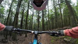
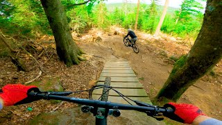
Hinter dem Gasthof der Bergstation beginnt die Freeride. Die Streckenlänge beträgt 2,2 km, der Höhenunterschied 260 m. Es befinden sich nur einige leicht zu umfahrende Sprünge in der Strecke.

Im oberen Teil ist die Strecke weit, steil und steinig. Im unteren Teil wird die Strecke enger und wurzeliger, insgesamt technischer. Die Freeride ist bei Trockenheit auch für Anfänger geeignet, bei Nässe jedoch wegen der vielen Wurzeln nur für Fortgeschrittene.

The Freeride trail begins behind the restaurant at the top. It has a length of 2.2 km and a difference in altitude of 260 m. The are only a few jumps on the trail which are easy to ride around.
In the upper part its an open,steep and rocky trail. The lower part gets more narrow, has many roots and is more technical. When it's dry the track is suitable for beginners as well, but due to the roots only recommended for advanced riders when wet.

Access Info

Der Trail beginnt hinter dem Gasthof an der Bergstation/The trail beginns behind the restaurant at the top.

Bike Park

Recent Activity on Trail

Past Week
  • 0 rides
  •  
6 Months
  • 185 rides
  • 21 miles avg distance
All
  • 658 rides
  • Last: Nov 8, 2026
c1c2c3c4
January
February
March
April
May
June
July
August
September
October
November
December
Status:
on Nov 1, 2026
Variable
Avg: 4.32 (32 votes)
Your vote: 0

view (5,465)
close
      Directions to mallettrail-freeride trailhead (48.923940, 13.038520)

      Photos

      4 more »
      mtb
      128 |
      May 29, 2020 @ 2:34pm
      May 29, 2020
      mtb
      145 |
      Oct 14, 2019 @ 10:33pm
      Oct 14, 2019
      mtb
      147 |
      Oct 14, 2019 @ 10:33pm
      Oct 14, 2019
      mtb
      156 |
      Oct 14, 2019 @ 10:33pm
      Oct 14, 2019

      Videos

      12 more »
      Mallet Trail - MTB Zone, Bikepark Geisskopf
      mtb
      7:31 | 99 | Jan 4, 2025 , Bischofsmais
      FREERIDE, Bikepark Geisskopf ... HARDEST TRAIL...
      mtb
      4:42 | 381 | Jun 12, 2022 , Bischofsmais
      Bikepark Geisskopf - Freeride 2018
      mtb
      4:13 | 500 | Oct 17, 2018 , Bischofsmais
      Bikepark Geisskopf – Freeride – Nomad CC
      mtb
      5:38 | 505 | Sep 7, 2018 , Bischofsmais
      4.4 ★★★★★
      32 Ratings
      5 ★ 53%
      4 ★ 34%
      3 ★ 9%
      2 ★ 3%
      1 ★

      2 Reviews & Comments

      ktnkgb ktnkgb
      Lots of lines to choose. As good and as fun as... 10 years ago. Not for light carcass tyres.
      MasterChris MasterChris
      The trail name may be confusing, while other 'freeride' trails are jump trails, this one is a rough downhill trail, with loads of rocks and roots.
      Other than that, the trail is pretty fun. Challenging to ride fast, some fun jumps, but flows pretty good and has easy chicken lines for beginners. Makes it a good trail for every rider.
      It's a little easier than the downhill track.
      Slippery when wet, also the trail i puncture on the most in the whole bikepark, so better run a little more air, or ride propper DH tires.

      We hope you've been enjoying Trailforks!

      Create a FREE account to view all trail reviews and much more.

      • By UniqueTerrainProductions & contributors
      • #25898 - 2,899 views

      Frequently Asked Questions

      ▼ Where is Mallet-Trail (Freeride) located?
      Mallet-Trail (Freeride) is located in MTB Zone Bikepark Geisskopf, Bischofsmais, Germany. It is part of the MTB Zone Bikepark Geisskopf trail network. The trailhead is located at coordinates 48.92394, 13.03852.
      ▼ How hard is Mallet-Trail (Freeride)?
      Mallet-Trail (Freeride) is rated as Red difficulty. The average grade is 15.7%.
      ▼ What is the elevation gain for Mallet-Trail (Freeride)?
      The trail has 701 ft of elevation descent. The elevation ranges from 2,904 ft to 3,605 ft.
      ▼ Is Mallet-Trail (Freeride) a point to point trail?
      Yes, Mallet-Trail (Freeride) is a point to point trail. The direction is Downhill Only. The trail type is singletrack.
      ▼ How long is Mallet-Trail (Freeride)?
      Mallet-Trail (Freeride) is 4,478 ft long. The trail type is singletrack.
      ▼ Are dogs allowed on Mallet-Trail (Freeride)?
      There is no information about dogs being allowed on Mallet-Trail (Freeride). Check with local trail managers or the trail page for the latest access rules.
      ▼ When is the best time of year to ride Mallet-Trail (Freeride)?
      Mallet-Trail (Freeride) is best visited during: April - November.
      ▼ How do I access Mallet-Trail (Freeride)? Where is the closest parking trailhead?
      The closest parking and trailhead locations to Mallet-Trail (Freeride) are: View all parking locations in the area.
      ▼ How long does it take to ride Mallet-Trail (Freeride)?
      Based on recorded activities, it takes an average of 7 minutes to ride Mallet-Trail (Freeride). The trail is 4,478 ft long. Actual times will vary based on fitness level, conditions, and pace. View recent activity logs for more details.
      ▼ How busy is Mallet-Trail (Freeride)?
      Mallet-Trail (Freeride) is a moderately popular trail. There have been 3,550 recorded activities on this trail. The trail has received 5,465 check-ins. View recent activity on this trail.

      Hit the Trail

      Open in App

      Get this trail on your phone instantly.

      open trail in app

      Download Trail

      Save to wishlist, Garmin & download.
      save the trail

      Find Related Routes

      Find routes and users activities that include this trail.
      find routes for this trail

      You must enter a description before submitting.