

more stats
928 ft
Distance
12 ft
Climb
-88 ft
Descent
00:02:08
Avg time
-75 ft
Altitude change
1,266 ft
Altitude min
1,342 ft
Altitude max
1,342 ft
Altitude start
1,266 ft
Altitude end
-8.1%
Grade
-26.2%
Grade max
12.5%
Grade min
151 ft
Distance climb
702 ft
Distance down
00:02:08
Avg time

Freeride Details

  • Activities
    • Mountain Bike
    • E-Bike
    • Hike
    • Trail Running
  • Riding Area
    Monte Mario
    Sasso Marconi
  • Difficulty Rating
  • Local Popularity
    65 in Mountain Biking heatmap [+]
    • 70 in E-Biking
    • 5 in Trail Running
    • 5 in Hiking
  • Global Ranking
    #69257 in Mountain Biking [+]
    • #34504 in E-Biking
    • #357096 in Trail Running
    • #336419 in Hiking
  • National Ranking
    #5,914 in Mountain Biking · Italy [+]
    • #4,009 in E-Biking
    • #13,712 in Trail Running
    • #12,966 in Hiking
  • Trail Type
    Singletrack
  • Bike Type
    AM, XC
  • Direction
    Downhill Only
    Popular Direction Shown
  • Trail Visibility
    Sometimes hard to follow
  • Dogs Allowed
    Yes
  • eBike Allowed
    Yes up to Class 1

Breve tratto che parte dal braciere (panchine) zona Commenda e si innesta nel Sentiero Gianna. Presenti due tratti molto difficili (all'inizio e alla fine) solo per esperti. Presenti vari chicken line lungo il percorso

Tags
Faint trail

Recent Activity on Trail

Past Week
  • 0 rides
  •  
6 Months
  • 11 rides
  • 25.3 km avg distance
All
  • 102 rides
  • Last: Sep 5, 2026
c1c2c3c4
January
February
March
April
May
June
July
August
September
October
November
December
Status:
on Nov 5, 2026
Ideal
Avg: 4.24 (3 votes)
Your vote: 0

view (908)
close
      Directions to freeride-32941 trailhead (44.376090, 11.271220)

      Photos

      1 more »
      mtb
      184 |
      Jul 5, 2018 @ 5:15am
      Jul 5, 2018

      Videos

      1 more »
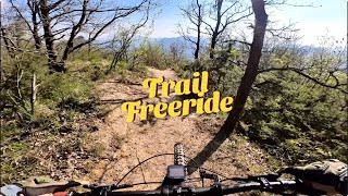
      Sasso Marconi (BO) - Trail Freeride
      mtb
      2:12 | 107 | Apr 11, 2025 , Sasso Marconi

      Routes with this trail

      more »
      21 miles • 4,315 ft • 12 • Point to Point •
      iniziando dalla chiesa di badolo, si sale fino a monte del frate passando da via delle valli. e si fa il...
      4.7 ★★★★★
      3 Ratings
      5 ★ 67%
      4 ★ 33%
      3 ★
      2 ★
      1 ★

      1 Review & Comments

      MontesiDani MontesiDani
      Non entusiasmante, forse xché corta e finisce presto il divertimento

      We hope you've been enjoying Trailforks!

      Create a FREE account to view all trail reviews and much more.

      • By Gullo & contributors
      • #32941 - 1,510 views

      Frequently Asked Questions

      ▼ Where is Freeride located?
      Freeride is located in Monte Mario, Sasso Marconi, Italy. It is part of the Monte Mario trail network. The trailhead is located at coordinates 44.37609, 11.27122.
      ▼ How hard is Freeride?
      Freeride is rated as Red difficulty. The average grade is 8.1%.
      ▼ What is the elevation gain for Freeride?
      Freeride has 12 ft of elevation gain. The trail has 88 ft of elevation descent. The elevation ranges from 1,266 ft to 1,342 ft.
      ▼ Is Freeride a point to point trail?
      Yes, Freeride is a point to point trail. The direction is Downhill Only. The trail type is singletrack.
      ▼ How long is Freeride?
      Freeride is 928 ft long. The trail type is singletrack.
      ▼ Are dogs allowed on Freeride?
      Yes, dogs are allowed on Freeride. Please keep dogs on a leash where required and clean up after them.
      ▼ How do I access Freeride? Where is the closest parking trailhead?
      The closest parking and trailhead locations to Freeride are: View all parking locations in the area.
      ▼ How long does it take to ride Freeride?
      Based on recorded activities, it takes an average of 2 minutes to ride Freeride. The trail is 928 ft long. Actual times will vary based on fitness level, conditions, and pace. View recent activity logs for more details.
      ▼ How busy is Freeride?
      Freeride is a moderately popular trail. There have been 894 recorded activities on this trail. The trail has received 908 check-ins. View recent activity on this trail.

      Hit the Trail

      Open in App

      Get this trail on your phone instantly.

      open trail in app

      Download Trail

      Save to wishlist, Garmin & download.
      save the trail

      Find Related Routes

      Find routes and users activities that include this trail.
      find routes for this trail

      You must enter a description before submitting.

