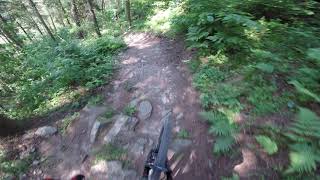
more stats
1,906 ft
Distance
-376 ft
Descent
00:07:58
Avg time
-376 ft
Altitude change
2,069 ft
Altitude min
2,444 ft
Altitude max
2,444 ft
Altitude start
2,070 ft
Altitude end
-19.7%
Grade
-43.4%
Grade max
20 ft
Distance climb
1,818 ft
Distance down
72 ft
Distance flat
00:07:58
Avg time

Freeride Details

  • Activities
    • Mountain Bike
  • Riding Area
  • AKA
    2ka
  • Difficulty Rating
  • Voted Difficulty
    Double Black Diamond (1 vote)
  • Local Popularity
    75 in Mountain Biking heatmap
  • Global Ranking
    #78779 in Mountain Biking
  • National Ranking
    #1,813 in Mountain Biking · Poland
  • Trail Type
    Singletrack
  • Bike Type
    DH, AM
  • Direction
    Downhill Primary
  • Physical Rating
    Easy
  • TTFs on Trail
    Rock Garden

Trasa naturalna trudna. Jej największą trudnością poza typowymi elementami jak kamienie i korzenie są stromizny i trawersy poprzeplatane licznymi zakrętami. Możliwe luźne kamienie i śliska nawierzchnia. Rekomendowany rower z pełnym zawieszeniem i sprawnymi hamulcami. Obowiązkowe ochraniacze i kask typu full face.

Tags
Rock gardens

Bike Park

Recent Activity on Trail

Past Week
  • 0 rides
  •  
6 Months
  • 4 rides
  • 6 miles avg distance
All
  • 56 rides
  • Last: Aug 30, 2026
Status:
on Jul 30, 2025
Ideal
Avg: 3.98 (1 votes)
Your vote: 0

view (887)
close
      Directions to freeride-91786 trailhead (49.456490, 20.318700)

      Photos

      12 more »
      mtb
      936 |
      Jul 21, 2011 @ 12:11pm
      Jul 21, 2011
      mtb
      539 |
      Jul 24, 2011 @ 12:56pm
      Jul 24, 2011
      mtb
      316 |
      Aug 24, 2012 @ 9:06am
      Aug 24, 2012
      mtb
      1,008 |
      Nov 4, 2012 @ 12:29pm
      Nov 4, 2012

      Videos

      4 more »
      JoyRide Bikepark Kluszkowce Freeride (os 4 enduro)
      mtb
      2:01 | 672 | Jun 17, 2019 , Czorsztyn
      Bikepark Rablow- Jaws & Pikap(POV)
      mtb
      0:08 | 2122 | Aug 30, 2012 , Czorsztyn
      FR Line
      mtb
      2:16 | 265 | Aug 30, 2011 , Czorsztyn
      Rzeszów biała FR line
      mtb
      0:43 | 761 | Apr 14, 2015 , Czorsztyn
      4.0 ★★★★★
      1 Ratings
      5 ★
      4 ★ 100%
      3 ★
      2 ★
      1 ★

      1 Review & Comments


      We hope you've been enjoying Trailforks!

      Create a FREE account to view all trail reviews and much more.

      • By kaiser81TF Pro & contributors
      • #91786 - 1,710 views

      Frequently Asked Questions

      ▼ Where is Freeride located?
      Freeride is located in Joy Ride Bike Park Kluszkowce, Czorsztyn, Poland. It is part of the Joy Ride Bike Park Kluszkowce trail network. The trailhead is located at coordinates 49.45649, 20.3187.
      ▼ How hard is Freeride?
      Freeride is rated as Red difficulty. The physical rating is Easy. The average grade is 19.7%.
      ▼ What is the elevation gain for Freeride?
      The trail has 376 ft of elevation descent. The elevation ranges from 2,069 ft to 2,444 ft.
      ▼ Is Freeride a point to point trail?
      Freeride is not a point to point trail. The direction is Downhill Primary. The trail type is singletrack.
      ▼ How long is Freeride?
      Freeride is 1,906 ft long. The trail type is singletrack.
      ▼ Are dogs allowed on Freeride?
      There is no information about dogs being allowed on Freeride. Check with local trail managers or the trail page for the latest access rules.
      ▼ How do I access Freeride? Where is the closest parking trailhead?
      The closest parking and trailhead locations to Freeride are: View all parking locations in the area.
      ▼ How long does it take to ride Freeride?
      Based on recorded activities, it takes an average of 8 minutes to ride Freeride. The trail is 1,906 ft long. Actual times will vary based on fitness level, conditions, and pace. View recent activity logs for more details.
      ▼ How busy is Freeride?
      Freeride is a very popular trail. There have been 682 recorded activities on this trail. The trail has received 887 check-ins. View recent activity on this trail.

      Hit the Trail

      Open in App

      Get this trail on your phone instantly.

      open trail in app

      Download Trail

      Save to wishlist, Garmin & download.
      save the trail

      Find Related Routes

      Find routes and users activities that include this trail.
      find routes for this trail

      You must enter a description before submitting.