more stats
4.8 miles
Distance
20 ft
Climb
-2,947 ft
Descent
00:47:52
Avg time
-2,927 ft
Altitude change
5,403 ft
Altitude min
8,330 ft
Altitude max
8,330 ft
Altitude start
5,404 ft
Altitude end
-11.5%
Grade
-70.1%
Grade max
12.4%
Grade min
699 ft
Distance climb
5 miles
Distance down
33 ft
Distance flat
00:47:52
Avg time

Furcletta Details

  • Activities
    • Mountain Bike
    • E-Bike
    • Hike
    • Trail Running
  • Riding Area
    Bike Kingdom
    Arosa Lenzerheide
  • Difficulty Rating
  • Trail Style
    Technical
  • Voted Difficulty
    Red (1 vote)
  • Local Popularity
    70 in Mountain Biking heatmap [+]
    • 50 in E-Biking
    • 60 in Trail Running
    • 5 in Hiking
  • Global Ranking
    #45781 in Mountain Biking [+]
    • #122668 in E-Biking
    • #130387 in Trail Running
    • #206087 in Hiking
  • National Ranking
    #1,075 in Mountain Biking · Switzerland [+]
    • #4,471 in E-Biking
    • #2,756 in Trail Running
    • #6,511 in Hiking
  • Hiking SAC Scale
    T2 Mountain Hiking
  • Trail Type
    Singletrack
  • Bike Type
    AM, XC
  • Direction
    Downhill Primary
    Popular Direction Shown
  • Physical Rating
    Moderate
  • Season
    Jul. - Sept.
  • Alpine Trail
    Yes
  • Dogs Allowed
    Yes
  • eBike Allowed
    Yes up to Class 1

Wunderschöner natürlicher Trail von der Furcletta durch das Welschtobel nach Arosa. Die meisten Stellen sind nicht wirklich schwierig zu fahren. An einigen steileren Stellen liegt loser Schotter. mit der nötigen Vorsicht können diese aber auch gut gefahren werden.

Access Info

Zugang via Lenzerheide Rothorn oder Alvaneu

Tags
AlpineViews

Bike Park

Recent Activity on Trail

Past Week
  • 0 rides
  •  
6 Months
  • 49 rides
  • 26 miles avg distance
All
  • 106 rides
  • Last: Oct 4, 2026
c1c2c3c4
January
February
March
April
May
June
July
August
September
October
November
December
Status:
on Oct 27, 2026
Snow Covered
Avg: 4.61 (20 votes)
Your vote: 0

view (463)
close
      Directions to furcletta trailhead (46.726640, 9.623200)

      Photos

      38 more »
      mtb
      66 |
      Jul 30, 2026 @ 8:54am
      Jul 30, 2026
      mtb
      119 |
      Oct 22, 2025 @ 2:06am
      Oct 22, 2025
      mtb
      122 |
      Oct 22, 2025 @ 2:06am
      Oct 22, 2025
      mtb
      115 |
      Oct 22, 2025 @ 2:06am
      Oct 22, 2025

      Videos

      6 more »
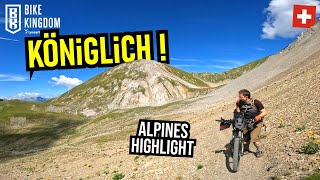
      youtuber BIKE KINGDOM Lenzerheide: die Furcletta-Tour...
      mtb
      21:40 | 354 | Mar 7, 2025 , Arosa Lenzerheide
      youtuber LENZERHEIDE SCHWEIZ Furcletta-Trail (upper,...
      mtb
      5:27 | 498 | Jun 17, 2022 , Arosa Lenzerheide
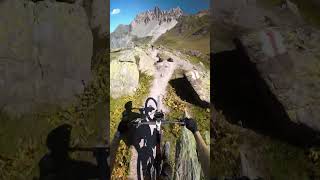
      youtuber Scenic Fun Trail
      mtb
      0:28 | 60 | Aug 18, 2025 , Arosa Lenzerheide
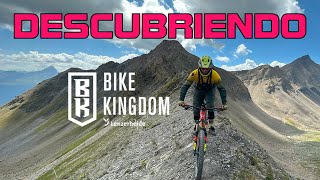
      Descubriendo Bike Kingdom - Graubünden -...
      mtb
      7:46 | 318 | Sep 13, 2023 , Arosa Lenzerheide

      Routes with this trail

      more »
      ★ 5.0 • 23 miles • 9,197 ft • 14 • Loop •
      This route is one of the highlights of the region. A demanding enduro route with a unique nature and...
      4.8 ★★★★★
      20 Ratings
      5 ★ 90%
      4 ★ 5%
      3 ★
      2 ★ 5%
      1 ★

      3 Reviews & Comments

      any0ngmtb any0ngmtb
      This trail is amazing. Not very steep but that's a good thing I think. Only "downside" is that it's pretty hard to get to. Honestly the easiest way is probably climbing the trail up.
      crisotop crisotop
      Superfun alpine flowtrail. Very much worth the transfer
      alexmarengo alexmarengo
      amazing....while the crowd is queuing in Lenzerheide to ride brake-bumps-autobahns, you'll likely find few riders on this incredible trail.

      We hope you've been enjoying Trailforks!

      Create a FREE account to view all trail reviews and much more.

      • By Benq00TF Pro & contributors
      • #140429 - 5,209 views

      Frequently Asked Questions

      ▼ Where is Furcletta located?
      Furcletta is located in Bike Kingdom, Arosa Lenzerheide, Switzerland. It is part of the Bike Kingdom trail network. The trailhead is located at coordinates 46.72664, 9.6232.
      ▼ How hard is Furcletta?
      Furcletta is rated as Red difficulty. The physical rating is Moderate. The average grade is 11.5%.
      ▼ What is the elevation gain for Furcletta?
      Furcletta has 20 ft of elevation gain. The trail has 2,947 ft of elevation descent. The elevation ranges from 5,403 ft to 8,330 ft.
      ▼ Is Furcletta a point to point trail?
      Furcletta is not a point to point trail. The direction is Downhill Primary. The trail type is singletrack.
      ▼ How long is Furcletta?
      Furcletta is 4.8 miles long. The trail type is singletrack.
      ▼ Are dogs allowed on Furcletta?
      Yes, dogs are allowed on Furcletta. Please keep dogs on a leash where required and clean up after them.
      ▼ When is the best time of year to ride Furcletta?
      Based on activity log data, the most popular months to ride Furcletta are:
      • August (34 activities)
      • July (18 activities)
      • September (11 activities)
      Check the reports page for current trail conditions.
      ▼ How do I access Furcletta? Where is the closest parking trailhead?
      The closest parking and trailhead locations to Furcletta are: View all parking locations in the area.
      ▼ How long does it take to ride Furcletta?
      Based on recorded activities, it takes an average of 48 minutes to ride Furcletta. The trail is 4.8 miles long. Actual times will vary based on fitness level, conditions, and pace. View recent activity logs for more details.
      ▼ How busy is Furcletta?
      Furcletta is a very popular trail. There have been 482 recorded activities on this trail. The trail has received 463 check-ins. View recent activity on this trail.

      Hit the Trail

      Open in App

      Get this trail on your phone instantly.

      open trail in app

      Download Trail

      Save to wishlist, Garmin & download.
      save the trail

      Find Related Routes

      Find routes and users activities that include this trail.
      find routes for this trail

      You must enter a description before submitting.