
more stats
1.3 miles
Distance
195 ft
Climb
-178 ft
Descent
00:17:44
Avg time
16 ft
Altitude change
268 ft
Altitude min
377 ft
Altitude max
361 ft
Altitude start
377 ft
Altitude end
0.2%
Grade
-52.7%
Grade max
23.6%
Grade min
3,346 ft
Distance climb
2,470 ft
Distance down
755 ft
Distance flat
00:17:44
Avg time

Gahnia Details

  • Activities
    • Mountain Bike
    • E-Bike
  • Riding Area
    Manly Dam
    Sydney
  • Difficulty Rating
  • Voted Difficulty
    Blue (11 votes)
  • Local Popularity
    85 in Mountain Biking heatmap [+]
    • 80 in E-Biking
  • Global Ranking
    #26178 in Mountain Biking [+]
    • #672 in E-Biking
  • National Ranking
    #1,322 in Mountain Biking · Australia [+]
    • #7 in E-Biking
  • Trail Type
    Singletrack
  • Bike Type
    AM
  • Direction
    One Direction
    Popular Direction Shown
  • Climb Difficulty
    Blue
  • Physical Rating
    Hard
  • Trail Visibility
    Always easy to follow
  • Dogs Allowed
    Yes
  • eBike Allowed
    Yes up to Class 1
  • TTFs on Trail
    Bridge, Drop, Rock Face
  • Land Owner
    Northern Beaches Council

Gahnia Mountain Bike Track
IMBA rated: More difficult (blue)
Length: 2.15 km
Direction: One way
Recommended: Experienced mountain bike riders with good skills.

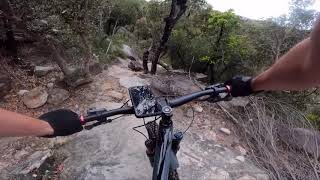
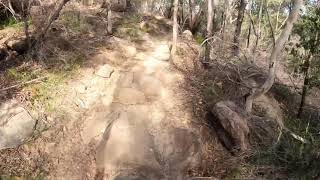
This is a one way, single width mountain bike track, to be ridden in the direction shown. Riders will find it challenging because it has variable surfaces and obstacles. Some steep sections have drop offs. Keep to the formed track and report any damage or track widening with reference to the nearest way marker.

Filter section: the first 50 m of this track has been designed to test if your bike handling skill is at the level needed for tracks rated ‘more difficult’. If you find you are not yet competent at all the challenges in this section, then do not proceed any further along the track. It is permitted to go back up the track to the start from this section only. Do not cut through the bush to exit the track.

Tags
BridgesDropsRock slabs

Local Trail Association

Traditionally Indigenous Territory

Recent Activity on Trail

Past Week
  • 0 rides
  •  
6 Months
  • 59 rides
  • 10 miles avg distance
All
  • 565 rides
  • Last: Nov 11, 2026
c1c2c3c4
January
February
March
April
May
June
July
August
September
October
November
December
Status:
on Nov 8, 2026
Ideal
Avg: 3.5 (31 votes)
Your vote: 0

view (4,684)
close
      Directions to gahnia trailhead (-33.765880, 151.228040)

      Photos

      34 more »
      mtb
      86 |
      Jan 23, 2026 @ 6:09pm
      Jan 23, 2026
      mtb
      84 |
      Jan 23, 2026 @ 6:09pm
      Jan 23, 2026
      mtb
      139 |
      Mar 9, 2024 @ 5:16pm
      Mar 9, 2024
      mtb
      133 |
      Mar 9, 2024 @ 5:09pm
      Mar 9, 2024

      Videos

      2 more »
      Gahnia Mountain Bike Track
      mtb
      2:15 | 2736 | Nov 8, 2020 , Sydney
      Gahnia
      mtb
      11:01 | 1416 | May 17, 2020 , Sydney

      Routes with this trail

      more »
      ★ 3.7 • 7 miles • 430 ft • 14 • Loop •
      The common Manly Dam loop, But now with Possums and Jumping Jack! (possums downhill) Common loop ridden by...
      9 miles • 896 ft • 18 • Loop •
      Nice loop combining flowy descents, technical climbs, and fun cornering. Start from the Frenchs Forest...
      5 miles • 525 ft • 22 • Loop •
      Nice warm up going down Dirty Schnitty then on to some more technical trail with Ghania, all the way up to...
      3.4 ★★★★★
      30 Ratings
      5 ★ 33%
      4 ★ 23%
      3 ★ 7%
      2 ★ 20%
      1 ★ 17%

      25 Reviews & Comments

      jamesheafey
      Yeah, i’m a blue rider on the best of days but have occasionally dabbled on black runs. If that is you, stay off this thing. I didn’t know i could walk back up after starting, if i knew the etiquette earlier, i would have turned around.
      Very techy. Rocks basically 98% of track. Took me an hour. Yeah, i suck at riding but i enjoy it.
      professed professed
      Trail has been trimmed heavily earlier this year. Still in poor condition and sections needing repair. A solid workout
      Blackhawk007
      All tech and no flow.. the top section is definitely black.. it has high consequences if you fail to negotiate the off camber steep S section.. I've come across a few bods that have fallen for the blurb that it's a blue.

      We hope you've been enjoying Trailforks!

      Create a FREE account to view all trail reviews and much more.

      • By typedmillepedeTF Pro & contributors
      • #35993 - 9,789 views

      Frequently Asked Questions

      ▼ Where is Gahnia located?
      Gahnia is located in Manly Dam, Sydney, Australia. It is part of the Manly Dam trail network. The trailhead is located at coordinates -33.76588, 151.22804.
      ▼ How hard is Gahnia?
      Gahnia is rated as Black Diamond difficulty. The physical rating is Hard. The average grade is 0.2%. The climb difficulty is rated Blue.
      ▼ What is the elevation gain for Gahnia?
      Gahnia has 195 ft of elevation gain. The trail has 178 ft of elevation descent. The elevation ranges from 268 ft to 377 ft.
      ▼ Is Gahnia a point to point trail?
      Yes, Gahnia is a point to point trail. The direction is One Direction. The trail type is singletrack.
      ▼ How long is Gahnia?
      Gahnia is 1.3 miles long. The trail type is singletrack.
      ▼ Are dogs allowed on Gahnia?
      Yes, dogs are allowed on Gahnia. Please keep dogs on a leash where required and clean up after them.
      ▼ When is the best time of year to ride Gahnia?
      Based on activity log data, the most popular months to ride Gahnia are:
      • July (35 activities)
      • October (30 activities)
      • March (28 activities)
      Check the reports page for current trail conditions.
      ▼ How do I access Gahnia? Where is the closest parking trailhead?
      The closest parking and trailhead locations to Gahnia are: View all parking locations in the area.
      ▼ How long does it take to ride Gahnia?
      Based on recorded activities, it takes an average of 18 minutes to ride Gahnia. The trail is 1.3 miles long. Actual times will vary based on fitness level, conditions, and pace. View recent activity logs for more details.
      ▼ How busy is Gahnia?
      Gahnia is a very popular trail. There have been 4,696 recorded activities on this trail. The trail has received 4,684 check-ins. View recent activity on this trail.

      Hit the Trail

      Open in App

      Get this trail on your phone instantly.

      open trail in app

      Download Trail

      Save to wishlist, Garmin & download.
      save the trail

      Find Related Routes

      Find routes and users activities that include this trail.
      find routes for this trail

      You must enter a description before submitting.