
more stats
4,413 ft
Distance
4 ft
Climb
-544 ft
Descent
00:06:30
Avg time
-540 ft
Altitude change
502 ft
Altitude min
1,042 ft
Altitude max
1,042 ft
Altitude start
502 ft
Altitude end
-12.2%
Grade
-50.1%
Grade max
10.7%
Grade min
26 ft
Distance climb
4,298 ft
Distance down
85 ft
Distance flat
00:06:30
Avg time

Gongolo Details

  • Activities
    • Mountain Bike
    • E-Bike
  • Riding Area
  • Difficulty Rating
  • Local Popularity
    70 in Mountain Biking heatmap [+]
    • 65 in E-Biking
  • Global Ranking
    #53545 in Mountain Biking [+]
    • #52855 in E-Biking
  • National Ranking
    #4,772 in Mountain Biking · Italy [+]
    • #6,346 in E-Biking
  • Trail Type
    Singletrack
  • Bike Type
    AM, XC
  • Direction
    Downhill Only
    Popular Direction Shown
  • Climb Difficulty
    Green
  • Physical Rating
    Moderate
  • eBike Allowed
  • TTFs on Trail
    Drop, Jump, Rock Garden

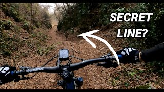
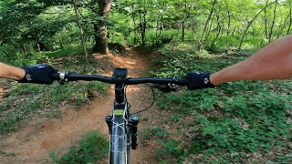
Percorso misto che varia dal veloce al tecnico con sezioni rocciose.
Il percorso inizia con un rettilineo veloce (prestare attenzione in questo tratto perché il percorso tende spesso a essere ostruito da alberi in mezzo al sentiero) che ci porta a fare due curve veloci e subito dopo troviamo due piccole contropendenze che possiamo copiare accompagnado la bici o utilizzarle per saltare. Subito dopo ci si sposta sulla sinistra dove dovremo pedalare per qualche metro. Dopo questo piccolo rilancio ci troveremo di fronte a una discesa a L molto ripida (prestare attenzione). Superata la discesa si entra in un vero e proprio canalone dove si tratterà solo di seguire il tracciato e prestare attenzione a qualche masso. Il sentiero esce su una strada bianca che basterà attraversare per proseguire scendendo nel secondo canalone. Il sentiero in questa sezione è molto simile al tratto precedente l'unica cosa è prestare attenzione nel primo tratto in cui bisognerà passare tra due pareti di rocce e si passa a filo.

Access Info

Presa XIV (Via della Vittoria). Bisogna percorrere quasi tutta la presa. Consiglio di prendere come riferimento la prima casa che troverete salendo sulla sinistra. Un 10m prima di superarla c'è una stradina sulla destra (un modo in più per riconoscerla è un cavo d'acciaio che solitamente ostruisce l'entrata), imboccate quella e percorretela fino a quando non inizierà una curva in discesa. Superata la curva inizia il sentiero.

Tags
DropsJumpsRock gardens

Recent Activity on Trail

Past Week
  • 0 rides
  •  
6 Months
  • 10 rides
  • 12 miles avg distance
All
  • 85 rides
  • Last: Nov 1, 2026
c1c2c3c4
January
February
March
April
May
June
July
August
September
October
November
December
update trails status or condition

Gongolo Trail Reports

statusdatedescription
Jan 31, 2026 @ 11:45am (Europe/Rome)
Jan 31, 2026
Mar 7, 2025 @ 5:19am
Mar 7, 2025
Feb 23, 2025 @ 11:36am
Feb 23, 2025
Feb 3, 2024 @ 2:10am
Feb 3, 2024
Al momento stanno ripulendo il bosco dove si prende la strada che imbocca il trail, perciò c'è qualche mucchio di rami che si aggira facilmente....
Dec 24, 2023 @ 12:19am
Dec 24, 2023
more »
Status:
on Jan 31, 2026
Wet
Avg: 4.41 (6 votes)
Your vote: 0

view (1,131)
close
      Directions to gongolo trailhead (45.797920, 12.099470)

      Photos

      No photos have been added for Gongolo yet, add a photo.

      Videos

      2 more »
      Unleashing Speed: Shredding Trails with My New...
      mtb
      9:02 | 208 | Feb 26, 2024 , Volpago del Montello
      MTB Montello Full Send  | vol. 1
      mtb
      11:03 | 168 | Jun 9, 2023 , Volpago del Montello
      4.9 ★★★★★
      6 Ratings
      5 ★ 83%
      4 ★ 17%
      3 ★
      2 ★
      1 ★

      Reviews / Comments

      No reviews yet, be the first to write a review or ask a question.
      Use trail reports to comment on trail conditions.


      We hope you've been enjoying Trailforks!

      Create a FREE account to view all trail reviews and much more.

      • By Foit06 & contributors
      • #123894 - 5,944 views

      Frequently Asked Questions

      ▼ Where is Gongolo located?
      Gongolo is located in Volpago del Montello, Italy. It is part of the Volpago del Montello trail network. The trailhead is located at coordinates 45.79792, 12.09947.
      ▼ How hard is Gongolo?
      Gongolo is rated as Blue difficulty. The physical rating is Moderate. The average grade is 12.2%. The climb difficulty is rated Green.
      ▼ What is the elevation gain for Gongolo?
      Gongolo has 4 ft of elevation gain. The trail has 544 ft of elevation descent. The elevation ranges from 502 ft to 1,042 ft.
      ▼ Is Gongolo a point to point trail?
      Yes, Gongolo is a point to point trail. The direction is Downhill Only. The trail type is singletrack.
      ▼ How long is Gongolo?
      Gongolo is 4,413 ft long. The trail type is singletrack.
      ▼ Are dogs allowed on Gongolo?
      There is no information about dogs being allowed on Gongolo. Check with local trail managers or the trail page for the latest access rules.
      ▼ When is the best time of year to ride Gongolo?
      Based on activity log data, the most popular months to ride Gongolo are:
      • April (7 activities)
      • March (6 activities)
      • May (6 activities)
      Check the reports page for current trail conditions.
      ▼ How do I access Gongolo? Where is the closest parking trailhead?
      The closest parking and trailhead locations to Gongolo are: View all parking locations in the area.
      ▼ How long does it take to ride Gongolo?
      Based on recorded activities, it takes an average of 7 minutes to ride Gongolo. The trail is 4,413 ft long. Actual times will vary based on fitness level, conditions, and pace. View recent activity logs for more details.
      ▼ How busy is Gongolo?
      Gongolo is a very popular trail. There have been 789 recorded activities on this trail. The trail has received 1,131 check-ins. View recent activity on this trail.

      Hit the Trail

      Open in App

      Get this trail on your phone instantly.

      open trail in app

      Download Trail

      Save to wishlist, Garmin & download.
      save the trail

      Find Related Routes

      Find routes and users activities that include this trail.
      find routes for this trail

      You must enter a description before submitting.

