
more stats
1.7 miles
Distance
88 ft
Climb
-1,860 ft
Descent
00:24:16
Avg time
-1,771 ft
Altitude change
2,945 ft
Altitude min
4,726 ft
Altitude max
4,718 ft
Altitude start
2,946 ft
Altitude end
-20.3%
Grade
-92.6%
Grade max
22.7%
Grade min
1,257 ft
Distance climb
1 mile
Distance down
636 ft
Distance flat
00:24:16
Avg time

Gradieto Details

  • Activities
    • Mountain Bike
    • E-Bike
    • Hike
    • Trail Running
  • Riding Area
  • Difficulty Rating
  • Voted Difficulty
    Red (2 votes)
  • Local Popularity
    70 in Mountain Biking heatmap [+]
    • 85 in E-Biking
    • 90 in Trail Running
    • 5 in Hiking
  • Global Ranking
    #98042 in Mountain Biking [+]
    • #1165 in E-Biking
    • #310047 in Trail Running
    • #300442 in Hiking
  • National Ranking
    #7,133 in Mountain Biking · Spain [+]
    • #343 in E-Biking
    • #32,726 in Trail Running
    • #29,813 in Hiking
  • Hiking SAC Scale
    T2 Mountain Hiking
  • Trail Type
    Singletrack
  • Bike Type
    AM, Fat
  • Direction
    Downhill Primary
    Popular Direction Shown
  • Climb Difficulty
    Black Diamond
  • Trail Visibility
    Sometimes hard to follow
  • Season
    Abril-Noviembre
  • Alpine Trail
    Yes
  • Dogs Allowed
    Yes
  • eBike Allowed
    Yes up to Class 1
  • Year Opened
    2022

Variante de la ruta 30 de Zona Zero, La fuente del gato.
Esta señalizado al poco de pasar la fuente, al lado de las 2as casas en ruinas que nos encontramos en la bajada.
Senda con zonas de bastante pendiente y curvas cerradas. La senda esta recién abierta, necesita ser usada para que mejorar, pero es mas fluida y menos pedregosa que las otras 2 opciones de bajada.
Le pongo dificultad roja por algunas curvas que se pueden atragantar.

Tags
AlpineFaint trail

Local Trail Association

Recent Activity on Trail

Past Week
  • 0 rides
  •  
6 Months
  • 2 rides
  • 15 miles avg distance
All
  • 20 rides
  • Last: Oct 17, 2026
c1c2c3c4
January
February
March
April
May
June
July
August
September
October
November
December
update trails status or condition

Gradieto Trail Reports

statusdatedescription
Oct 17, 2026 @ 11:01am (Europe/Andorra)
Oct 17, 2026
Ha sido limpiado para una carrera de running
Sep 12, 2026 @ 8:17am (Europe/Madrid)
Sep 11, 2026
Varios arboles caidos, uno de ellos obliga a bajarse de la bici
Aug 1, 2026 @ 7:58am (Europe/Andorra)
Jul 31, 2026
Seco y polvoriento pero divertido! Algún árbol cruzado que se pasa sin problema
Jul 18, 2026 @ 10:34am (Europe/Madrid)
Jul 18, 2026
Jul 13, 2026 @ 7:52am (Europe/Andorra)
Jul 12, 2026
Algún árbol aún sigue caído, pero se puede disfrutar la bajada bastante bien.
more »
Status:
on Oct 17, 2026
Ideal
Avg: 4.18 (11 votes)
Your vote: 0

view (94)
close
      Directions to gradieto trailhead (42.606370, -0.107610)

      Photos

      3 more »
      mtb
      74 |
      Jun 26, 2024 @ 3:18am
      Jun 26, 2024
      mtb
      68 |
      Jun 26, 2024 @ 3:18am
      Jun 26, 2024
      hike
      72 |
      Jun 26, 2024 @ 3:18am
      Jun 26, 2024

      Videos

      1 more »
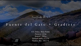
      Trailforks #117 - Fuente del Gato y  Gradieto...
      ebike
      15:59 | 44 | Feb 8, 2026 , Ainsa

      Routes with this trail

      more »
      ★ 5.0 • 11 miles • 3,687 ft • 4 • Loop •
      Una vuelta de tuerca mas a la famosa ruta clásica de la fuente del Gato. Ahora con mucho mas sendero,...
      ★ 4.5 • 14 miles • 3,804 ft • 5 • Loop •
      DIFICULTAD: Roja+ DISTANCIA: 22,5 km ASCENSIÓN: +1180 m TIEMPO: 3-4 h CON BARRO: Poco recomendable...
      4.3 ★★★★★
      11 Ratings
      5 ★ 36%
      4 ★ 55%
      3 ★ 9%
      2 ★
      1 ★

      4 Reviews & Comments

      Crisjaca Crisjaca
      Largaaaaaa, disfrutona, con sus curvas cerradas de pivotar, mucho más ciclable que la parte inferior de la Fuente del Gato
      raulgm
      Bajada espectacular, mucho mejor que las otras 2 alternativas de la fuente del gato. Esta no tiene tanta piedra y mucho más flow. Se pueden atragantar algunas curvas. Sendero en perfectas condiciones, bien marcado y sin maleza. Algo expuesto en algunos puntos.
      Fred-de-Fiscal
      Excellent sentier, un grand Merci pour l'avoir créé !
      Du technique, du flow ... bref de l'enduro.
      Un poil trop sec en ce mois d'août 2023, mais excellent.

      We hope you've been enjoying Trailforks!

      Create a FREE account to view all trail reviews and much more.

      • By jabaluismiTF Pro & contributors
      • #585850 - 643 views

      Frequently Asked Questions

      ▼ Where is Gradieto located?
      Gradieto is located in Zona Zero Centro, Ainsa, Spain. It is part of the Zona Zero Centro trail network. The trailhead is located at coordinates 42.60637, -0.10761.
      ▼ How hard is Gradieto?
      Gradieto is rated as Red difficulty. The average grade is 20.3%. The climb difficulty is rated Black Diamond.
      ▼ What is the elevation gain for Gradieto?
      Gradieto has 88 ft of elevation gain. The trail has 1,860 ft of elevation descent. The elevation ranges from 2,945 ft to 4,726 ft.
      ▼ Is Gradieto a point to point trail?
      Gradieto is not a point to point trail. The direction is Downhill Primary. The trail type is singletrack.
      ▼ How long is Gradieto?
      Gradieto is 1.7 miles long. The trail type is singletrack.
      ▼ Are dogs allowed on Gradieto?
      Yes, dogs are allowed on Gradieto. Please keep dogs on a leash where required and clean up after them.
      ▼ When is the best time of year to ride Gradieto?
      Based on activity log data, the most popular months to ride Gradieto are:
      • July (3 activities)
      • August (3 activities)
      • September (3 activities)
      Check the reports page for current trail conditions.
      ▼ How do I access Gradieto? Where is the closest parking trailhead?
      The closest parking and trailhead locations to Gradieto are: View all parking locations in the area.
      ▼ How long does it take to ride Gradieto?
      Based on recorded activities, it takes an average of 24 minutes to ride Gradieto. The trail is 1.7 miles long. Actual times will vary based on fitness level, conditions, and pace. View recent activity logs for more details.
      ▼ How busy is Gradieto?
      Gradieto is a very popular trail. There have been 93 recorded activities on this trail. The trail has received 94 check-ins. View recent activity on this trail.

      Hit the Trail

      Open in App

      Get this trail on your phone instantly.

      open trail in app

      Download Trail

      Save to wishlist, Garmin & download.
      save the trail

      Find Related Routes

      Find routes and users activities that include this trail.
      find routes for this trail

      You must enter a description before submitting.