
more stats
4,879 ft
Distance
3 ft
Climb
-467 ft
Descent
00:11:07
Avg time
-465 ft
Altitude change
1,111 ft
Altitude min
1,578 ft
Altitude max
1,576 ft
Altitude start
1,112 ft
Altitude end
-9.5%
Grade
-30.1%
Grade max
6.9%
Grade min
180 ft
Distance climb
4,403 ft
Distance down
299 ft
Distance flat
00:11:07
Avg time

Hebert-Trail Details

  • Activities
    • Mountain Bike
    • E-Bike
  • Riding Area
  • Difficulty Rating
  • Voted Difficulty
    Blue (2 votes)
  • Local Popularity
    50 in Mountain Biking heatmap [+]
    • 65 in E-Biking
  • Global Ranking
    #24069 in Mountain Biking [+]
    • #48667 in E-Biking
  • National Ranking
    #866 in Mountain Biking · Germany [+]
    • #2,709 in E-Biking
  • Trail Type
    Singletrack
  • Bike Type
    AM, XC
  • Direction
    Downhill Only
    Popular Direction Shown
  • Dogs Allowed
    Yes
  • eBike Allowed
  • Year Opened
    2023

Start: Hebert/Frohnwaldweg
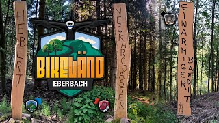
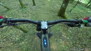
Der längste Bikeländ Trail mit dem höchsten Startpunkt am gleichnamigen Berg. Der Trail strengt an, hat viel Senken und offene Kurven und immer wieder kurze Tretpassagen. Oben felsiger, nach unten kurviger. Enduro pur bei Puls 180.

Tags

Trail Supporters

Local Trail Association

Recent Activity on Trail

Past Week
  • 0 rides
  •  
6 Months
  • 21 rides
  • 17 miles avg distance
All
  • 122 rides
  • Last: Oct 30, 2026
c1c2c3c4
January
February
March
April
May
June
July
August
September
October
November
December
update trails status or condition

Hebert-Trail Trail Reports

statusdatedescription
Sep 12, 2026 @ 9:00pm (Europe/Berlin)
Sep 12, 2026
Aug 18, 2026 @ 10:11am (Europe/Berlin)
Aug 18, 2026
Aug 18, 2026 @ 10:09am (Europe/Berlin)
Aug 18, 2026
Vollernter im oberen Bereich. Abgesperrt. Grossräumige Arbeiten vom Forst. Trail momentan nicht mehr vorhanden geschweige denn befahrbar. Der...
Aug 15, 2026 @ 12:13am (Pacific/Midway)
Aug 15, 2026
Jul 29, 2026 @ 12:00pm (Europe/Berlin)
Jul 29, 2026
Der Ausgang vom oberen Teil hat flatterband. Baum Fell arbeiten. FYI Ich bin dann nicht ganz hoch gefahren.
more »
Status:
on Sep 12, 2026
Dry
Avg: 4.05 (15 votes)
Your vote: 0

view (664)
close
      Directions to heberttrail trailhead (49.440570, 8.974280)

      Photos

      13 more »
      mtb
      42 |
      Sep 10, 2026 @ 3:09am
      Sep 10, 2026
      mtb
      44 |
      May 18, 2026 @ 2:24am
      May 18, 2026
      mtb
      74 |
      May 18, 2026 @ 2:23am
      May 18, 2026
      mtb
      42 |
      May 18, 2026 @ 2:23am
      May 18, 2026

      Videos

      6 more »
      youtuber Let's Ride MTB - #Bikeländ Eberbach - Süden...
      mtb
      12:05 | 241 | May 31, 2023 , Eberbach
      youtuber 3 Jahre Bikeländ Eberbach // Hebert-Trail +...
      mtb
      26:31 | 148 | Aug 16, 2026 , Eberbach
      Der einfachste Trail in Eberbach?
      mtb
      9:08 | 261 | Jan 20, 2025 , Eberbach
      EMTB - Bikeländ Eberbach - schwer, schwerer,...
      mtb
      15:06 | 232 | Nov 5, 2024 , Eberbach

      Routes with this trail

      more »
      ★ 4.3 • 27 miles • 6,262 ft • 25 •
      Die Rundstrecke mit allen 12 Trails im BIKELÄND. Sie ist mit dem Logo "Eb3" beschildert. Gestartet wird...
      4.0 ★★★★★
      15 Ratings
      5 ★ 27%
      4 ★ 47%
      3 ★ 20%
      2 ★ 7%
      1 ★

      1 Review & Comments

      ktm-boy-69 ktm-boy-69
      Wenn man den Trail auf Druck fahren möchte richtig gut anstrengend

      We hope you've been enjoying Trailforks!

      Create a FREE account to view all trail reviews and much more.

      • By Freischneider TLB & contributors
      • #642607 - 1,327 views

      Frequently Asked Questions

      ▼ Where is Hebert-Trail located?
      Hebert-Trail is located in Bikeländ Eberbach, Eberbach, Germany. It is part of the Bikeländ Eberbach trail network. The trailhead is located at coordinates 49.44057, 8.97428.
      ▼ How hard is Hebert-Trail?
      Hebert-Trail is rated as Blue difficulty. The average grade is 9.5%.
      ▼ What is the elevation gain for Hebert-Trail?
      Hebert-Trail has 3 ft of elevation gain. The trail has 467 ft of elevation descent. The elevation ranges from 1,111 ft to 1,578 ft.
      ▼ Is Hebert-Trail a point to point trail?
      Yes, Hebert-Trail is a point to point trail. The direction is Downhill Only. The trail type is singletrack.
      ▼ How long is Hebert-Trail?
      Hebert-Trail is 4,879 ft long. The trail type is singletrack.
      ▼ Are dogs allowed on Hebert-Trail?
      Yes, dogs are allowed on Hebert-Trail. Please keep dogs on a leash where required and clean up after them.
      ▼ When is the best time of year to ride Hebert-Trail?
      Based on activity log data, the most popular months to ride Hebert-Trail are:
      • May (23 activities)
      • April (19 activities)
      • August (13 activities)
      Check the reports page for current trail conditions.
      ▼ How do I access Hebert-Trail? Where is the closest parking trailhead?
      The closest parking and trailhead locations to Hebert-Trail are: View all parking locations in the area.
      ▼ How long does it take to ride Hebert-Trail?
      Based on recorded activities, it takes an average of 11 minutes to ride Hebert-Trail. The trail is 4,879 ft long. Actual times will vary based on fitness level, conditions, and pace. View recent activity logs for more details.
      ▼ How busy is Hebert-Trail?
      Hebert-Trail is a moderately popular trail. There have been 598 recorded activities on this trail. The trail has received 664 check-ins. View recent activity on this trail.

      Hit the Trail

      Open in App

      Get this trail on your phone instantly.

      open trail in app

      Download Trail

      Save to wishlist, Garmin & download.
      save the trail

      Find Related Routes

      Find routes and users activities that include this trail.
      find routes for this trail

      You must enter a description before submitting.