

more stats
3,022 ft
Distance
-493 ft
Descent
00:03:07
Avg time
-493 ft
Altitude change
951 ft
Altitude min
1,444 ft
Altitude max
1,444 ft
Altitude start
951 ft
Altitude end
-16.3%
Grade
-37.2%
Grade max
-2.1%
Grade min
2,986 ft
Distance down
36 ft
Distance flat
00:03:07
Avg time

Hinterholz 8 Details

  • Activities
    • Mountain Bike
    • E-Bike
  • Riding Area
  • Difficulty Rating
  • Local Popularity
    60 in Mountain Biking heatmap [+]
    • 70 in E-Biking
  • Global Ranking
    #12365 in Mountain Biking [+]
    • #45509 in E-Biking
  • National Ranking
    #125 in Mountain Biking · Austria [+]
    • #329 in E-Biking
  • Trail Type
    Singletrack
  • Bike Type
    DH, AM, XC
  • Direction
    Downhill Only
    Popular Direction Shown
  • Physical Rating
    Moderate
  • Trail Visibility
    Always easy to follow
  • Season
    March-October
  • eBike Allowed
    Yes up to Class 1
  • TTFs on Trail
    Berm, Jump, Gap Jump
  • Year Opened
    2024
  • Land Owner

Der Name ist nicht gleich Programm. Es erwartet dich ein verspielter Naturtrail mit der vielleicht besten Aussicht aller Trails in Wien.

Tags
BermsJumps

Bike Park

Recent Activity on Trail

Past Week
  • 0 rides
  •  
6 Months
  • 24 rides
  • 15 miles avg distance
All
  • 117 rides
  • Last: Nov 7, 2026
c1c2c3c4
January
February
March
April
May
June
July
August
September
October
November
December
update trails status or condition

Hinterholz 8 Trail Reports

statusdatedescription
Nov 4, 2026 @ 12:39pm (Europe/Vienna)
Nov 4, 2026
Das Trailcenter Wien geht in die verdiente Winterpause! Wir sehen uns im März wieder!
Sep 27, 2026 @ 10:26am (Europe/Vienna)
Sep 27, 2026
Mar 3, 2026 @ 10:34am (Europe/Vienna)
Mar 3, 2026
Die Saison 2026 ist gestartet! Für detailliertere Trail Reports schaut auf unseren Social Media Kanälen vorbei. Da versorgen wir euch mit allen...
Nov 4, 2025 @ 10:59am (Europe/Vienna)
Nov 4, 2025
Das Trailcenter Wien geht in die verdiente Winterpause! Wir sehen uns im März wieder!
Oct 26, 2025 @ 11:41am (Europe/Vienna)
Oct 26, 2025
more »
Status:
on Nov 4, 2026
Variable
Avg: 4.36 (5 votes)
Your vote: 0

view (587)
close
      Directions to hinterholz-8 trailhead (48.232430, 16.212870)

      Photos

      7 more »
      mtb
      101 |
      Jul 15, 2024 @ 10:05am
      Jul 15, 2024
      mtb
      93 |
      Jul 15, 2024 @ 10:05am
      Jul 15, 2024
      mtb
      160 |
      May 13, 2024 @ 4:46am
      May 13, 2024
      mtb
      129 |
      May 13, 2024 @ 4:46am
      May 13, 2024

      Videos

      1 more »
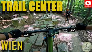
      Trailcenter Wien: Parádne MTB traily len...
      mtb
      44:07 | 0 | Nov 10, 2026 , Vienna
      4.8 ★★★★★
      5 Ratings
      5 ★ 80%
      4 ★ 20%
      3 ★
      2 ★
      1 ★

      2 Reviews & Comments

      EdwUPH
      Coole idee aber im Vergleich zu den anderen trails etwas langweilig… für moderate und Kinder aber sehr sehr gut geeignet!
      ktm-boy-69 ktm-boy-69
      Bist du hinig des is geil. Sehr viel Gaudi beim Fahren, obwohl er auf unten hin schon sau- bis unpackbarschnell wird, massivst geil angelegt, gefühlt jede Geländewelle ausgenutzt wo geht Smile Smile Smile

      We hope you've been enjoying Trailforks!

      Create a FREE account to view all trail reviews and much more.

      • By m0le & contributors
      • #756855 - 996 views

      Frequently Asked Questions

      ▼ Where is Hinterholz 8 located?
      Hinterholz 8 is located in Trailcenter Wien, Vienna, Austria. It is part of the Trailcenter Wien trail network. The trailhead is located at coordinates 48.23243, 16.21287.
      ▼ How hard is Hinterholz 8?
      Hinterholz 8 is rated as Red difficulty. The physical rating is Moderate. The average grade is 16.3%.
      ▼ What is the elevation gain for Hinterholz 8?
      The trail has 493 ft of elevation descent. The elevation ranges from 951 ft to 1,444 ft.
      ▼ Is Hinterholz 8 a point to point trail?
      Yes, Hinterholz 8 is a point to point trail. The direction is Downhill Only. The trail type is singletrack.
      ▼ How long is Hinterholz 8?
      Hinterholz 8 is 3,022 ft long. The trail type is singletrack.
      ▼ Are dogs allowed on Hinterholz 8?
      There is no information about dogs being allowed on Hinterholz 8. Check with local trail managers or the trail page for the latest access rules.
      ▼ When is the best time of year to ride Hinterholz 8?
      Based on activity log data, the most popular months to ride Hinterholz 8 are:
      • March (32 activities)
      • May (18 activities)
      • October (16 activities)
      Check the reports page for current trail conditions.
      ▼ How do I access Hinterholz 8? Where is the closest parking trailhead?
      The closest parking and trailhead locations to Hinterholz 8 are: View all parking locations in the area.
      ▼ How long does it take to ride Hinterholz 8?
      Based on recorded activities, it takes an average of 3 minutes to ride Hinterholz 8. The trail is 3,022 ft long. Actual times will vary based on fitness level, conditions, and pace. View recent activity logs for more details.
      ▼ How busy is Hinterholz 8?
      Hinterholz 8 is a moderately popular trail. There have been 497 recorded activities on this trail. The trail has received 587 check-ins. View recent activity on this trail.

      Hit the Trail

      Open in App

      Get this trail on your phone instantly.

      open trail in app

      Download Trail

      Save to wishlist, Garmin & download.
      save the trail

      Find Related Routes

      Find routes and users activities that include this trail.
      find routes for this trail

      You must enter a description before submitting.

