
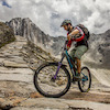
more stats
3,878 ft
Distance
-859 ft
Descent
00:08:19
Avg time
-859 ft
Altitude change
3,874 ft
Altitude min
4,733 ft
Altitude max
4,733 ft
Altitude start
3,875 ft
Altitude end
-22.1%
Grade
-70.3%
Grade max
-5.9%
Grade min
3,878 ft
Distance down
00:08:19
Avg time

Hirschleiten-Trail Details

  • Activities
    • Mountain Bike
    • E-Bike
    • Hike
    • Trail Running
  • Riding Area
  • Difficulty Rating
  • Local Popularity
    75 in Mountain Biking heatmap [+]
    • 5 in E-Biking
    • 100 in Trail Running
    • 100 in Hiking
  • Global Ranking
    #98023 in Mountain Biking [+]
    • #138948 in E-Biking
    • #73515 in Trail Running
    • #69866 in Hiking
  • National Ranking
    #628 in Mountain Biking · Austria [+]
    • #584 in E-Biking
    • #116 in Trail Running
    • #234 in Hiking
  • Trail Type
    Singletrack
  • Bike Type
    DH, AM, XC
  • Physical Rating
    Moderate
  • Trail Visibility
    Always easy to follow
  • Dogs Allowed
    Yes
  • eBike Allowed
    Yes up to Class 1

Trail starts about 300 elevation-metres under "Kleinarler Hütte" (Kurzeggalm). It is part of the "Kleinarler Runde" and a legal and official singletrail of the mountainbike-system of Salzburg (Region Wagrain-Kleinarl). Trail is marked as "Hirschleitentrail (S2)" in the offical maps. There are some roots on the trail, but in general not that hard or technical trail.

Please keep in mind that hikers use this trail too Be friendly and respectful. Ride with care!

There are hiking paths before and after the Hirschleiten-Trail. Please note that they are still not official trails.

Disclaimer

Wearing a helmet is compulsory. Be friendly to hikers.

Tags

Recent Activity on Trail

Past Week
  • 0 rides
  •  
6 Months
  • 4 rides
  • 46 miles avg distance
All
  • 18 rides
  • Last: Sep 5, 2026
c1c2c3c4
January
February
March
April
May
June
July
August
September
October
November
December
update trails status or condition

Hirschleiten-Trail Trail Reports

Status:
on Jun 17, 2025
Ideal
Avg: 3.54 (4 votes)
Your vote: 0

view (53)
close
      Directions to hirschleitentrail trailhead (47.275040, 13.300390)

      Photos

      3 more »
      mtb
      52 |
      Aug 11, 2024 @ 2:31pm
      Aug 11, 2024
      mtb
      68 |
      Aug 11, 2024 @ 2:31pm
      Aug 11, 2024
      mtb
      71 |
      Aug 11, 2024 @ 2:31pm
      Aug 11, 2024

      Videos

      no videos have been added for Hirschleiten-Trail yet, add a video.
      2.3 ★★★★★
      4 Ratings
      5 ★
      4 ★ 25%
      3 ★
      2 ★ 50%
      1 ★ 25%

      1 Review & Comments

      ktm-boy-69 ktm-boy-69
      Das ist ja ein schlechter Scherz. Erster Abschnitt ein straighter geschotterter breiter Weg, danach fast straighte Abfahrt über Wiese. Lediglich auf den letzten paar Metern ein ganz cooler (sehr breiter) Wurzeltrail im Wald.

      Wie Wurzelsektion ist rot, der Rest hat die technische Anforderung einer Forststraße – maximal grün.
      Lohnt sich jedenfalls nicht dafür extra hinzufahren.

      We hope you've been enjoying Trailforks!

      Create a FREE account to view all trail reviews and much more.

      Frequently Asked Questions

      ▼ Where is Hirschleiten-Trail located?
      Hirschleiten-Trail is located in Kleinarl, Austria. It is part of the Kleinarl trail network. The trailhead is located at coordinates 47.27504, 13.30039.
      ▼ How hard is Hirschleiten-Trail?
      Hirschleiten-Trail is rated as Red difficulty. The physical rating is Moderate. The average grade is 22.1%.
      ▼ What is the elevation gain for Hirschleiten-Trail?
      The trail has 859 ft of elevation descent. The elevation ranges from 3,874 ft to 4,733 ft.
      ▼ How long is Hirschleiten-Trail?
      Hirschleiten-Trail is 3,878 ft long. The trail type is singletrack.
      ▼ Are dogs allowed on Hirschleiten-Trail?
      Yes, dogs are allowed on Hirschleiten-Trail. Please keep dogs on a leash where required and clean up after them.
      ▼ When is the best time of year to ride Hirschleiten-Trail?
      Based on activity log data, the most popular months to ride Hirschleiten-Trail are:
      • August (6 activities)
      • June (3 activities)
      • February (2 activities)
      Check the reports page for current trail conditions.
      ▼ How do I access Hirschleiten-Trail? Where is the closest parking trailhead?
      The closest parking and trailhead locations to Hirschleiten-Trail are: View all parking locations in the area.
      ▼ How long does it take to ride Hirschleiten-Trail?
      Based on recorded activities, it takes an average of 8 minutes to ride Hirschleiten-Trail. The trail is 3,878 ft long. Actual times will vary based on fitness level, conditions, and pace. View recent activity logs for more details.
      ▼ How busy is Hirschleiten-Trail?
      Hirschleiten-Trail is a very popular trail. There have been 52 recorded activities on this trail. The trail has received 53 check-ins. View recent activity on this trail.

      Hit the Trail

      Open in App

      Get this trail on your phone instantly.

      open trail in app

      Download Trail

      Save to wishlist, Garmin & download.
      save the trail

      Find Related Routes

      Find routes and users activities that include this trail.
      find routes for this trail

      You must enter a description before submitting.

