
more stats
1.6 miles
Distance
423 ft
Climb
-716 ft
Descent
00:24:00
Avg time
-293 ft
Altitude change
3,711 ft
Altitude min
4,263 ft
Altitude max
4,097 ft
Altitude start
3,806 ft
Altitude end
-3.4%
Grade
-42.5%
Grade max
58.4%
Grade min
3,550 ft
Distance climb
4,701 ft
Distance down
220 ft
Distance flat
00:24:00
Avg time

Hüttlsteig Details

  • Activities
    • Mountain Bike
    • E-Bike
    • Hike
    • Trail Running
  • Riding Area
    Garmisch Area
    Garmisch
  • Difficulty Rating
  • Voted Difficulty
    Blue (5 votes)
  • Local Popularity
    80 in Mountain Biking heatmap [+]
    • 90 in E-Biking
    • 95 in Trail Running
    • 65 in Hiking
  • Global Ranking
    #45154 in Mountain Biking [+]
    • #3434 in E-Biking
    • #82764 in Trail Running
    • #130435 in Hiking
  • National Ranking
    #1,662 in Mountain Biking · Germany [+]
    • #120 in E-Biking
    • #619 in Trail Running
    • #1,456 in Hiking
  • Trail Type
    Singletrack
  • Bike Type
    AM
  • Alpine Trail
    Yes
  • Dogs Allowed
    Yes
  • Ride in Rain
    Yes

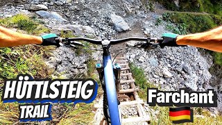
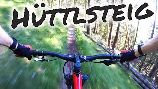
Trail traversing the Wank starting near Esterbergalm and ending near the Wank gondola middle station. There are a few difficult spots where you might have to get off the bike for a second, but the overall difficulty is moderate/blue.

Access Info

Fireroad towards esterbergalm. The trail begins on the right a few minutes before reaching the alm.

This trail is unsanctioned.

Tags
Alpine

Recent Activity on Trail

Past Week
  • 0 rides
  •  
6 Months
  • 3 rides
  • 12 miles avg distance
All
  • 18 rides
  • Last: Oct 17, 2026
update trails status or condition

Hüttlsteig Trail Reports

statusdatedescription
May 29, 2026 @ 9:32am (Europe/Vaduz)
May 29, 2026
To be ridden consciously. It's flowly and calls for speed, but some quick turns don't have a bailout, and one can fall off a cliff.
May 10, 2026 @ 4:31pm (Europe/Berlin)
May 10, 2026
Perfect conditions.
Oct 30, 2025 @ 12:46pm (Europe/Berlin)
Oct 30, 2025
nice - flowy dry
May 10, 2025 @ 10:22am
May 10, 2025
Good conditions. Rode in both directions with an e-bike. Very cool as an uphill trail.
Jul 6, 2024 @ 1:55am
Jul 6, 2024
more »
Status:
on May 29, 2026
Ideal
Avg: 4 (9 votes)
Your vote: 0

view (124)
close
      Directions to huttlsteig trailhead (47.521080, 11.137770)

      Photos

      11 more »
      mtb
      94 |
      Sep 3, 2023 @ 3:20am
      Sep 3, 2023
      mtb
      85 |
      Sep 3, 2023 @ 3:20am
      Sep 3, 2023
      mtb
      118 |
      Sep 3, 2023 @ 3:20am
      Sep 3, 2023
      mtb
      94 |
      Sep 3, 2023 @ 3:20am
      Sep 3, 2023

      Videos

      4 more »
      INSANE TRAILS in Germany! Hüttlsteig and Wank...
      mtb
      28:12 | 235 | Sep 10, 2025 , Garmisch
      Abschüssig, schmal und flowig – Hüttlsteig...
      mtb
      755 | Oct 11, 2020 , Garmisch
      mtb
      0:09 | 137 | May 29, 2023 , Garmisch
      4.0 ★★★★★
      9 Ratings
      5 ★ 33%
      4 ★ 33%
      3 ★ 33%
      2 ★
      1 ★

      8 Reviews & Comments

      belfastandy
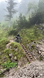
      nice easy trail, for the most part, couple of unrideable sections (a wooden ladder!) super exposed in parts but lovely singletrack
      PerNordentoft
      A bit too technical for me... I went over the side of the track today, and my bike fell 15 meters down through the forest. It was a pain to drag it up the slope to the trail
      MondPhoenix
      Not a real downhill and to be honest there are better trails in the area....to get to middle Station Wank and going down the other blue trail, therefore it may be an option and worth to check out Smile

      We hope you've been enjoying Trailforks!

      Create a FREE account to view all trail reviews and much more.

      • #184517 - 3,506 views

      Frequently Asked Questions

      ▼ Where is Hüttlsteig located?
      Hüttlsteig is located in Garmisch Area, Garmisch, Germany. It is part of the Garmisch Area trail network. The trailhead is located at coordinates 47.52108, 11.13777.
      ▼ How hard is Hüttlsteig?
      Hüttlsteig is rated as Blue difficulty. The average grade is 3.4%.
      ▼ What is the elevation gain for Hüttlsteig?
      Hüttlsteig has 423 ft of elevation gain. The trail has 716 ft of elevation descent. The elevation ranges from 3,711 ft to 4,263 ft.
      ▼ How long is Hüttlsteig?
      Hüttlsteig is 1.6 miles long. The trail type is singletrack.
      ▼ Are dogs allowed on Hüttlsteig?
      Yes, dogs are allowed on Hüttlsteig. Please keep dogs on a leash where required and clean up after them.
      ▼ How do I access Hüttlsteig? Where is the closest parking trailhead?
      The closest parking and trailhead locations to Hüttlsteig are: View all parking locations in the area.
      ▼ How long does it take to ride Hüttlsteig?
      Based on recorded activities, it takes an average of 24 minutes to ride Hüttlsteig. The trail is 1.6 miles long. Actual times will vary based on fitness level, conditions, and pace. View recent activity logs for more details.
      ▼ How busy is Hüttlsteig?
      Hüttlsteig is a very popular trail. There have been 125 recorded activities on this trail. The trail has received 124 check-ins. View recent activity on this trail.

      Hit the Trail

      Open in App

      Get this trail on your phone instantly.

      open trail in app

      Download Trail

      Save to wishlist, Garmin & download.
      save the trail

      Find Related Routes

      Find routes and users activities that include this trail.
      find routes for this trail

      You must enter a description before submitting.

