
more stats
7.0 miles
Distance
4,009 ft
Climb
-115 ft
Descent
02:56:04
Avg time
3,894 ft
Altitude change
3,905 ft
Altitude min
7,825 ft
Altitude max
3,906 ft
Altitude start
7,802 ft
Altitude end
10.6%
Grade
-43.2%
Grade max
73.8%
Grade min
7 miles
Distance climb
1,667 ft
Distance down
600 ft
Distance flat
02:56:04
Avg time

Ibón De Urdiceto Details

  • Activities
    • Mountain Bike
    • E-Bike
    • Hike
    • Trail Running
  • Riding Area
  • Difficulty Rating
  • Local Popularity
    5 in Mountain Biking heatmap [+]
    • 5 in E-Biking
    • 5 in Trail Running
    • 5 in Hiking
  • Trail Type
    Doubletrack
  • Bike Type
    AM, XC
  • Direction
    Both Directions
    Popular Direction Shown
  • Climb Difficulty
    Blue
  • Physical Rating
    Hard
  • Trail Visibility
    Always easy to follow
  • Dogs Allowed
    Yes
  • eBike Allowed
    Yes up to Class 1

No community description for Ibón De Urdiceto trail has been added yet!

AI Generated Description

Ibón De Urdiceto is a 11 km less popular doubletrack trail located near Bielsa. This multi-use trail can be used both directions and has a hard overall physical rating with a 1,222 m blue climb. Trail visibility is always easy to follow. On average it takes 2 hours56 minutes to complete this trail.

Tags

Local Trail Association

Recent Activity on Trail

Past Week
  • 0 rides
  •  
6 Months
  • 0 rides
  •  
All
  • 31 rides
  • Last: Oct 6, 2025
update trails status or condition

Ibón De Urdiceto Trail Reports

statusdatedescription
Oct 17, 2026 @ 6:45am (Europe/Madrid)
Oct 16, 2026
reporter Me habían dicho que era una pista rota, difícil de subir y no me lo pareció. Pista bastante buena en mi opinión.
Sep 10, 2026 @ 8:32am (Europe/Andorra)
Sep 9, 2026
reporter
Aug 1, 2026 @ 9:08am (Europe/Madrid)
Aug 1, 2026
Large parking accessible en traversant à gué le rio. La piste est raide et peu roulante dans l'ensemble. Bien fatiguante Piste normalement...
Sep 8, 2024 @ 9:47am
Sep 8, 2024
reporter El puente que cruza el río Barrosa está derrumbado por las lluvias. Luego la pista hasta Urdiceto está erosionada pero se puede subir sin problema
Aug 11, 2024 @ 7:14am
Aug 11, 2024
more »
Status:
on Oct 17, 2026
Ideal
Avg: 3.99 (3 votes)
Your vote: 0

view (118)
close
      Directions to ibon-de-urdiceto trailhead (42.672850, 0.214600)

      Photos

      1 more »
      mtb
      87 |
      Aug 11, 2024 @ 5:54am
      Aug 11, 2024

      Videos

      1 more »
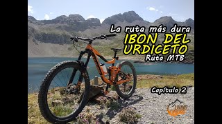
      youtuber La ruta MTB más dura  del PIRINEO | IBÓN DEL...
      mtb
      6:45 | 334 | Sep 20, 2021 , Bielsa

      Routes with this trail

      more »
      ★ 5.0 • 32 miles • 9,077 ft • 7 • Loop •
      TIEMPO: 11h. - 13h. h CON BARRO: Factible BALIZADA: No. GPS ZONA: Bielsa SALIDA: Bielsa LLEGADA: Bielsa...
      ★ 4.0 • 18 miles • 6,785 ft • 5 • Loop •
      Porteo 500 d+ Empuje100 d+ Aprox Porteo en algunas zonas delicado donde hay que tener el pie seguro, no...
      277 miles • 69,481 ft • 84 • Point to Point •
      Ruta y track original del Usuario https://www.trailforks.com/profile/clota/ La TransPiriCentral és una...
      4.4 ★★★★★
      3 Ratings
      5 ★ 67%
      4 ★
      3 ★ 33%
      2 ★
      1 ★

      Reviews / Comments

      No reviews yet, be the first to write a review or ask a question.
      Use trail reports to comment on trail conditions.


      We hope you've been enjoying Trailforks!

      Create a FREE account to view all trail reviews and much more.

      • By KalamarrrrrdoTF Pro TFSPAIN & contributors
      • #423478 - 966 views

      Frequently Asked Questions

      ▼ Where is Ibón De Urdiceto located?
      Ibón De Urdiceto is located in Bielsa, Spain. It is part of the Bielsa trail network. The trailhead is located at coordinates 42.67285, 0.2146.
      ▼ What is the elevation gain for Ibón De Urdiceto?
      Ibón De Urdiceto has 4,009 ft of elevation gain. The trail has 115 ft of elevation descent. The elevation ranges from 3,905 ft to 7,825 ft.
      ▼ Is Ibón De Urdiceto a point to point trail?
      Ibón De Urdiceto is not a point to point trail. The direction is Both Directions. The trail type is doubletrack.
      ▼ How long is Ibón De Urdiceto?
      Ibón De Urdiceto is 7.0 miles long. The trail type is doubletrack.
      ▼ Are dogs allowed on Ibón De Urdiceto?
      Yes, dogs are allowed on Ibón De Urdiceto. Please keep dogs on a leash where required and clean up after them.
      ▼ How do I access Ibón De Urdiceto? Where is the closest parking trailhead?
      The closest parking and trailhead locations to Ibón De Urdiceto are: View all parking locations in the area.
      ▼ How long does it take to ride Ibón De Urdiceto?
      Based on recorded activities, it takes an average of 2 hours 56 minutes to ride Ibón De Urdiceto. The trail is 7.0 miles long. Actual times will vary based on fitness level, conditions, and pace. View recent activity logs for more details.
      ▼ How busy is Ibón De Urdiceto?
      Ibón De Urdiceto is a less popular trail with lighter traffic. There have been 112 recorded activities on this trail. The trail has received 118 check-ins. View recent activity on this trail.

      Hit the Trail

      Open in App

      Get this trail on your phone instantly.

      open trail in app

      Download Trail

      Save to wishlist, Garmin & download.
      save the trail

      Find Related Routes

      Find routes and users activities that include this trail.
      find routes for this trail

      You must enter a description before submitting.

