
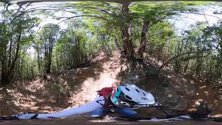

more stats
1.1 miles
Distance
33 ft
Climb
-932 ft
Descent
00:08:07
Avg time
-899 ft
Altitude change
1,136 ft
Altitude min
2,036 ft
Altitude max
2,036 ft
Altitude start
1,136 ft
Altitude end
-15.146%
Grade
-37.86%
Grade max
19.068%
Grade min
553 ft
Distance climb
5,231 ft
Distance down
153 ft
Distance flat
00:08:07
Avg time

Il Grado Details

  • Activities
    • Mountain Bike
    • E-Bike
  • Riding Area
    Rokkaround
    Rocchetta Cairo
  • Difficulty Rating
  • Local Popularity
    100 in Mountain Biking heatmap [+]
    • 90 in E-Biking
  • Global Ranking
    #34036 in Mountain Biking [+]
    • #747 in E-Biking
  • National Ranking
    #3,279 in Mountain Biking · Italy [+]
    • #172 in E-Biking
  • Trail Type
    Singletrack
  • Bike Type
    DH, AM, XC
  • Direction
    Downhill Only
    Popular Direction Shown
  • Physical Rating
    Easy
  • Trail Visibility
    Sometimes hard to follow
  • Alpine Trail
    Yes
  • Family Friendly
    Yes
  • eBike Allowed
    Yes up to Class 1
  • TTFs on Trail
    Bridge, Drop, Jump, Gap Jump, Rock Face
  • Land Owner

No community description for Il Grado trail has been added yet!

AI Generated Description

Il Grado is a 2 km popular blue difficulty family friendly alpine singletrack trail located near Rocchetta Cairo. Riders describe it as faint trail. It has rock slabs. This mountain bike primary trail can be used downhill only and has a easy overall physical rating. It features bridge, drop, jump, gap jump and rock face. Trail visibility is sometimes hard to follow. On average it takes 8 minutes to complete this trail.

Recent Activity on Trail

Past Week
  • 1 rides
  • 11 miles average
6 Months
  • 10 rides
  • 20 miles avg distance
All
  • 73 rides
  • Last: Nov 16, 2026
c1c2c3c4
January
February
March
April
May
June
July
August
September
October
November
December
update trails status or condition

Il Grado Trail Reports

statusdatedescription
Oct 11, 2026 @ 12:45pm (Europe/Rome)
Oct 11, 2026
Molto scavato dall' acqua
Jul 19, 2026 @ 8:01am (Europe/Rome)
Jul 18, 2026
Fare attenzione in alcuni tratti rovinati dalle forti piogge Pietro smosse e buchi
Jun 17, 2026 @ 7:19pm (Europe/Rome)
Jun 17, 2026
Pulita in qualche sponda un po scavata ma ottimo lavoro di manutenzione
Apr 6, 2026 @ 9:09am (Europe/Monaco)
Apr 6, 2026
Attenzione ad un albero caduto altezza testa nella prima parte
Mar 29, 2026 @ 2:57pm (Europe/Rome)
Mar 29, 2026
Pulito ma qualche tratto scavato dall'acqua comunque è tutto perfettamente percorribile
more »
Status:
on Oct 11, 2026
Variable
Avg: 4.32 (5 votes)
Your vote: 0

view (754)
close
      Directions to il-grado trailhead (44.413570, 8.301560)

      Photos

      5 more »
      mtb
      129 |
      Nov 17, 2020 @ 8:26am
      Nov 17, 2020
      mtb
      137 |
      May 23, 2020 @ 8:44am
      May 23, 2020
      mtb
      115 |
      Jul 6, 2019 @ 5:48am
      Jul 6, 2019
      report
      mtb
      117 |
      Feb 28, 2020 @ 10:11pm
      Feb 28, 2020

      Videos

      1 more »
      trail il Grado (spherical uploads app wifi 4k)
      mtb
      6:52 | 275 | Apr 28, 2021 , Rocchetta Cairo

      Routes with this trail

      more »
      22 miles • 3,918 ft • 11 •
      una raccolta di quelli che per me sono i piu belli e divertenti sentieri in zona cairo montenotte....giro...
      4.8 ★★★★★
      5 Ratings
      5 ★ 80%
      4 ★ 20%
      3 ★
      2 ★
      1 ★

      2 Reviews & Comments

      Manutrek
      Sentiero sempre pulito. Bello e divertente!
      ciclistabrontolone ciclistabrontolone
      sentiero veloce e divertente..in costante aggiornamento.....prenti molti tornantini alcuni salti..appoggi e un bel po di pezzi molto veloci...qualche roccia....uno dei piu belli in zona....con le ultime migliorie e piu verso il blu come difficolta....

      We hope you've been enjoying Trailforks!

      Create a FREE account to view all trail reviews and much more.

      • By MarcuxTF Pro & contributors
      • #195736 - 1,124 views

      Frequently Asked Questions

      ▼ Where is Il Grado located?
      Il Grado is located in Rokkaround, Rocchetta Cairo, Italy. It is part of the Rokkaround trail network. The trailhead is located at coordinates 44.41357, 8.30156.
      ▼ How hard is Il Grado?
      Il Grado is rated as Blue difficulty. The physical rating is Easy. The average grade is 15.146%.
      ▼ What is the elevation gain for Il Grado?
      Il Grado has 33 ft of elevation gain. The trail has 932 ft of elevation descent. The elevation ranges from 1,136 ft to 2,036 ft.
      ▼ Is Il Grado a point to point trail?
      Yes, Il Grado is a point to point trail. The direction is Downhill Only. The trail type is singletrack.
      ▼ How long is Il Grado?
      Il Grado is 1.1 miles long. The trail type is singletrack.
      ▼ Are dogs allowed on Il Grado?
      There is no information about dogs being allowed on Il Grado. Check with local trail managers or the trail page for the latest access rules.
      ▼ When is the best time of year to ride Il Grado?
      Based on activity log data, the most popular months to ride Il Grado are:
      • September (9 activities)
      • April (8 activities)
      • May (6 activities)
      Check the reports page for current trail conditions.
      ▼ How do I access Il Grado? Where is the closest parking trailhead?
      The closest parking and trailhead locations to Il Grado are: View all parking locations in the area.
      ▼ How long does it take to ride Il Grado?
      Based on recorded activities, it takes an average of 8 minutes to ride Il Grado. The trail is 1.1 miles long. Actual times will vary based on fitness level, conditions, and pace. View recent activity logs for more details.
      ▼ How busy is Il Grado?
      Il Grado is a very popular trail. There have been 758 recorded activities on this trail. The trail has received 754 check-ins. View recent activity on this trail.

      Hit the Trail

      Open in App

      Get this trail on your phone instantly.

      open trail in app

      Download Trail

      Save to wishlist, Garmin & download.
      save the trail

      Find Related Routes

      Find routes and users activities that include this trail.
      find routes for this trail

      You must enter a description before submitting.

