more stats
2,054 ft
Distance
23 ft
Climb
-18 ft
Descent
00:02:52
Avg time
6 ft
Altitude change
69 ft
Altitude min
93 ft
Altitude max
87 ft
Altitude start
92 ft
Altitude end
0.3%
Grade
-5.2%
Grade max
7.8%
Grade min
709 ft
Distance climb
594 ft
Distance down
696 ft
Distance flat
00:02:52
Avg time

IMBA Details

  • Activities
    • Mountain Bike
    • Winter Fat Bike
    • Hike
    • Trail Running
  • Riding Area
    Cunningham Park
    Queens, New York
  • Difficulty Rating
  • Local Popularity
    90 in Mountain Biking [+]
    • 90 in Trail Running
    • 85 in Hiking
  • Global Ranking
    #30318 in Mountain Biking [+]
    • #35416 in Trail Running
    • #72583 in Hiking
  • Trail Type
    Singletrack
  • Bike Type
    AM, XC, Fat
  • Direction
    One Direction
    Popular Direction Shown
  • Climb Difficulty
    Blue
  • Physical Rating
    Moderate
  • Trail Visibility
    Sometimes hard to follow
  • eBike Allowed
  • Land Owner
    New York Citi Parks

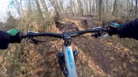
IMBA is a trail that IMBA helped build to train our volunteers on sustainable trail design. This trail starts off with a chicane to a log riding feature then surfs it's way along the contours then climbs back up and past a few more log features before joining the green trail again.

Disclaimer

Use trails at your own risk. Hidden hazards may exist.

Local Trail Association
Traditionally Indigenous Territory

Recent Activity on Trail

Past Week
  • 6 rides
  • 7 miles average
6 Months
  • 104 rides
  • 8 miles avg distance
All
  • 2,228 rides
  • Last: Jun 20, 2026
c1c2c3c4
January
February
March
April
May
June
July
August
September
October
November
December
update trails status or condition

IMBA Trail Reports

statusdatedescription
Nov 20, 2025 @ 1:13pm (America/New_York)
Nov 20, 2025
Leafy
Jan 13, 2025 @ 4:52am
Jan 13, 2025
Tree down at the bottom of the hill just before the hairpin. Approx. 8" caliper, a good handsaw would do the job.
Oct 26, 2024 @ 11:25am
Oct 26, 2024
Lots of leafs some of the obstacles are broken and need rebuilding otherwise as always lots of fun appreciate having and MTB trail in NYC
Sep 5, 2024 @ 4:36pm
Sep 5, 2024
Cleaned up debris leaves and sticks on imba did some trimming and restored a old feature enjoy happy trails
May 29, 2024 @ 1:35pm
May 29, 2024
Could use a trim
more »
Status:
on Nov 20, 2025
Freeze/thaw Cycle
Avg: 3.82 (6 votes)
Your vote: 0

view (7,674)
close
3D
Trail Conditions
  • Unknown
  • Snow Groomed
  • Snow Packed
  • Snow Covered
  • Snow Cover Partial
  • Freeze/thaw Cycle
  • Icy
  • Prevalent Mud
  • Wet
  • Variable
  • Ideal
  • Dry
  • Very Dry
Trail Flow (Ridden Direction)
Trailforks scans users ridelogs to determine the most popular direction each trail is ridden. A good flowing trail network will have most trails flowing in a single direction according to their intension.
The colour categories are based on what percentage of riders are riding a trail in its intended direction.
  • > 96%
  • > 90%
  • > 80%
  • > 70%
  • > 50%
  • < 50%
  • bi-directional trail
  • no data
Trail Last Ridden
Trailforks scans ridelogs to determine the last time a trail was ridden.
  • < 2 days
  • < 1 week
  • < 2 weeks
  • < 1 month
  • < 6 months
  • > 6 months
Trail Ridden Direction
The intended direction a trail should be ridden.
  • Downhill Only
  • Downhill Primary
  • Both Directions
  • Uphill Primary
  • Uphill Only
  • One Direction
Contribute Details
Colors indicate trail is missing specified detail.
  • Description
  • Photos
  • Description & Photos
  • Videos
Trail Popularity ?
Trailforks scans ridelogs to determine which trails are ridden the most in the last 9 months. Trails are compared with nearby trails in the same city region with a possible 25 colour shades. Think of this as a heatmap, more rides = more kinetic energy = warmer colors.
  • most popular
  • popular
  • less popular
  • not popular
ATV/ORV/OHV Filter
Max Vehicle Width
inches
US Cell Coverage
Legend
cell carrier legend

Radar Time
Activity Recordings
Trailforks uses anonymized public activity data. ?
Activity Recordings
Trailforks uses anonymized public activity data. ?
Personal Heatmap
Activity Types
all / none
Options
2
Date range month
Winter Trails
Warning A routing network for winter maps does not exist. Selecting trails using the winter trails layer has been disabled.
Missing Trails
Most Popular
Least Popular
Trails are colored based on popularity. The more popular a trail is, the more red. Less popular trails trend towards green.
Jump Magnitude Heatmap
Heatmap of where riders jump on trails. Zoom in to see individual jumps, click circles to view jump details.
BC Backroad Status

Service Road Atlas is a free to use, community-driven service for viewing and creating reports on the numerous back-country service roads around B.C. and Alberta.

map legend
Slope Aspect
Direction the slope faces
Flat N NE E SE S SW W NW
Trails Deemphasized
Trails are shown in grey.
disable
Only show trails with no bike usage.
Enable
Suggested Layers
Based on selected activity type

    Save the current map location and zoom level as your default home location whenever this page is loaded.

    Save
        Directions to imba trailhead (40.743960, -73.768680)

        Photos

        7 more »
        107 |
        Aug 7, 2022 @ 4:20pm
        Aug 7, 2022
        99 |
        Aug 7, 2022 @ 4:20pm
        Aug 7, 2022
        112 |
        Aug 14, 2017 @ 12:11pm
        Aug 14, 2017
        115 |
        Apr 11, 2017 @ 3:39pm
        Apr 11, 2017

        Videos

        2 more »
        Cunningham shred
        0:00 | 403 | Dec 25, 2017 , Queens
        Mountain Creek - Women's Ride Days
        2:43 | 2807 | Aug 11, 2014 , Queens

        Routes with this trail

        Cunningham Blue Featured
        5.0 5 miles 173 ft 10 Loop
        This route included BLUE trails at Cunningham Park.
        5.0 8 miles 280 ft 16 Loop
        This route included ALL trails at Cunningham Park.

        Reviews / Comments

        No reviews yet, be the first to write a review or ask a question.
        Use trail reports to comment on trail conditions.


        We hope you've been enjoying Trailforks!

        Create a FREE account to view trail comments and much more.

        Frequently Asked Questions About IMBA

        Where is IMBA located?
        IMBA is located in Cunningham Park, Queens, New York, United States. It is part of the Cunningham Park trail network. The trailhead is located at coordinates 40.74396, -73.76868.
        How hard is IMBA?
        IMBA is rated as Blue difficulty. The physical rating is Moderate. The average grade is 0.3%. The climb difficulty is rated Blue.
        What is the elevation gain for IMBA?
        IMBA has 23 ft of elevation gain. The trail has 18 ft of elevation descent. The elevation ranges from 69 ft to 93 ft.
        Is IMBA a point to point trail?
        Yes, IMBA is a point to point trail. The direction is One Direction. The trail type is singletrack.

        Hit the Trail

        Open in App

        Get this trail on your phone instantly.
        open trail in app

        Download Trail

        Save to wishlist, Garmin & download.
        save the trail

        Find Related Routes

        Find routes and users activities that include this trail.
        find routes for this trail

        You must enter a description before submitting.