

more stats
1.8 miles
Distance
114 ft
Climb
-806 ft
Descent
00:19:13
Avg time
-693 ft
Altitude change
816 ft
Altitude min
1,577 ft
Altitude max
1,509 ft
Altitude start
817 ft
Altitude end
-7.2%
Grade
-43.1%
Grade max
28.6%
Grade min
1,811 ft
Distance climb
1 mile
Distance down
771 ft
Distance flat
00:19:13
Avg time

Iron Tor Details

  • Activities
    • Mountain Bike
  • Riding Area
    Dial Range
    Penguin
  • Difficulty Rating
  • Local Popularity
    100 in Mountain Biking heatmap
  • Global Ranking
    #14845 in Mountain Biking
  • National Ranking
    #773 in Mountain Biking · Australia
  • Trail Type
    Singletrack
  • Bike Type
    AM, XC
  • Direction
    Downhill Only
    Popular Direction Shown
  • Physical Rating
    Moderate
  • eBike Allowed
    Yes up to Class 1
  • TTFs on Trail
    Berm, Drop, Jump, Gap Jump, Rock Face, Rock Garden
  • Land Owner
    Tasmanian Parks and Wildlife

Iron Tor is a bolder strewn, berm filled, adrenaline pumping descent that leads you back onto the Montgomery Loop from the Ironcliffe Ridge trail and the Iron Tor climb trail.
The Trail is a dark blue rated trail with black features. Caution is need for less experienced riders or sending it for the first time.

Access Info

The trail is accessed from either the Dial Summit trail and the Dial it Up trail

Disclaimer

Emergency access if very limited on this trail. There are high consequence features on the trail and the potential for high speed. Please ride to you ability and notify others when riding alone.

Trail Supporters

Local Trail Association

Traditionally Indigenous Territory

Recent Activity on Trail

Past Week
  • 1 rides
  • 23.9 km average
6 Months
  • 17 rides
  • 19.4 km avg distance
All
  • 221 rides
  • Last: Nov 6, 2026
c1c2c3c4
January
February
March
April
May
June
July
August
September
October
November
December
update trails status or condition

Iron Tor Trail Reports

statusdatedescription
Oct 11, 2026 @ 10:29am (Australia/Hobart)
Oct 10, 2026
Dry and riding well.
Sep 20, 2026 @ 9:08am (Australia/Hobart)
Sep 19, 2026
Totally dry and even a little loose in places
Aug 14, 2026 @ 2:52pm (Australia/Hobart)
Aug 13, 2026
Some slippery spots but pretty good overall
Jul 31, 2026 @ 9:19am (Australia/Hobart)
Jul 30, 2026
It’s riding very well
May 24, 2026 @ 3:13pm (Australia/Hobart)
May 23, 2026
Riding great
more »
Status:
on Oct 11, 2026
Ideal
Avg: 4.54 (20 votes)
Your vote: 0

view (2,333)
close
      Directions to iron-tor trailhead (-41.161130, 146.043700)

      Photos

      26 more »
      mtb
      14 |
      Nov 2, 2026 @ 5:59am
      Nov 2, 2026
      mtb
      120 |
      Jan 18, 2022 @ 11:42pm
      Jan 18, 2022
      mtb
      90 |
      Jan 18, 2022 @ 11:42pm
      Jan 18, 2022
      mtb
      281 |
      Feb 24, 2021 @ 11:29pm
      Feb 24, 2021

      Videos

      5 more »
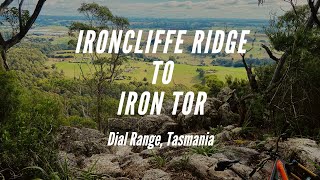
      Ironcliffe Ridge to Iron Tor Descent. Penguin,...
      mtb
      9:23 | 417 | Apr 19, 2023 , Penguin
      Iron Tor Descent
      mtb
      7:57 | 414 | Feb 8, 2023 , Penguin
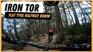
      Iron Tor - Penguin MTB (Flat Tyre Half Way Down)
      mtb
      6:20 | 364 | Jan 26, 2023 , Penguin
      Iron Tor Part 1
      mtb
      4:16 | 686 | Dec 10, 2020 , Penguin

      Routes with this trail

      more »
      ★ 5.0 • 11 miles • 2,105 ft • 10 • Loop • Race •
      Course for Round 2 of the Dales of Derby Tas Gravity Enduro Series for 2025/2026.
      13 miles • 2,265 ft • 10 •
      Quad Crown Wild Penguin Plan D
      11 miles • 1,777 ft • 9 •
      Wild Penguin course plan C
      4.7 ★★★★★
      20 Ratings
      5 ★ 80%
      4 ★ 15%
      3 ★
      2 ★ 5%
      1 ★

      7 Reviews & Comments

      toquerider
      Expect a rocky technical descent. The "blue" rating is fantasy.
      jaydentassiemtb
      Unreal track with great rock tech and optional lines at the top with some of the sickest flow sections and corners ever.
      Djshall Djshall
      Such a awsome trail! Well done to the trail crew!

      We hope you've been enjoying Trailforks!

      Create a FREE account to view all trail reviews and much more.

      • By streddazTF Pro CCMBC & contributors
      • #310820 - 6,652 views

      Frequently Asked Questions

      ▼ Where is Iron Tor located?
      Iron Tor is located in Dial Range, Penguin, Australia. It is part of the Dial Range trail network. The trailhead is located at coordinates -41.16113, 146.0437.
      ▼ How hard is Iron Tor?
      Iron Tor is rated as Blue difficulty. The physical rating is Moderate. The average grade is 7.2%.
      ▼ What is the elevation gain for Iron Tor?
      Iron Tor has 114 ft of elevation gain. The trail has 806 ft of elevation descent. The elevation ranges from 816 ft to 1,577 ft.
      ▼ Is Iron Tor a point to point trail?
      Yes, Iron Tor is a point to point trail. The direction is Downhill Only. The trail type is singletrack.
      ▼ How long is Iron Tor?
      Iron Tor is 1.8 miles long. The trail type is singletrack.
      ▼ Are dogs allowed on Iron Tor?
      There is no information about dogs being allowed on Iron Tor. Check with local trail managers or the trail page for the latest access rules.
      ▼ When is the best time of year to ride Iron Tor?
      Based on activity log data, the most popular months to ride Iron Tor are:
      • December (17 activities)
      • January (16 activities)
      • March (16 activities)
      Check the reports page for current trail conditions.
      ▼ How do I access Iron Tor? Where is the closest parking trailhead?
      The closest parking and trailhead locations to Iron Tor are: View all parking locations in the area.
      ▼ How long does it take to ride Iron Tor?
      Based on recorded activities, it takes an average of 19 minutes to ride Iron Tor. The trail is 1.8 miles long. Actual times will vary based on fitness level, conditions, and pace. View recent activity logs for more details.
      ▼ How busy is Iron Tor?
      Iron Tor is a very popular trail. There have been 2,153 recorded activities on this trail. The trail has received 2,333 check-ins. View recent activity on this trail.

      Hit the Trail

      Open in App

      Get this trail on your phone instantly.

      open trail in app

      Download Trail

      Save to wishlist, Garmin & download.
      save the trail

      Find Related Routes

      Find routes and users activities that include this trail.
      find routes for this trail

      You must enter a description before submitting.