more stats
2.4 miles
Distance
1,929 ft
Climb
00:41:53
Avg time
1,929 ft
Altitude change
2,053 ft
Altitude min
3,982 ft
Altitude max
2,053 ft
Altitude start
3,983 ft
Altitude end
15%
Grade
1.1%
Grade max
108.1%
Grade min
2 miles
Distance climb
00:41:53
Avg time

Issalo Details

  • Activities
    • Mountain Bike
  • Riding Area
    Finale Outdoor Region
    Finale Ligure
  • Ref Number
    #371
  • Difficulty Rating
  • Voted Difficulty
    Blue (2 votes)
  • Local Popularity
    10 in Mountain Biking
  • Global Ranking
    #164586 in Mountain Biking
  • National Ranking
    #12,552 in Mountain Biking · Italy
  • Trail Type
    Singletrack
  • Bike Type
    AM, XC
  • Direction
    Uphill Only
  • Climb Difficulty
    Black Diamond
  • Physical Rating
    Hard
  • Trail Visibility
    Sometimes hard to follow
  • Season
    All-year round
  • Dogs Allowed
    Yes
  • eBike Allowed
    Yes up to Class 1
  • Land Owner
    Finale Outdoor Region

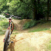
Thought with the E-Bike in mind, Issalo is a complete, all-rounded uphill E-Bike trail. The constant angle, the challenges that keep you on your toes and the terrain variety within one only trail are breathtaking. From the first sweepy section to the top steep and tecky bits, Issalo has it all to be the perfect E-Bike experience.

source: ...
Access Info

Exit the E80 highway in Pietra Ligure. Keep going towards the sea and you'll get to Pietra Ligure. You'll then be able to drive toward the mountains in order to reach Val Maremola towns and trails.
Other option would be the E80 exit in Finale Ligure. Keep going towards the sea until you catch the SS1 Via Aurelia and move west until Pietra Ligure.

Disclaimer

There is no water stop here and no connection to any town other than turning around and going back. Make sure you have all you need with you. Given its nature, the trail can change after weather happenings and season changes. Always pay attention.

Tags
Faint trail

Trail Supporters

Local Trail Association

Recent Activity on Trail

Past Week
  • 0 rides
  •  
6 Months
  • 0 rides
  •  
All
  • 5 rides
  • Last: Oct 31, 2026
c1c2c3c4
January
February
March
April
May
June
July
August
September
October
November
December
update trails status or condition

Issalo Trail Reports

statusdatedescription
Oct 27, 2026 @ 8:21am (Europe/Rome)
Oct 27, 2026
sentier très peu marqué, bcp de poussage, pistes qui se perdent... seulement pour les très motivés 😅
Sep 30, 2026 @ 7:08pm (Europe/Rome)
Sep 30, 2026
To my eyes, the trail/uphill is not usable. don't do it. It took us more than an hour and lots of hiking and seeking. Totally Overgrown by...
Jul 26, 2026 @ 11:07pm (Europe/Rome)
Jul 26, 2026
May 5, 2026 @ 5:38pm (Europe/Rome)
May 5, 2026
Der "Uphill Trail" Issalo ist absolut nicht mehr passierbar. Auch mit eMTB. Ab der Hälfte und dieser Lichtung ist kein durchkommen mehr. Zuletzt...
Apr 20, 2026 @ 10:02pm (Europe/Rome)
Apr 20, 2026
Von unserem lGuide empfohlen, und die Erwartungen wurden erfüllt und übertroffen.
more »
Status:
on Oct 27, 2026
Dry
Avg: 3.38 (9 votes)
Your vote: 0

view (29)
close
      Directions to issalo trailhead (44.206090, 8.201980)

      Photos

      2 more »
      report
      mtb
      50 |
      Apr 8, 2026 @ 3:16am
      Apr 8, 2026
      report
      mtb
      47 |
      Apr 8, 2026 @ 3:16am
      Apr 8, 2026

      Videos

      no videos have been added for Issalo yet, add a video.
      2.7 ★★★★★
      9 Ratings
      5 ★ 11%
      4 ★ 22%
      3 ★ 22%
      2 ★ 11%
      1 ★ 33%

      10 Reviews & Comments

      Zee85 Zee85
      It was a climbe trail ONCE. Not at the moment it starts ok and then it just disappears. If you look closely you can see some tree markings here and there but it's not maintained at all and it passes through some private land. Probably that's why it's not maintained. Do not attempt!! 👎👎
      Lsormani
      Confermo: provato a fare ieri 23/6/25...dopo un inizio che illude, diventa sporco e infattibile. Non tentare di farlo se non viene sistemato (mi hanno detto che ci sono problemi di passaggio in proprietà privata).
      GuidotgN39B
      There is NO way!!! You can't ride, and you can't walk there!
      Please delete that trail in the Liste

      We hope you've been enjoying Trailforks!

      Create a FREE account to view all trail reviews and much more.

      • By finaleoutdoorregion FOR & contributors
      • #429408 - 2,718 views

      Frequently Asked Questions

      ▼ Where is Issalo located?
      Issalo is located in Finale Outdoor Region, Finale Ligure, Italy. It is part of the Finale Outdoor Region trail network. The trailhead is located at coordinates 44.20609, 8.20198.
      ▼ How hard is Issalo?
      Issalo is rated as Blue difficulty. The physical rating is Hard. The average grade is 15%. The climb difficulty is rated Black Diamond.
      ▼ What is the elevation gain for Issalo?
      Issalo has 1,929 ft of elevation gain. The elevation ranges from 2,053 ft to 3,982 ft.
      ▼ Is Issalo a point to point trail?
      Yes, Issalo is a point to point trail. The direction is Uphill Only. The trail type is singletrack.
      ▼ How long is Issalo?
      Issalo is 2.4 miles long. The trail type is singletrack.
      ▼ Are dogs allowed on Issalo?
      Yes, dogs are allowed on Issalo. Please keep dogs on a leash where required and clean up after them.
      ▼ When is the best time of year to ride Issalo?
      Based on activity log data, the most popular months to ride Issalo are:
      • June (1 activities)
      • November (1 activities)
      Check the reports page for current trail conditions.
      ▼ How do I access Issalo? Where is the closest parking trailhead?
      The closest parking and trailhead locations to Issalo are: View all parking locations in the area.
      ▼ How long does it take to ride Issalo?
      Based on recorded activities, it takes an average of 42 minutes to ride Issalo. The trail is 2.4 miles long. Actual times will vary based on fitness level, conditions, and pace. View recent activity logs for more details.
      ▼ How busy is Issalo?
      Issalo is a less popular trail with lighter traffic. There have been 28 recorded activities on this trail. The trail has received 29 check-ins. View recent activity on this trail.

      Hit the Trail

      Open in App

      Get this trail on your phone instantly.

      open trail in app

      Download Trail

      Save to wishlist, Garmin & download.
      save the trail

      Find Related Routes

      Find routes and users activities that include this trail.
      find routes for this trail

      You must enter a description before submitting.