

more stats
2,159 ft
Distance
68 ft
Climb
-248 ft
Descent
00:07:37
Avg time
-180 ft
Altitude change
3,200 ft
Altitude min
3,380 ft
Altitude max
3,380 ft
Altitude start
3,199 ft
Altitude end
-8.3%
Grade
-51.1%
Grade max
26.5%
Grade min
568 ft
Distance climb
1,506 ft
Distance down
89 ft
Distance flat
00:07:37
Avg time

Jane-Jake Details

  • Activities
    • Mountain Bike
    • E-Bike
    • Hike
    • Trail Running
  • Riding Area
    Jane Lakes
    Whistler, British Columbia
  • Difficulty Rating
  • Local Popularity
    35 in Mountain Biking heatmap [+]
    • 15 in E-Biking
    • 45 in Trail Running
    • 70 in Hiking
  • Global Ranking
    #284684 in Mountain Biking [+]
    • #118654 in E-Biking
    • #142767 in Trail Running
    • #102050 in Hiking
  • Provincial Ranking
    #10,316 in Mountain Biking · British Columbia [+]
    • #5,699 in E-Biking
    • #8,345 in Trail Running
    • #5,442 in Hiking
  • Hiking SAC Scale
    T2 Mountain Hiking
  • Trail Type
    Wilderness Trail
  • Bike Type
    AM, XC
  • Direction
    Both Directions
    Popular Direction Shown
  • Climb Difficulty
    Black Diamond
  • Physical Rating
    Hard
  • Trail Visibility
    Always easy to follow
  • Dogs Allowed
    Yes
  • eBike Allowed
    Yes up to Class 1

Primitive wilderness trail. Steep descending segments with un-rideable hike-a-bike section in the middle. Skinny log creek crossings. Trail surface and bridging to be upgraded in the future.

Tags
Creek crossingHike-a-bikeSkinnies

Recent Activity on Trail

Past Week
  • 0 rides
  •  
6 Months
  • 15 rides
  • 17 miles avg distance
All
  • 75 rides
  • Last: Nov 1, 2026
c1c2c3c4
January
February
March
April
May
June
July
August
September
October
November
December
update trails status or condition

Jane-Jake Trail Reports

statusdatedescription
Sep 1, 2026 @ 11:47am (America/Vancouver)
Sep 1, 2026
May 30, 2026 @ 8:12pm (America/Vancouver)
May 30, 2026
reporter deadfall cleared.
May 18, 2026 @ 11:00pm (America/Vancouver)
May 18, 2026
A couple of trees down but easy to get around. Again, that stated average time of 10 minutes is completely unrealistic. The hike a bike section...
Dec 24, 2025 @ 10:32pm (America/Vancouver)
Dec 24, 2025
Oct 27, 2025 @ 10:42am (America/Vancouver)
Oct 27, 2025
reporter 2 cougars encountered on Jane Lakes FSR Travel in groups, make noise.
more »
Status:
on Sep 1, 2026
Ideal
no votes yet
Your vote: 0

view (357)
close
      Directions to janejake trailhead (50.041640, -123.063470)

      Photos

      1 more »
      report
      mtb
      79 |
      Sep 9, 2023 @ 5:05pm
      Sep 9, 2023

      Videos

      1 more »
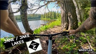
      JANE and JAKE LAKES | Black Trail | Whistler
      mtb
      8:27 | 130 | Jul 16, 2024 , Whistler

      Routes with this trail

      more »
      5 miles • 688 ft • 7 •
      WORCA Virtual Thriller Monday July 8 - Saturday July 13 Collect your badge to earn your Apres deal and...
      20 miles • 4,543 ft • 17 •
      Up Farside, Far Out, Far Out 2, SCAP Access, Down Highside, Hihi, down road, across suspension bridge,...
      13 miles • 2,479 ft • 5 •
      Gravel and dirt, double and single track 20k loop taking in Cheakamus River and Jane lakes

      Trail Products

      2 Reviews & Comments

      SummitCycles SummitCycles
      The log fall section has long since been cleared but there is still a short section that's probably unrideable by most humans - but quite walkable. Stated times are unrealistic. 11 minutes? 13 minutes uphill? Really? Maybe for a fast trail runner. The further you go the more technical it gets.
      Jxroussel Jxroussel
      Hike a bike might be do able by the best of climbers but overall a very ridable trail.

      We hope you've been enjoying Trailforks!

      Create a FREE account to view all trail reviews and much more.

      • By flipfantasiaTF Pro WORCA & contributors
      • #139387 - 1,911 views

      Frequently Asked Questions

      ▼ Where is Jane-Jake located?
      Jane-Jake is located in Jane Lakes, Whistler, British Columbia, Canada. It is part of the Jane Lakes trail network. The trailhead is located at coordinates 50.04164, -123.06347.
      ▼ How hard is Jane-Jake?
      Jane-Jake is rated as Black Diamond difficulty. The physical rating is Hard. The average grade is 8.3%. The climb difficulty is rated Black Diamond.
      ▼ What is the elevation gain for Jane-Jake?
      Jane-Jake has 68 ft of elevation gain. The trail has 248 ft of elevation descent. The elevation ranges from 3,200 ft to 3,380 ft.
      ▼ Is Jane-Jake a point to point trail?
      Jane-Jake is not a point to point trail. The direction is Both Directions. The trail type is wilderness trail.
      ▼ How long is Jane-Jake?
      Jane-Jake is 2,159 ft long. The trail type is wilderness trail.
      ▼ Are dogs allowed on Jane-Jake?
      Yes, dogs are allowed on Jane-Jake. Please keep dogs on a leash where required and clean up after them.
      ▼ When is the best time of year to ride Jane-Jake?
      Based on activity log data, the most popular months to ride Jane-Jake are:
      • July (12 activities)
      • August (9 activities)
      • September (8 activities)
      Check the reports page for current trail conditions.
      ▼ How do I access Jane-Jake? Where is the closest parking trailhead?
      The closest parking and trailhead locations to Jane-Jake are: View all parking locations in the area.
      ▼ How long does it take to ride Jane-Jake?
      Based on recorded activities, it takes an average of 8 minutes to ride Jane-Jake. The trail is 2,159 ft long. Actual times will vary based on fitness level, conditions, and pace. View recent activity logs for more details.
      ▼ How busy is Jane-Jake?
      Jane-Jake is a less popular trail with lighter traffic. There have been 329 recorded activities on this trail. The trail has received 357 check-ins. View recent activity on this trail.

      Hit the Trail

      Open in App

      Get this trail on your phone instantly.

      open trail in app

      Download Trail

      Save to wishlist, Garmin & download.
      save the trail

      Find Related Routes

      Find routes and users activities that include this trail.
      find routes for this trail

      You must enter a description before submitting.

