
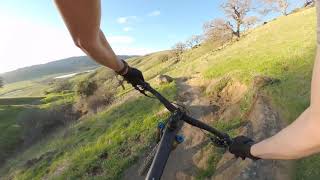
more stats
2.5 miles
Distance
196 ft
Climb
-802 ft
Descent
00:15:43
Avg time
-606 ft
Altitude change
267 ft
Altitude min
909 ft
Altitude max
908 ft
Altitude start
302 ft
Altitude end
-4.5%
Grade
-43.6%
Grade max
26%
Grade min
2,861 ft
Distance climb
2 miles
Distance down
2,251 ft
Distance flat
00:15:43
Avg time

Jepson Trails Details

  • Activities
    • Mountain Bike
    • E-Bike
    • Hike
    • Trail Running
  • Riding Area
    Lagoon Valley Park
    Vacaville, California
  • Difficulty Rating
  • Voted Difficulty
    Blue (2 votes)
  • Local Popularity
    90 in Mountain Biking heatmap [+]
    • 85 in E-Biking
    • 75 in Trail Running
    • 95 in Hiking
  • Global Ranking
    #71167 in Mountain Biking [+]
    • #3514 in E-Biking
    • #100151 in Trail Running
    • #77712 in Hiking
  • State Ranking
    #2,231 in Mountain Biking · California [+]
    • #99 in E-Biking
    • #4,869 in Trail Running
    • #4,409 in Hiking
  • Trail Type
    Singletrack
  • Bike Type
    DH, AM, XC
  • Trail Visibility
    Always easy to follow
  • Dogs Allowed
    Yes
  • eBike Allowed
    Yes up to Class 1
  • TTFs on Trail
    Bridge
  • Land Owner
    City of Vacaville

No community description for Jepson Trails trail has been added yet!

AI Generated Description

Jepson Trails is a 3 mile popular green difficulty singletrack trail located near Vacaville California. This mountain bike primary trail. It features bridge. Trail visibility is always easy to follow. On average it takes 15 minutes to complete this trail.

Tags
Bridges

Traditionally Indigenous Territory

Recent Activity on Trail

Past Week
  • 0 rides
  •  
6 Months
  • 37 rides
  • 13 miles avg distance
All
  • 212 rides
  • Last: Nov 15, 2026
c1c2c3c4
January
February
March
April
May
June
July
August
September
October
November
December
update trails status or condition

Jepson Trails Trail Reports

statusdatedescription
Mar 15, 2025 @ 4:31pm
Mar 15, 2025
Cows, significant rain, and lack of maintenance has made this trail borderline unusable. Not worth riding
Nov 27, 2024 @ 4:05pm
Nov 27, 2024
70% smooth hero dirt, 30% rutted with some major holes. Exercise caution when riding blind as the holes seem to come out of nowhere!
Dec 24, 2023 @ 11:17am
Dec 24, 2023
Great trail surface several days after rain. There are some ruts, some relatively short sections chopped up, and minor washed out areas but trail...
Apr 17, 2023 @ 10:37pm
Apr 17, 2023
Trail is is nothing but cow ruts now....hard packed cow ruts that's like trying to ride on cobbles the size of duck pin bowling balls. Also,...
Feb 10, 2023 @ 1:50am
Feb 10, 2023
Torn up badly on the top half and some unrideable. With the rains the cows have made the trail really bad at the top. I have a 170/170 Full...
more »
Status:
on Mar 15, 2025
Prevalent Mud
Avg: 3.49 (6 votes)
Your vote: 0

view (1,467)
close
      Directions to jepson-trails trailhead (38.318100, -121.991850)

      Photos

      33 more »
      mtb
      165 |
      Dec 12, 2020 @ 11:54am
      Dec 12, 2020
      mtb
      165 |
      Dec 12, 2020 @ 11:54am
      Dec 12, 2020
      mtb
      134 |
      Dec 12, 2020 @ 11:53am
      Dec 12, 2020
      mtb
      136 |
      Dec 12, 2020 @ 11:53am
      Dec 12, 2020

      Videos

      1 more »
      Mountain Biking Pena Adobe (Vacaville, CA)
      mtb
      9:56 | 601 | Jun 3, 2023 , Vacaville

      Routes with this trail

      more »
      ★ 5.0 • 9 miles • 1,273 ft • 9 • Loop •
      Figure 8 Loop utilizing the gravel road on the inclines and the single tracks for the DH. Start and End at...
      3.0 ★★★★★
      6 Ratings
      5 ★ 17%
      4 ★ 17%
      3 ★ 33%
      2 ★ 17%
      1 ★ 17%

      8 Reviews & Comments

      FutureMonopoly
      The berms at the end is now a pothole and the trail has lots of ruts and will shake you up should be a blue trail
      V5D8NE
      This is not a green trail. This should be labeled as a blue or black depending on the sections you’re riding. Single track, very steep downhill at the beginning, lots of rocks, steep hills on the left/right sides. The beginning and middle is tough with some mellow sections. At the end the berms are rocky and there are sink holes.
      6q7ENkmp
      Info on this trail from a local: In the winter each year it rains a ton and the cows get on the trails and ruin them. DO NOT RIDE DURING THIS TIME. Even early spring, the trails are still pretty bad. But sometime in April when the rain looks like it is done, some locals come out and fix the trails from the damage the cows caused. After April through early December (or first big rain storms) these trails are sick! Lots of hikers on a mild temperature weekend in the fall and spring, sometimes some cow patties. The climb is a little steep, but totally worth it. This trail can really rip. I've ridden it about 50 times and I love it. Definitely not a green trail though. It is tight single track on the descent, steep at times, and a total blast. Blue is a more accurate rating of this trail. Hopefully this helps! Just want more riders to enjoy this awesome trail

      We hope you've been enjoying Trailforks!

      Create a FREE account to view all trail reviews and much more.

      Frequently Asked Questions

      ▼ Where is Jepson Trails located?
      Jepson Trails is located in Lagoon Valley Park, Vacaville, California, United States. It is part of the Lagoon Valley Park trail network. The trailhead is located at coordinates 38.3181, -121.99185.
      ▼ How hard is Jepson Trails?
      Jepson Trails is rated as Green difficulty. The average grade is 4.5%.
      ▼ What is the elevation gain for Jepson Trails?
      Jepson Trails has 196 ft of elevation gain. The trail has 802 ft of elevation descent. The elevation ranges from 267 ft to 909 ft.
      ▼ How long is Jepson Trails?
      Jepson Trails is 2.5 miles long. The trail type is singletrack.
      ▼ Are dogs allowed on Jepson Trails?
      Yes, dogs are allowed on Jepson Trails. Please keep dogs on a leash where required and clean up after them.
      ▼ When is the best time of year to ride Jepson Trails?
      Based on activity log data, the most popular months to ride Jepson Trails are:
      • May (17 activities)
      • March (16 activities)
      • August (11 activities)
      Check the reports page for current trail conditions.
      ▼ How do I access Jepson Trails? Where is the closest parking trailhead?
      The closest parking and trailhead locations to Jepson Trails are: View all parking locations in the area.
      ▼ How long does it take to ride Jepson Trails?
      Based on recorded activities, it takes an average of 16 minutes to ride Jepson Trails. The trail is 2.5 miles long. Actual times will vary based on fitness level, conditions, and pace. View recent activity logs for more details.
      ▼ How busy is Jepson Trails?
      Jepson Trails is a very popular trail. There have been 1,405 recorded activities on this trail. The trail has received 1,467 check-ins. View recent activity on this trail.

      Hit the Trail

      Open in App

      Get this trail on your phone instantly.

      open trail in app

      Download Trail

      Save to wishlist, Garmin & download.
      save the trail

      Find Related Routes

      Find routes and users activities that include this trail.
      find routes for this trail

      You must enter a description before submitting.

