
more stats
2,260 ft
Distance
-247 ft
Descent
00:04:28
Avg time
-249 ft
Altitude change
971 ft
Altitude min
1,220 ft
Altitude max
1,220 ft
Altitude start
971 ft
Altitude end
-11%
Grade
-66.6%
Grade max
16 ft
Distance climb
2,231 ft
Distance down
10 ft
Distance flat
00:04:28
Avg time

Krebsbachtrail Details

  • Activities
    • Hike
    • Mountain Bike
    • E-Bike
    • Trail Running
  • Riding Area
    Königstuhl
    Heidelberg
  • Difficulty Rating
  • Local Popularity
    20 in Mountain Biking heatmap [+]
    • 35 in E-Biking
    • 5 in Trail Running
    • 5 in Hiking
  • Global Ranking
    #141683 in Mountain Biking [+]
    • #131501 in E-Biking
    • #166595 in Trail Running
    • #165926 in Hiking
  • National Ranking
    #5,170 in Mountain Biking · Germany [+]
    • #4,888 in E-Biking
    • #1,285 in Trail Running
    • #1,774 in Hiking
  • Hiking SAC Scale
    T1 Hiking
  • Trail Type
    Singletrack
  • Bike Type
    AM, XC
  • Direction
    Downhill Primary
    Popular Direction Shown
  • Physical Rating
    Easy
  • Dogs Allowed
    Yes
  • eBike Allowed
  • TTFs on Trail
    Other
  • OSM Way

Das obere Stück ist recht einfach. Bis zu den Spitzkehren, die dann nicht mehr ganz so einfach sind - Umsetzen können wird empfohlen. Mittlerweile hat sich da auch eine etwas steilere Umfahrung gebildet.

Der zweite Teil ist dann wieder flowig und relativ einfach, allerdings kann die Sicht je nach Vegetationsdichte sehr eingeschränkt sein.
Eine Bachquerung bzw. ein Bachzufluss ist auch dabei, da steht meistens das Wasser und es ist etwas matschig.

Wie auch schon beim Trail direkt davor ist die Einteilung eigentlich eher so zwischen Grün und Blau.

Tags

Recent Activity on Trail

Past Week
  • 0 rides
  •  
6 Months
  • 1 rides
  • 22 miles avg distance
All
  • 36 rides
  • Last: Jul 9, 2026
c1c2c3c4
January
February
March
April
May
June
July
August
September
October
November
December
update trails status or condition

Krebsbachtrail Trail Reports

statusdatedescription
Aug 5, 2026 @ 2:06pm (Europe/Berlin)
Aug 5, 2026
Der Baum bei der Bachquerung ist wieder weg, aber es liegt noch einiges Geäst dort.
Jun 28, 2026 @ 11:15pm (Europe/Berlin)
Jun 28, 2026
reporter Beim letzten Stück mit der Bachquerung liegt ein fetter Baum inklusive kleineren Bäumen über den Trail. Da ist kein Durchkommen. Ein paar...
Dec 31, 2024 @ 7:17am
Dec 31, 2024
Oct 29, 2023 @ 2:43pm
Oct 29, 2023
reporter Nass, aber derzeit alles frei. Vorgestern lag allerdings wieder ein dicker Ast im Weg.
Aug 30, 2022 @ 2:25pm
Aug 30, 2022
reporter Ein Wandernazi hatte am Ende direkt nach dem Steinkicker einen Ast mitten auf Bike-Höhe quergelegt. Ich hab ihn weggeräumt, Vorsicht bleibt aber...
more »
Status:
on Aug 5, 2026
Dry
Avg: 4.11 (2 votes)
Your vote: 0

view (210)
close
      Directions to krebsbachtrail trailhead (49.380640, 8.743850)

      Photos

      1 more »
      report
      mtb
      53 |
      Jun 28, 2026 @ 2:31pm
      Jun 28, 2026

      Videos

      1 more »
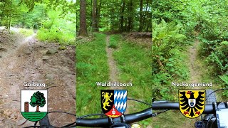
      youtuber Let's Ride MTB - Heidelberg // Gaiberg,...
      mtb
      13:35 | 214 | Aug 30, 2022 , Heidelberg
      4.5 ★★★★★
      2 Ratings
      5 ★ 50%
      4 ★ 50%
      3 ★
      2 ★
      1 ★

      Reviews / Comments

      No reviews yet, be the first to write a review or ask a question.
      Use trail reports to comment on trail conditions.


      We hope you've been enjoying Trailforks!

      Create a FREE account to view all trail reviews and much more.

      • By sp00n82TF Pro HDRiders & contributors
      • #109656 - 1,011 views

      Frequently Asked Questions

      ▼ Where is Krebsbachtrail located?
      Krebsbachtrail is located in Königstuhl, Heidelberg, Germany. It is part of the Königstuhl trail network. The trailhead is located at coordinates 49.38064, 8.74385.
      ▼ How hard is Krebsbachtrail?
      Krebsbachtrail is rated as Blue difficulty. The physical rating is Easy. The average grade is 11%.
      ▼ What is the elevation gain for Krebsbachtrail?
      The trail has 247 ft of elevation descent. The elevation ranges from 971 ft to 1,220 ft.
      ▼ Is Krebsbachtrail a point to point trail?
      Krebsbachtrail is not a point to point trail. The direction is Downhill Primary. The trail type is singletrack.
      ▼ How long is Krebsbachtrail?
      Krebsbachtrail is 2,260 ft long. The trail type is singletrack.
      ▼ Are dogs allowed on Krebsbachtrail?
      Yes, dogs are allowed on Krebsbachtrail. Please keep dogs on a leash where required and clean up after them.
      ▼ How do I access Krebsbachtrail? Where is the closest parking trailhead?
      The closest parking and trailhead locations to Krebsbachtrail are: View all parking locations in the area.
      ▼ How long does it take to ride Krebsbachtrail?
      Based on recorded activities, it takes an average of 4 minutes to ride Krebsbachtrail. The trail is 2,260 ft long. Actual times will vary based on fitness level, conditions, and pace. View recent activity logs for more details.
      ▼ How busy is Krebsbachtrail?
      Krebsbachtrail is a less popular trail with lighter traffic. There have been 231 recorded activities on this trail. The trail has received 210 check-ins. View recent activity on this trail.

      Hit the Trail

      Open in App

      Get this trail on your phone instantly.

      open trail in app

      Download Trail

      Save to wishlist, Garmin & download.
      save the trail

      Find Related Routes

      Find routes and users activities that include this trail.
      find routes for this trail

      You must enter a description before submitting.

