
more stats
5,144 ft
Distance
40 ft
Climb
-408 ft
Descent
00:02:58
Avg time
-370 ft
Altitude change
4,131 ft
Altitude min
4,500 ft
Altitude max
4,500 ft
Altitude start
4,131 ft
Altitude end
-7.2%
Grade
-48.8%
Grade max
11.2%
Grade min
538 ft
Distance climb
4,498 ft
Distance down
108 ft
Distance flat
00:02:58
Avg time

L'intégral #5 Details

  • Activities
    • Hike
    • Mountain Bike
    • E-Bike
    • Trail Running
  • Riding Area
  • Difficulty Rating
  • Voted Difficulty
    Red (1 vote)
  • Local Popularity
    45 in Mountain Biking heatmap [+]
    • 5 in E-Biking
    • 90 in Trail Running
    • 5 in Hiking
  • Global Ranking
    #136018 in Mountain Biking [+]
    • #178851 in E-Biking
    • #12117 in Trail Running
    • #155559 in Hiking
  • National Ranking
    #5,526 in Mountain Biking · France [+]
    • #13,123 in E-Biking
    • #555 in Trail Running
    • #3,009 in Hiking
  • Hiking SAC Scale
    T1 Hiking
  • Trail Type
    Singletrack
  • Bike Type
    DH, AM, XC
  • Direction
    Downhill Primary
    Popular Direction Shown
  • Dogs Allowed
    Yes
  • eBike Allowed
    Yes up to Class 1
  • TTFs on Trail
    Berm, Bridge

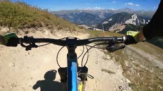
If you could choose just one route during your stay in Courchevel, it should without doubt be this one. But beware, L'Integrale isn’t for everyone, this magnificent track is only for experienced riders looking for an exciting challenge and who are not afraid of high-speed cycling as they tackle this whopping 13km track
The starting point is impressive. At 2738m high, Sommet de la Saulire mountain (accessible free of charge by the Verdons gondola and La Saulire cable car), the views are magical: Mont Blanc, the Grande Casse, the glaciers of the Vanoise... After you’ve enjoyed the views, it's time to get on your bike and take the descent to Lake Praz, 1430m below. Beneath your wheels, the varied terrain will fly by: sometimes rocky, smoother as you cross the pastures, more technical on the raised curves of the Funny track, and a glorious finish on the steep tracks of the Praz forest.

Disclaimer

Ce Trail est un PR, c'est donc un chemin de randonnée pedestre. (VTT accepté)

Tags
BermsBridgesGlacier

Recent Activity on Trail

Past Week
  • 0 rides
  •  
6 Months
  • 0 rides
  •  
All
  • 0 rides
  • Last: Apr 19, 2026
update trails status or condition

L'intégral #5 Trail Reports

statusdatedescription
Aug 22, 2023 @ 9:48am
Aug 22, 2023
Aug 13, 2021 @ 1:06am
Aug 13, 2021
Description from the tourist office? It is a lot of double track/ fireroad
more »
Status:
on Aug 22, 2023
Very Dry
Avg: 3.26 (5 votes)
Your vote: 0

view (7)
close
      Directions to l-integral-5 trailhead (45.427480, 6.635020)

      Photos

      7 more »
      mtb
      31 |
      Jul 17, 2024 @ 5:13am
      Jul 17, 2024
      mtb
      42 |
      Jul 17, 2024 @ 5:13am
      Jul 17, 2024
      mtb
      94 |
      Aug 22, 2023 @ 9:50am
      Aug 22, 2023
      mtb
      63 |
      Aug 22, 2023 @ 9:50am
      Aug 22, 2023

      Videos

      1 more »
      E7 L'intégral (black) - MTB downhill from...
      mtb
      21:11 | 429 | Aug 31, 2023 , Courchevel
      2.4 ★★★★★
      5 Ratings
      5 ★
      4 ★ 40%
      3 ★
      2 ★ 20%
      1 ★ 40%

      6 Reviews & Comments

      Lambdo
      The trail is often on fireroad transfers an has a lot of boring straight sections. Ideal to burn vertical and to get to Courchevel but obly a few short secrions of actual fun.
      Trailuca Trailuca
      Some new segments have been added to the trail. So only a few sections have to be driven on fireroads.
      will-angsten-clark will-angsten-clark
      It's not a trail you want to session over and over but as a way to get back to Courchevel / La Praz from meribel, it's awesome. Top section, loose, fast, quite exposed. Some high speed flat bits, a super fun set of berms and then kinda flat out pinning to join the Courchevel bike park trails. Out of Courchevel 1850, when you drop off the fire road it's a super fun rocky and rooty natural descent, this is a multi use trail so watch out for hikers. All in all its pretty awesome descent.

      We hope you've been enjoying Trailforks!

      Create a FREE account to view all trail reviews and much more.

      Frequently Asked Questions

      ▼ Where is L'intégral #5 located?
      L'intégral #5 is located in Courchevel, France. It is part of the Courchevel trail network. The trailhead is located at coordinates 45.42748, 6.63502.
      ▼ How hard is L'intégral #5?
      L'intégral #5 is rated as Red difficulty. The average grade is 7.2%.
      ▼ What is the elevation gain for L'intégral #5?
      L'intégral #5 has 40 ft of elevation gain. The trail has 408 ft of elevation descent. The elevation ranges from 4,131 ft to 4,500 ft.
      ▼ Is L'intégral #5 a point to point trail?
      L'intégral #5 is not a point to point trail. The direction is Downhill Primary. The trail type is singletrack.
      ▼ How long is L'intégral #5?
      L'intégral #5 is 5,144 ft long. The trail type is singletrack.
      ▼ Are dogs allowed on L'intégral #5?
      Yes, dogs are allowed on L'intégral #5. Please keep dogs on a leash where required and clean up after them.
      ▼ How do I access L'intégral #5? Where is the closest parking trailhead?
      The closest parking and trailhead locations to L'intégral #5 are: View all parking locations in the area.
      ▼ How long does it take to ride L'intégral #5?
      Based on recorded activities, it takes an average of 3 minutes to ride L'intégral #5. The trail is 5,144 ft long. Actual times will vary based on fitness level, conditions, and pace. View recent activity logs for more details.
      ▼ How busy is L'intégral #5?
      L'intégral #5 is a moderately popular trail. There have been 6 recorded activities on this trail. The trail has received 7 check-ins. View recent activity on this trail.

      Hit the Trail

      Open in App

      Get this trail on your phone instantly.

      open trail in app

      Download Trail

      Save to wishlist, Garmin & download.
      save the trail

      Find Related Routes

      Find routes and users activities that include this trail.
      find routes for this trail

      You must enter a description before submitting.

