
more stats
1.2 miles
Distance
44 ft
Climb
-786 ft
Descent
00:16:51
Avg time
-743 ft
Altitude change
1,707 ft
Altitude min
2,450 ft
Altitude max
2,450 ft
Altitude start
1,706 ft
Altitude end
-11.6%
Grade
-47.2%
Grade max
23%
Grade min
528 ft
Distance climb
1 mile
Distance down
466 ft
Distance flat
00:16:51
Avg time

La Cigale Details

  • Activities
    • Mountain Bike
  • Riding Area
    Le Massif de Charlevoix
    Petite-Rivière-Saint-François, Quebec
  • Difficulty Rating
  • Local Popularity
    50 in Mountain Biking heatmap
  • Global Ranking
    #20612 in Mountain Biking
  • Provincial Ranking
    #425 in Mountain Biking · Quebec
  • Trail Type
    Singletrack
  • Bike Type
    DH, AM
  • Direction
    Downhill Only
    Popular Direction Shown
  • Physical Rating
    Moderate
  • Trail Visibility
    Always easy to follow
  • eBike Allowed
  • TTFs on Trail
    Berm, Rock Face, Rock Garden
  • Land Owner
    Le Massif de Charlevoix

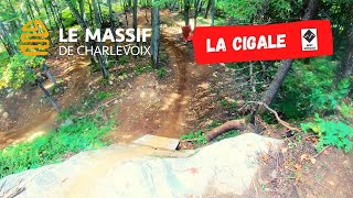
La Cigale est une longue descente pour experts seulement.
Dans sa première moitié, le sentier traverse les flancs du mont Liguori sur un sentier aménagé mécaniquement mais comportant beaucoup d'exposition. Ne vous laissez pas distraire par les paysages spectaculaires, une erreur pourrait coûter cher La deuxième portion du sentier est plus technique, avec de belles sections aménagées à la main.
Vous serez en milieu éloigné - vu la difficulté du tracé, merci de respecter vos habiletés et de rester en contrôle de votre vitesse en tout temps vu la difficulté d'accès pour toute équipe de sauvetage.

Tags
BermsRock gardensRock slabs

Bike Park

Local Trail Association

Traditionally Indigenous Territory

Recent Activity on Trail

Past Week
  • 0 rides
  •  
6 Months
  • 27 rides
  • 25 miles avg distance
All
  • 184 rides
  • Last: Oct 11, 2026
c1c2c3c4
January
February
March
April
May
June
July
August
September
October
November
December
update trails status or condition

La Cigale Trail Reports

statusdatedescription
Sep 20, 2025 @ 9:44am (America/Toronto)
Sep 20, 2025
Jul 11, 2025 @ 12:50pm
Jul 11, 2025
A lot of puddles and really slick roots and rocks
Jan 6, 2025 @ 9:56pm
Jan 6, 2025
reporter Fermée pour la saison / Closed for the season
Oct 1, 2024 @ 4:21am
Oct 1, 2024
Definitely a blue tech trail with one big feature that makes it a black. Beautify maple tree forest.
Sep 30, 2023 @ 3:05am
Sep 30, 2023
more »
Status:
on Sep 20, 2025
Dry
Avg: 4.16 (6 votes)
Your vote: 0

view (1,172)
close
      Directions to la-cigale trailhead (47.291710, -70.613820)

      Photos

      5 more »
      mtb
      95 |
      Aug 23, 2025 @ 5:36pm
      Aug 23, 2025
      mtb
      245 |
      Oct 7, 2023 @ 6:00pm
      Oct 7, 2023
      mtb
      337 |
      Sep 12, 2022 @ 8:47am
      Sep 12, 2022
      mtb
      354 |
      Sep 12, 2022 @ 8:47am
      Sep 12, 2022

      Videos

      6 more »
      youtuber ⛈️ Sous la pluie avec BKXC au Massif de...
      mtb
      14:49 | 353 | Aug 31, 2023 , Petite-Rivière-Saint-François
      youtuber La Cigale and half of La fourmi ! - New trails...
      mtb
      16:07 | 669 | Jul 10, 2022 , Petite-Rivière-Saint-François
      Le Massif La Cigale
      mtb
      9:46 | 154 | Sep 13, 2023 , Petite-Rivière-Saint-François
      Le Massif de Charlevoix   La Cigale First Time...
      mtb
      12:05 | 237 | Jan 13, 2023 , Petite-Rivière-Saint-François
      4.2 ★★★★★
      6 Ratings
      5 ★ 33%
      4 ★ 50%
      3 ★ 17%
      2 ★
      1 ★

      1 Review & Comments

      Andytrek
      This trail is really dope. Not exactly a black though. More like a hard blue. Good technical with some flow. Gets a little greasy when wet but superb trail! Make sure to run slightly higher tire pressure. Lots of rocks that can take out a rim or give you a flat. Love this trail!

      We hope you've been enjoying Trailforks!

      Create a FREE account to view all trail reviews and much more.

      • By LeMassif & contributors
      • #463404 - 1,487 views

      Frequently Asked Questions

      ▼ Where is La Cigale located?
      La Cigale is located in Le Massif de Charlevoix, Petite-Rivière-Saint-François, Quebec, Canada. It is part of the Le Massif de Charlevoix trail network. The trailhead is located at coordinates 47.29171, -70.61382.
      ▼ How hard is La Cigale?
      La Cigale is rated as Black Diamond difficulty. The physical rating is Moderate. The average grade is 11.6%.
      ▼ What is the elevation gain for La Cigale?
      La Cigale has 44 ft of elevation gain. The trail has 786 ft of elevation descent. The elevation ranges from 1,707 ft to 2,450 ft.
      ▼ Is La Cigale a point to point trail?
      Yes, La Cigale is a point to point trail. The direction is Downhill Only. The trail type is singletrack.
      ▼ How long is La Cigale?
      La Cigale is 1.2 miles long. The trail type is singletrack.
      ▼ Are dogs allowed on La Cigale?
      There is no information about dogs being allowed on La Cigale. Check with local trail managers or the trail page for the latest access rules.
      ▼ How do I access La Cigale? Where is the closest parking trailhead?
      The closest parking and trailhead locations to La Cigale are: View all parking locations in the area.
      ▼ How long does it take to ride La Cigale?
      Based on recorded activities, it takes an average of 17 minutes to ride La Cigale. The trail is 1.2 miles long. Actual times will vary based on fitness level, conditions, and pace. View recent activity logs for more details.
      ▼ How busy is La Cigale?
      La Cigale is a moderately popular trail. There have been 1,085 recorded activities on this trail. The trail has received 1,172 check-ins. View recent activity on this trail.

      Hit the Trail

      Open in App

      Get this trail on your phone instantly.

      open trail in app

      Download Trail

      Save to wishlist, Garmin & download.
      save the trail

      Find Related Routes

      Find routes and users activities that include this trail.
      find routes for this trail

      You must enter a description before submitting.