



more stats
2.1 miles
Distance
101 ft
Climb
-1,663 ft
Descent
00:30:15
Avg time
-1,562 ft
Altitude change
6,023 ft
Altitude min
7,589 ft
Altitude max
7,589 ft
Altitude start
6,027 ft
Altitude end
-14.4%
Grade
-111%
Grade max
20.6%
Grade min
1,529 ft
Distance climb
2 miles
Distance down
528 ft
Distance flat
00:30:15
Avg time

Le Cune Details

  • Activities
    • Mountain Bike
    • E-Bike
    • Hike
    • Trail Running
  • Riding Area
    Stelvio Natural Trail Park
    Santa Caterina Valfurva
  • Difficulty Rating
  • Voted Difficulty
    Red (5 votes)
  • Local Popularity
    95 in Mountain Biking [+]
    • 95 in E-Biking
    • 5 in Trail Running
    • 5 in Hiking
  • Global Ranking
    #38114 in Mountain Biking [+]
    • #87915 in E-Biking
    • #297625 in Trail Running
    • #289947 in Hiking
  • National Ranking
    #3,650 in Mountain Biking · Italy [+]
    • #9,879 in E-Biking
    • #9,953 in Trail Running
    • #9,864 in Hiking
  • Hiking SAC Scale
    T1 Hiking
  • Trail Type
    Singletrack
  • Direction
    Downhill Primary
    Popular Direction Shown
  • Alpine Trail
    Yes
  • Dogs Allowed
    Yes
  • eBike Allowed
    Yes up to Class 1

One of the best enduro trail in Bormio/S.Caterina area. Access road is quite narrow, steep and difficult to pedal all the way to the top. The descent is the best this area can offer: roots, rock gardens, tight berms and steep sections (average S3). The whole trail is inside a beautiful wood, no exposed part and a lot of fun for Enduro/All mountain lovers. Combine this trail with "Bormio 3000 single" for an awesome freeride / all mountain adventure.

Tags
AlpineBermsRock gardens

Recent Activity on Trail

Past Week
  • 0 rides
  •  
6 Months
  • 18 rides
  • 28 miles avg distance
All
  • 39 rides
  • Last: Sep 3, 2026
c1c2c3c4
January
February
March
April
May
June
July
August
September
October
November
December
update trails status or condition

Le Cune Trail Reports

statusdatedescription
Aug 4, 2026 @ 10:39am (Europe/Vaduz)
Aug 4, 2026
Top
Jul 22, 2026 @ 6:28am (Europe/Rome)
Jul 21, 2026
Aug 6, 2025 @ 10:22am
Aug 6, 2025
Dire che questo Trail è top è dire poco... Terreno perfetto e sentiero in ottime condizioni. Nella parte bassa diventa un double-track con fondo...
Sep 7, 2024 @ 9:18am
Sep 7, 2024
Aug 24, 2024 @ 4:01am
Aug 24, 2024
Solo il tratto finale è molto scivoloso per via di accumuli di sassi.
more »
Status:
on Aug 4, 2026
Ideal
Avg: 4.62 (15 votes)
Your vote: 0

view (255)
close
      Directions to le-cune trailhead (46.415060, 10.444250)

      Photos

      7 more »
      mtb
      88 |
      Jul 16, 2022 @ 7:42am
      Jul 16, 2022
      mtb
      98 |
      Jul 16, 2022 @ 7:42am
      Jul 16, 2022
      mtb
      93 |
      Jul 16, 2022 @ 7:42am
      Jul 16, 2022
      mtb
      93 |
      Jul 16, 2022 @ 7:41am
      Jul 16, 2022

      Videos

      1 more »
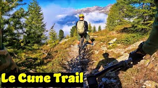
      Le Cune Trail - Santa Caterina Valfurva- (sept...
      mtb
      5:49 | 225 | Nov 8, 2023 , Santa Caterina Valfurva

      Routes with this trail

      ★ 3.4 • 21 miles • 7,540 ft • 2 •
      A two faced tour. The first part leading to Bormio is an easy ride through the century old conifer trees,...
      10 miles • 2,725 ft • 3 • Loop •
      Technical but never boring this interesting ring offers variety and a chance to discover some of the...
      4.9 ★★★★★
      15 Ratings
      5 ★ 87%
      4 ★ 13%
      3 ★
      2 ★
      1 ★

      3 Reviews & Comments

      alpinemattiyt
      Trail molto tecnico nel bosco, pieno di rocce e radici e spesso in tratti ripidi. È molto divertente per chi sa guidare bene il mezzo e che sa fare enduro. Nella prima parte fuori dal bosco c'è solo qualche roccetta. Poi si entra nel bosco di pini, e iniziano le tantissime radici, la principale caratteristica del percorso. Dopo aver percorso il sentiero si arriva a un double-track che inizialmente sale abbastanza dolcemente e poi scende verso Santa Caterina. A un tratto diventa molto scassato per qualche tornantini, pieno di grossi sassi smossi e qualche roccetta ( sembra quasi il greto di un torrente ). Successivamente ultima parte molto semplice per poi arrivare sulla strada sterrata. Bellissimo e divertentissimo, ma bisogna una buona capacità di guida per farlo. Sconsiglio di farlo dopo la pioggia, perché dato che la principale caratteristica del percorso sono le radici, se trovate bagnate possono diventare scivolosissime. Consigliata la combinata con il Trail che scende da Bormio 3000, per una discesa "infinita".
      karlacio karlacio
      Very nice, a lot of technical and steeply sections. After the farm nothing special it became a steep road and no longer the fun trail as before.
      sp1marco sp1marco
      Top trail ! Tra radici, tratti ripidi e sassi. Bellissimo!

      We hope you've been enjoying Trailforks!

      Create a FREE account to view all trail reviews and much more.

      • By StelvioNaturalTrailPark & contributors
      • #83802 - 3,308 views

      Frequently Asked Questions

      ▼ Where is Le Cune located?
      Le Cune is located in Stelvio Natural Trail Park, Santa Caterina Valfurva, Italy. It is part of the Stelvio Natural Trail Park trail network. The trailhead is located at coordinates 46.41506, 10.44425.
      ▼ How hard is Le Cune?
      Le Cune is rated as Red difficulty. The average grade is 14.4%.
      ▼ What is the elevation gain for Le Cune?
      Le Cune has 101 ft of elevation gain. The trail has 1,663 ft of elevation descent. The elevation ranges from 6,023 ft to 7,589 ft.
      ▼ Is Le Cune a point to point trail?
      Le Cune is not a point to point trail. The direction is Downhill Primary. The trail type is singletrack.
      ▼ How long is Le Cune?
      Le Cune is 2.1 miles long. The trail type is singletrack.
      ▼ Are dogs allowed on Le Cune?
      Yes, dogs are allowed on Le Cune. Please keep dogs on a leash where required and clean up after them.
      ▼ How do I access Le Cune? Where is the closest parking trailhead?
      The closest parking and trailhead locations to Le Cune are: View all parking locations in the area.
      ▼ How long does it take to ride Le Cune?
      Based on recorded activities, it takes an average of 30 minutes to ride Le Cune. The trail is 2.1 miles long. Actual times will vary based on fitness level, conditions, and pace. View recent activity logs for more details.
      ▼ How busy is Le Cune?
      Le Cune is a very popular trail. There have been 264 recorded activities on this trail. The trail has received 255 check-ins. View recent activity on this trail.

      Hit the Trail

      Open in App

      Get this trail on your phone instantly.

      open trail in app

      Download Trail

      Save to wishlist, Garmin & download.
      save the trail

      Find Related Routes

      Find routes and users activities that include this trail.
      find routes for this trail

      You must enter a description before submitting.


