


more stats
2.0 miles
Distance
1,049 ft
Climb
-81 ft
Descent
00:27:08
Avg time
969 ft
Altitude change
680 ft
Altitude min
1,649 ft
Altitude max
680 ft
Altitude start
1,650 ft
Altitude end
9%
Grade
-19.1%
Grade max
51.9%
Grade min
2 miles
Distance climb
1,224 ft
Distance down
295 ft
Distance flat
00:27:08
Avg time

Limekiln - Lower Details

  • Activities
    • Mountain Bike
    • Gravel Bike
    • Horse
    • Hike
    • Trail Running
  • Riding Area
    Sierra Azul Open Space Preserve
    Los Gatos, California
  • AKA
    Overgrown
  • Difficulty Rating
  • Voted Difficulty
    Blue (2 votes)
  • Local Popularity
    70 in Mountain Biking heatmap [+]
    • 75 in Trail Running
    • 70 in Hiking
    • 5 in Horseback
    • 60 in Gravel Biking
  • Global Ranking
    #130304 in Mountain Biking [+]
    • #115407 in Trail Running
    • #116905 in Hiking
    • #22586 in Horseback
    • #14246 in Gravel Biking
  • State Ranking
    #4,891 in Mountain Biking · California [+]
    • #5,677 in Trail Running
    • #6,506 in Hiking
    • #1,545 in Horseback
    • #1,041 in Gravel Biking
  • Hiking SAC Scale
    T2 Mountain Hiking
  • Trail Type
    Dirt/Gravel Road
  • Bike Type
    AM, XC, Gravel
  • Direction
    Both Directions[+]
    • Both Directions for Horseback
    • Both Directions for Gravel Biking
  • Climb Difficulty
    Blue
  • Physical Rating
    Hard
  • Trail Visibility
    Always easy to follow
  • Season
    All Year
  • Dogs Allowed
    Yes
  • TTFs on Trail
    Rock Garden
  • Ride in Rain
    Yes
  • Land Owner

A shaded and leafy climb through the mountains above the reservoir. There are steep sections (in both directions) and the terrain can become rocky. Look out for hikers and for people descending at high speed - this is a local speed workout.

Disclaimer

Trail is slippery in the Winter - ride with caution!

Tags
Rock gardens

Local Trail Association

Traditionally Indigenous Territory

Recent Activity on Trail

Past Week
  • 4 rides
  • 15 miles average
6 Months
  • 28 rides
  • 17 miles avg distance
All
  • 182 rides
  • Last: Nov 15, 2026
c1c2c3c4
January
February
March
April
May
June
July
August
September
October
November
December
update trails status or condition

Limekiln - Lower Trail Reports

Status:
on Oct 12, 2026
Very Dry
Avg: 3.81 (5 votes)
Your vote: 0

view (3,046)
close
      Directions to limekiln-lower-105258 trailhead (37.200160, -121.980140)

      Photos

      1 more »
      mtb
      210 |
      Feb 25, 2018 @ 9:34pm
      Feb 25, 2018

      Videos

      2 more »
      Limekiln/Overgrown
      mtb
      12:25 | 404 | Dec 20, 2020 , Los Gatos
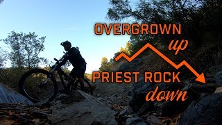
      youtuber Overgrown Up and Priest Down
      mtb
      10:34 | 474 | Aug 11, 2020 , Los Gatos

      Routes with this trail

      more »
      ★ 5.0 • 13 miles • 2,528 ft • 2 • Loop •
      The Los Gatos Turkey Day Ride is a tradition that dates back to the early 1990's. Come on out on...
      16 miles • 2,840 ft • 3 • Loop •
      This route is also known as "The Turkey Ride". It begins on the streets of Los Gatos, traveling up some...
      ★ 2.0 • 28 miles • 6,283 ft • 8 • Out & Back •
      Ride to Mount Umunhum from the Lexington Reservoir. Can start from downtown Los Gatos and end at a nice...
      3.6 ★★★★★
      5 Ratings
      5 ★ 20%
      4 ★ 40%
      3 ★ 20%
      2 ★ 20%
      1 ★

      3 Reviews & Comments

      spokesmanmtb spokesmanmtb
      This really should be 2 trails - segmented where it crosses Priest Rock. It is a very popular trail, I have probably ridden this trail more then any other. It is a fun climb, nice and shady, and it has a few steep spots. Overall, a great workout and a great loop if you turn right at Priest Rock and take PR back to the road.

      We hope you've been enjoying Trailforks!

      Create a FREE account to view all trail reviews and much more.

      Frequently Asked Questions

      ▼ Where is Limekiln - Lower located?
      Limekiln - Lower is located in Sierra Azul Open Space Preserve, Los Gatos, California, United States. It is part of the Sierra Azul Open Space Preserve trail network. The trailhead is located at coordinates 37.20016, -121.98014.
      ▼ How hard is Limekiln - Lower?
      Limekiln - Lower is rated as Blue difficulty. The physical rating is Hard. The average grade is 9%. The climb difficulty is rated Blue.
      ▼ What is the elevation gain for Limekiln - Lower?
      Limekiln - Lower has 1,049 ft of elevation gain. The trail has 81 ft of elevation descent. The elevation ranges from 680 ft to 1,649 ft.
      ▼ Is Limekiln - Lower a point to point trail?
      Limekiln - Lower is not a point to point trail. The direction is Both Directions. The trail type is dirt/gravel road.
      ▼ How long is Limekiln - Lower?
      Limekiln - Lower is 2.0 miles long. The trail type is dirt/gravel road.
      ▼ Are dogs allowed on Limekiln - Lower?
      Yes, dogs are allowed on Limekiln - Lower. Please keep dogs on a leash where required and clean up after them.
      ▼ When is the best time of year to ride Limekiln - Lower?
      Limekiln - Lower is best visited during: All Year.
      ▼ How do I access Limekiln - Lower? Where is the closest parking trailhead?
      The closest parking and trailhead locations to Limekiln - Lower are: View all parking locations in the area.
      ▼ How long does it take to ride Limekiln - Lower?
      Based on recorded activities, it takes an average of 27 minutes to ride Limekiln - Lower. The trail is 2.0 miles long. Actual times will vary based on fitness level, conditions, and pace. View recent activity logs for more details.
      ▼ How busy is Limekiln - Lower?
      Limekiln - Lower is a very popular trail. There have been 2,629 recorded activities on this trail. The trail has received 3,046 check-ins. View recent activity on this trail.

      Hit the Trail

      Open in App

      Get this trail on your phone instantly.

      open trail in app

      Download Trail

      Save to wishlist, Garmin & download.
      save the trail

      Find Related Routes

      Find routes and users activities that include this trail.
      find routes for this trail

      You must enter a description before submitting.

